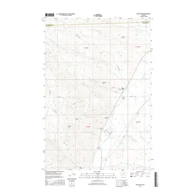
2017 Map of Silver Star
USGS Topo · Published 2017About this map
The Silver Star settlement occupies the eastern edge of this landscape, situated where the high terrain of the Highland Mountains descends toward the Jefferson River. This 2017 survey details a landscape of managed water and rugged drainages, where the Jefferson River is paralleled by irrigation works like the Creeklyn Ditch and Cornforth Ditch. Local history is anchored by the Silver Star Cem and several family-named landmarks, including Tom Benton Gulch and Blackman Gulch.
Find a feature on this map
45 named features on this map. Tap any name to fly to it.
Don’t see what you’re looking for? This feature index may not catch every label — zoom into the map to look around manually.
Map Details
Editions of this 2017 Silver Star Map
This is the sole edition of this map. No revisions or reprints were ever made.
Other maps of this area

1893 · Dillon
USGS Topo · 1:250,000

1955 · Dillon
USGS Topo · 1:250,000

1957 · Dillon
USGS Topo · 1:250,000

1958 · Dillon
USGS Topo · 1:250,000

1960 · Twin Bridges
USGS Topo · 1:62,500

1960 · Waterloo
USGS Topo · 1:62,500

1962 · Dillon
USGS Topo · 1:250,000

1963 · Pipestone Pass
USGS Topo · 1:24,000

1963 · Vendome
USGS Topo · 1:24,000
1963 · Grace
USGS Topo · 1:24,000