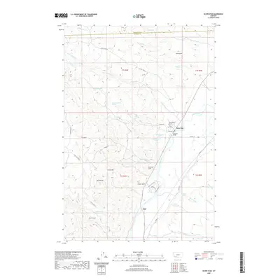
2020 Map of Silver Star
USGS Topo · Published 2020About this map
The Jefferson River carves a broad valley through the center of this southwestern Montana landscape, serving as the primary corridor for settlement and agriculture. Along its western bank, the small community of Silver Star serves as a focal point, connected to the surrounding countryside by the Silver Star Bridge. The geography is defined by a series of named gulches and high peaks, including Bulldog Mtn and the striking Silica Butte.
Find a feature on this map
51 named features on this map. Tap any name to fly to it.
Don’t see what you’re looking for? This feature index may not catch every label — zoom into the map to look around manually.
Map Details
Editions of this 2020 Silver Star Map
This is the sole edition of this map. No revisions or reprints were ever made.
Other maps of this area

1893 · Dillon
USGS Topo · 1:250,000

1955 · Dillon
USGS Topo · 1:250,000

1957 · Dillon
USGS Topo · 1:250,000

1958 · Dillon
USGS Topo · 1:250,000

1960 · Twin Bridges
USGS Topo · 1:62,500

1960 · Waterloo
USGS Topo · 1:62,500

1962 · Dillon
USGS Topo · 1:250,000

1963 · Pipestone Pass
USGS Topo · 1:24,000

1963 · Vendome
USGS Topo · 1:24,000
1963 · Grace
USGS Topo · 1:24,000