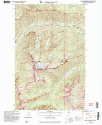
2002 Map of Silver Star Mountain
USGS Topo · Published 2006About this map
Silver Star Mountain stands as the central landmark of this high-elevation terrain within the Okanogan National Forest. This mapping of the North Cascades, based on topography compiled in 1958 and updated with 2002 imagery, illustrates a landscape defined by sharp elevation changes and drainage networks. The northern portion is bisected by the North Cascades Scenic Highway Corridor Boundary, which follows the path of Early Winters Creek and Klipchuck Creek toward the Lone Fir site.
Find a feature on this map
25 named features on this map. Tap any name to fly to it.
Don’t see what you’re looking for? This feature index may not catch every label — zoom into the map to look around manually.
Map Details
Editions of this 2002 Silver Star Mountain Map
This is the sole edition of this map. No revisions or reprints were ever made.
Other maps of this area

1899 · Methow
USGS Topo · 1:125,000

1901 · Methow
USGS Topo · 1:125,000

1902 · Stehekin
USGS Topo · 1:125,000

1904 · Stehekin
USGS Topo · 1:125,000

1920 · Slate Pass
USGS Topo · 1:125,000

1955 · Concrete
USGS Topo · 1:250,000

1958 · Concrete
USGS Topo · 1:250,000

1962 · Concrete
USGS Topo · 1:250,000

1962 · Mazama
USGS Topo · 1:62,500

1963 · Washington Pass
USGS Topo · 1:24,000