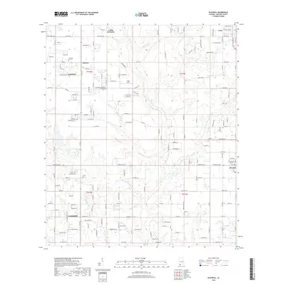
2018 Map of Silverhill
USGS Topo · Published 2018About this map
Fish River and its many tributaries, including Perone Br and Pensacola Br, carve through the landscape of Baldwin County, defining the rural character between larger centers. The map documents the spatial relationship between growing communities like Daphne, Fairhope, and Loxley during a period of modern residential expansion. Smaller, established areas such as Belforest and the Yelling Settlement remain distinct, while the local aviation history is marked by Treeo Airport. Genealogists will find a wealth of data in the numerous burial grounds documented here, from the centrally located Silverhill Cem to the Friends Cem and Christ the King Cem. The road network, including Co Rd 64 and Co Rd 13, shows the transition from agricultural tracts to suburban developments as the region's population continues to densify.
Find a feature on this map
174 named features on this map. Tap any name to fly to it.
Don’t see what you’re looking for? This feature index may not catch every label — zoom into the map to look around manually.
Map Details
Editions of this 2018 Silverhill Map
This is the sole edition of this map. No revisions or reprints were ever made.
Other maps of this area

1920 · Robertsdale
USGS Topo · 1:62,500

1921 · Bon Secour
USGS Topo · 1:62,500

1921 · Point Clear
USGS Topo · 1:62,500

1921 · Fairhope
USGS Topo · 1:62,500

1939 · Daphne
USGS Topo · 1:31,680

1940 · Silverhill
USGS Topo · 1:31,680

1941 · Daphne
USGS Topo · 1:31,680

1941 · Silverhill
USGS Topo · 1:31,680

1941 · Blakeley
USGS Topo · 1:31,680

1941 · Robertsdale
USGS Topo · 1:62,500