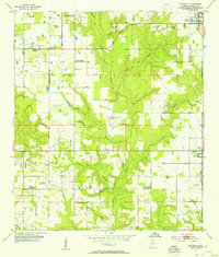
1953 Map of Silverhill
USGS Topo · Published 1955About this map
Silverhill and the surrounding Baldwin County countryside appear as a patchwork of small-scale agriculture and community centers in this 1953 revision. The settlement of Belforest serves as a local hub in the northwest, supported by the Belforest Sch and Belforest Ch. Cultural landmarks such as the Bohemian Hall and Friends Meetinghouse reflect the diverse social and religious fabric of the area during the mid-century. The landscape is deeply defined by the drainage systems of the Fish River and its numerous tributaries, including Corn Branch and Perone Branch, which carve through the terrain.
Find a feature on this map
34 named features on this map. Tap any name to fly to it.
Don’t see what you’re looking for? This feature index may not catch every label — zoom into the map to look around manually.
Map Details
Editions of this 1953 Silverhill Map
2 editions found
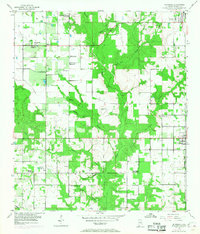
Other maps of this area

1920 · Robertsdale
USGS Topo · 1:62,500

1921 · Bon Secour
USGS Topo · 1:62,500

1921 · Point Clear
USGS Topo · 1:62,500

1921 · Fairhope
USGS Topo · 1:62,500

1939 · Daphne
USGS Topo · 1:31,680

1940 · Silverhill
USGS Topo · 1:31,680

1941 · Daphne
USGS Topo · 1:31,680

1941 · Silverhill
USGS Topo · 1:31,680

1941 · Blakeley
USGS Topo · 1:31,680

1941 · Robertsdale
USGS Topo · 1:62,500