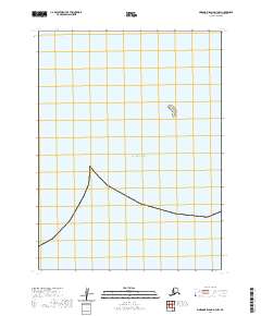
2020 Map of Simeonof Island D-3 NW
USGS Topo · Published 2020About this map
The vast expanse of the Pacific Ocean dominates this maritime survey in the Aleutians East Borough. This specific area represents a near-empty stretch of sea, save for a small, isolated landmark known as the Twins, which rises from the water as the only significant navigational point in the immediate vicinity. The map documents the aquatic boundary where the Pacific waters meet the Aleutian maritime shelf, primarily defined by its bathymetry and the absence of any major landmasses or human infrastructure. It serves as a stark record of the open sea at the start of the 2020s, emphasizing the maritime isolation and geological simplicity of this remote Alaskan corner.
Find a feature on this map
6 named features on this map. Tap any name to fly to it.
Don’t see what you’re looking for? This feature index may not catch every label — zoom into the map to look around manually.
Map Details
Editions of this 2020 Simeonof Island D-3 NW Map
This is the sole edition of this map. No revisions or reprints were ever made.
Other maps of this area

1951 · Stepovak Bay
USGS Topo · 1:250,000

1953 · Port Moller
USGS Topo · 1:250,000

1963 · Port Moller A-1
USGS Topo · 1:63,360
1963 · Simeonof Island D-3
USGS Topo · 1:63,360
1963 · Stepovak Bay A-6
USGS Topo · 1:63,360
1963 · Simeonof Island D-4
USGS Topo · 1:63,360

1963 · Simeonof Island
USGS Topo · 1:250,000

1963 · Stepovak Bay
USGS Topo · 1:250,000

1967 · Simeonof Island
USGS Topo · 1:250,000

1969 · Stepovak Bay
USGS Topo · 1:250,000