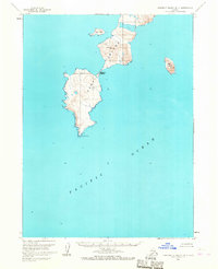
1963 Map of Simeonof Island D-4
USGS Topo · Published 1967About this map
Simeonof Island stands isolated in the Pacific Ocean in this topographic study, reflecting the maritime landscape of the Shumagin Islands in the early 1960s. The terrain is defined by its prominent heights, notably Saddler Peak, and its complex coastline which includes the curiously named Saddlers Mistake. Smaller landmasses like John Island to the north and Near Island to the east provide a glimpse into the archipelago's distribution before modern navigational changes. The map traces the natural contours of the land down to Mountain Point at its southern tip, offering researchers a look at the island's morphology as documented by the Geological Survey during a period when hydrographic data was being updated from USC&GS charts.
Find a feature on this map
7 named features on this map. Tap any name to fly to it.
Don’t see what you’re looking for? This feature index may not catch every label — zoom into the map to look around manually.
Map Details
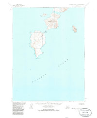
Editions of this 1963 Simeonof Island D-4 Map
2 editions found
Other maps of this area

1951 · Stepovak Bay
USGS Topo · 1:250,000

1953 · Port Moller
USGS Topo · 1:250,000

1963 · Port Moller A-1
USGS Topo · 1:63,360

1963 · Port Moller A-2
USGS Topo · 1:63,360
1963 · Simeonof Island D-3
USGS Topo · 1:63,360
1963 · Stepovak Bay A-6
USGS Topo · 1:63,360

1963 · Simeonof Island
USGS Topo · 1:250,000

1963 · Stepovak Bay
USGS Topo · 1:250,000

1967 · Simeonof Island
USGS Topo · 1:250,000

1969 · Stepovak Bay
USGS Topo · 1:250,000