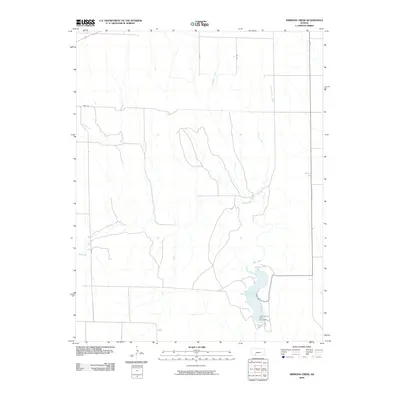
2009 Map of Simmons Creek
USGS Topo · Published 2009About this map
Clark County State Lake dominates the southeast corner of this Ford County landscape, held in place by the Clark County State Lake Dam. The terrain is defined by a dendritic network of drainages that feed into larger watercourses, most notably the meandering path of Bluff Creek as it winds through the southern half of the quadrangle. Northward, the land is etched by Simmons Creek, Rattlesnake Creek, and Hargis Creek, reflecting the importance of water management in this part of the Kansas plains.
Find a feature on this map
10 named features on this map. Tap any name to fly to it.
Don’t see what you’re looking for? This feature index may not catch every label — zoom into the map to look around manually.
Map Details
Editions of this 2009 Simmons Creek Map
This is the sole edition of this map. No revisions or reprints were ever made.
Other maps of this area

1892 · Spearville
USGS Topo · 1:125,000

1894 · Spearville
USGS Topo · 1:125,000

1896 · Ashland
USGS Topo · 1:125,000

1955 · Pratt
USGS Topo · 1:250,000

1959 · Pratt
USGS Topo · 1:250,000

1967 · Bloom
USGS Topo · 1:24,000
1969 · Fort Dodge SW
USGS Topo · 1:24,000

1969 · Bucklin
USGS Topo · 1:24,000

1969 · Kingsdown
USGS Topo · 1:24,000

1979 · Bloom SE
USGS Topo · 1:24,000