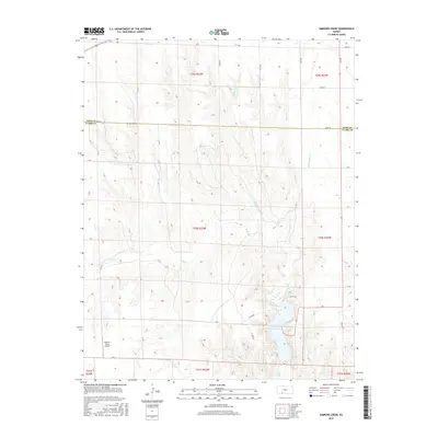
2016 Map of Simmons Creek
USGS Topo · Published 2016About this map
Clark County State Lake anchors the southern portion of this landscape, where the waters of Bluff Cr are impounded near the border of Ford and Clark counties. The terrain is defined by a series of drainage systems, including Simmons Creek, Hargis Cr, and Rattlesnake Cr, which carve through the high plains. This 2016 survey illustrates the persistent agricultural and ranching character of the region, where a geometric grid of rural routes like Zane Rd and CR 15 provides the primary infrastructure for local commerce. In the western reaches, the Esplund Farm Airport represents the integration of aviation into modern farm management, reflecting how large-scale landholdings are navigated in this part of Kansas.
Find a feature on this map
36 named features on this map. Tap any name to fly to it.
Don’t see what you’re looking for? This feature index may not catch every label — zoom into the map to look around manually.
Map Details
Editions of this 2016 Simmons Creek Map
This is the sole edition of this map. No revisions or reprints were ever made.
Other maps of this area

1892 · Spearville
USGS Topo · 1:125,000

1894 · Spearville
USGS Topo · 1:125,000

1896 · Ashland
USGS Topo · 1:125,000

1955 · Pratt
USGS Topo · 1:250,000

1959 · Pratt
USGS Topo · 1:250,000

1967 · Bloom
USGS Topo · 1:24,000
1969 · Fort Dodge SW
USGS Topo · 1:24,000

1969 · Bucklin
USGS Topo · 1:24,000

1969 · Kingsdown
USGS Topo · 1:24,000

1979 · Bloom SE
USGS Topo · 1:24,000