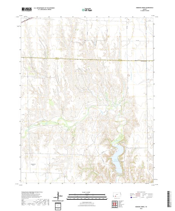
2022 Map of Simmons Creek
USGS Topo · Published 2022About this map
The boundary between Ford and Clark Counties defines the northern reaches of this landscape, where high prairie breaks into a complex system of drainage draws and seasonal creeks. The terrain is dominated by the winding course of Bluff Cr, which feeds into the recreational anchor of the area, Clark County State Lake. This southern reservoir is framed by N Lake Rd and S Lake Rd, serving as a focal point for the region's geography.
Find a feature on this map
36 named features on this map. Tap any name to fly to it.
Don’t see what you’re looking for? This feature index may not catch every label — zoom into the map to look around manually.
Map Details
Editions of this 2022 Simmons Creek Map
This is the sole edition of this map. No revisions or reprints were ever made.
Other maps of this area

1892 · Spearville
USGS Topo · 1:125,000

1894 · Spearville
USGS Topo · 1:125,000

1896 · Ashland
USGS Topo · 1:125,000

1955 · Pratt
USGS Topo · 1:250,000

1959 · Pratt
USGS Topo · 1:250,000

1967 · Bloom
USGS Topo · 1:24,000
1969 · Fort Dodge SW
USGS Topo · 1:24,000

1969 · Bucklin
USGS Topo · 1:24,000

1969 · Kingsdown
USGS Topo · 1:24,000

1979 · Bloom SE
USGS Topo · 1:24,000