
1966 Map of Simms NE
USGS Topo · Published 1969About this map
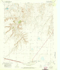
The High Plains of the Texas Panhandle are defined here by the winding course of Cottonwood Creek and the flat, high-elevation divide between two counties. This 1966 topographic study captures the boundary between Oldham Co and Deaf Smith Co, a landscape characterized by isolated basins and wide-open rangeland. Human activity in the mid-1960s is represented by an east-west Pipeline cutting across the center of the sheet and several scattered Well sites, indicating the subsurface resources of the region. The map reveals the intricate drainage patterns that feed into the creek, providing a clear look at the terrain before modern agricultural or industrial shifts. It is a quiet, functional landscape where the only named landmarks are the watercourses and the infrastructure required to extract and transport energy across the Llano Estacado.
Find a feature on this map
4 named features on this map. Tap any name to fly to it.
Don’t see what you’re looking for? This feature index may not catch every label — zoom into the map to look around manually.
Map Details
Editions of this 1966 Simms NE Map
This is the sole edition of this map. No revisions or reprints were ever made.
Other maps of this area

1954 · Tucumcari
USGS Topo · 1:250,000

1958 · Tucumcari
USGS Topo · 1:250,000

1966 · Overstreet Lake
USGS Topo · 1:24,000

1966 · Simms NW
USGS Topo · 1:24,000

1966 · Simms
USGS Topo · 1:24,000

1966 · Adrian
USGS Topo · 1:24,000

1966 · Landergin
USGS Topo · 1:24,000

1966 · Vega South
USGS Topo · 1:24,000

1966 · Ford
USGS Topo · 1:24,000
1966 · Vega North
USGS Topo · 1:24,000