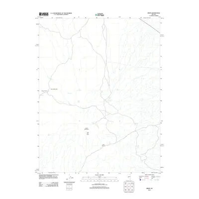
2012 Map of Simon
USGS Topo · Published 2012About this map
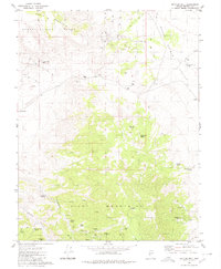
Simon (Historical) marks a site of significant human activity in this corner of Nye County, positioned near the base of Simon Mountain. The landscape is defined by the high elevations of the Cedar Mountains, where peaks like Little Pilot Peak overlook a terrain characterized by vital water sources. These springs, including Humdinger Spring, Well Spring, and Lou Spring, provided necessary resources for the early mining and ranching interests that once occupied the region.
Find a feature on this map
15 named features on this map. Tap any name to fly to it.
Don’t see what you’re looking for? This feature index may not catch every label — zoom into the map to look around manually.
Map Details
Editions of this 2012 Simon Map
This is the sole edition of this map. No revisions or reprints were ever made.
Other maps of this area

1907 · Tonopah
USGS Topo · 1:250,000

1908 · Tonopah
USGS Topo · 1:250,000

1956 · Tonopah
USGS Topo · 1:250,000

1959 · Tonopah
USGS Topo · 1:250,000

1962 · Tonopah
USGS Topo · 1:250,000
1979 · Goldyke
USGS Topo · 1:24,000
1979 · Stewart Spring
USGS Topo · 1:24,000
1979 · Simon
USGS Topo · 1:24,000

1980 · Cole Spring
USGS Topo · 1:24,000
1980 · Bettles Well
USGS Topo · 1:24,000