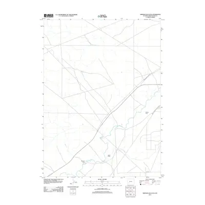
2012 Map of Simpson Gulch SE
USGS Topo · Published 2012About this map
The Big Sandy River meanders through this arid high-desert landscape in Sweetwater County, providing a vital corridor of water and drainage through the open sagebrush country. This 2012 survey illustrates the sparse human footprint in the region, defined largely by historical transportation routes and seasonal drainage channels. The presence of the Green River-South Pass Stage Rd highlights the area's legacy as part of a significant western travel network, connecting remote outposts through a terrain marked by deep erosional features like Carlson Draw and Bone Draw. Near the southern edge of the sheet, Simpson Gulch and the intersection of Lower Farson Cutoff Rd indicate the modern ranching and transit infrastructure that continues to serve this portion of Wyoming's interior basin.
Find a feature on this map
7 named features on this map. Tap any name to fly to it.
Don’t see what you’re looking for? This feature index may not catch every label — zoom into the map to look around manually.
Map Details
Editions of this 2012 Simpson Gulch SE Map
This is the sole edition of this map. No revisions or reprints were ever made.
Other maps of this area

1954 · Rock Springs
USGS Topo · 1:250,000

1955 · Lander
USGS Topo · 1:250,000

1958 · Lander
USGS Topo · 1:250,000

1958 · Rock Springs
USGS Topo · 1:250,000

1961 · Lander
USGS Topo · 1:250,000

1962 · Rock Springs
USGS Topo · 1:250,000

1963 · Gasson Bridge
USGS Topo · 1:24,000

1963 · Pittman Well
USGS Topo · 1:24,000

1968 · Farson
USGS Topo · 1:24,000

1968 · Twelvemile Knoll
USGS Topo · 1:24,000