
1963 Map of Gasson Bridge
USGS Topo · Published 1966About this map
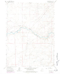
Big Sandy River meanders across this high desert landscape in Sweetwater County during the early 1960s, defining a corridor of historical transit. The map traces the legendary Emigrant Trail as it cuts through the sagebrush and arroyos, following the natural contours of the land south of the Big Bend. This route represents a critical historical artery for westward expansion, where the terrain transitions into the stark topography of the Badlands and the rising elevations of the Mormon Knolls.
Find a feature on this map
11 named features on this map. Tap any name to fly to it.
Don’t see what you’re looking for? This feature index may not catch every label — zoom into the map to look around manually.
Map Details
Editions of this 1963 Gasson Bridge Map
2 editions found
Other maps of this area

1954 · Rock Springs
USGS Topo · 1:250,000

1955 · Lander
USGS Topo · 1:250,000

1958 · Lander
USGS Topo · 1:250,000

1958 · Rock Springs
USGS Topo · 1:250,000

1961 · Lander
USGS Topo · 1:250,000

1962 · Rock Springs
USGS Topo · 1:250,000

1963 · Pittman Well
USGS Topo · 1:24,000

1963 · Big Island Bridge
USGS Topo · 1:24,000
1963 · Thoman School
USGS Topo · 1:24,000
1963 · Lombard Buttes
USGS Topo · 1:24,000