
1963 Map of Big Island Bridge
USGS Topo · Published 1966About this map
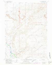
The Green River flows through the southwestern corner of this high desert landscape, creating a fertile contrast to the surrounding Badlands Hills. Central to the area's history is the Emigrant Trail, which cuts across the western portion of the sheet, marking a historic corridor of western expansion. The namesake Big Island Bridge provides a crossing point near a large river feature known as Big Island.
Find a feature on this map
18 named features on this map. Tap any name to fly to it.
Don’t see what you’re looking for? This feature index may not catch every label — zoom into the map to look around manually.
Map Details
Editions of this 1963 Big Island Bridge Map
2 editions found
Other maps of this area

1954 · Rock Springs
USGS Topo · 1:250,000

1958 · Rock Springs
USGS Topo · 1:250,000

1961 · Blue Point
USGS Topo · 1:24,000

1961 · Austin Ranch
USGS Topo · 1:24,000

1961 · Stevens Flat
USGS Topo · 1:24,000

1962 · Rock Springs
USGS Topo · 1:250,000

1963 · Gasson Bridge
USGS Topo · 1:24,000

1963 · Pittman Well
USGS Topo · 1:24,000
1963 · Thoman School
USGS Topo · 1:24,000
1963 · Lombard Buttes
USGS Topo · 1:24,000