
1961 Map of Austin Ranch
USGS Topo · Published 1964About this map
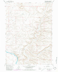
The Austin Ranch area in Sweetwater County sits in a landscape of high desert drainages and mesa rims as it appeared in the early 1960s. The Green River carves through the southwestern corner of the map, providing a vital water source for the namesake ranch and the nearby Manns Flat. Away from the river, the terrain is defined by the prominent Blue Rim and a series of deep draws and canyons that channel seasonal runoff toward the river valley. The presence of Blue Rim Res No 1 highlights the essential water management required in this arid environment.
Find a feature on this map
11 named features on this map. Tap any name to fly to it.
Don’t see what you’re looking for? This feature index may not catch every label — zoom into the map to look around manually.
Map Details
Editions of this 1961 Austin Ranch Map
2 editions found
Other maps of this area

1954 · Rock Springs
USGS Topo · 1:250,000

1958 · Rock Springs
USGS Topo · 1:250,000

1961 · Scott Spring
USGS Topo · 1:24,000

1961 · Peru
USGS Topo · 1:24,000

1961 · Stevens Flat
USGS Topo · 1:24,000

1961 · Green River
USGS Topo · 1:24,000

1961 · Bryan
USGS Topo · 1:24,000

1962 · Rock Springs
USGS Topo · 1:250,000

1963 · Big Island Bridge
USGS Topo · 1:24,000
1963 · Chrisman Ranch
USGS Topo · 1:24,000