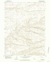
1961 Map of Scott Spring
USGS Topo · Published 1964About this map
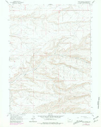
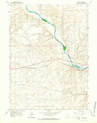
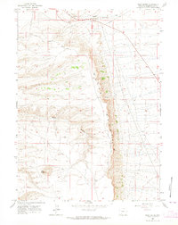
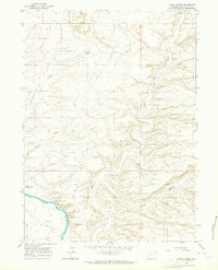
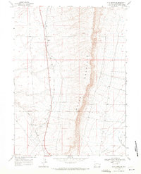
Scott Canyon dominates the central landscape of this 1961 survey, carving through the arid high country of Sweetwater County. This terrain is characterized by intricate drainage systems and steep elevation shifts, visible in the many-forked pathways of Skunk Canyon to the north. These features highlight the natural water-driven erosion of the Wyoming plateau, where vital water sources like Scott Spr provided essential points of relief in a remote landscape. While most of the area remains undeveloped, the presence of Blue Rim Rd in the northwest corner and unimproved tracks suggest the historical movement of ranchers or early energy explorers through these rugged basins. The map serves as a detailed record of the physical geography before more modern utility corridors or infrastructure altered the surface of this section of the High Plains.
Find a feature on this map
8 named features on this map. Tap any name to fly to it.
Don’t see what you’re looking for? This feature index may not catch every label — zoom into the map to look around manually.
Map Details
Editions of this 1961 Scott Spring Map
2 editions found
Other maps of this area

1954 · Rock Springs
USGS Topo · 1:250,000

1958 · Rock Springs
USGS Topo · 1:250,000
1961 · Peru
USGS Topo · 1:24,000
1961 · Pilot Butte
USGS Topo · 1:24,000
1961 · Austin Ranch
USGS Topo · 1:24,000
1961 · Kanda
USGS Topo · 1:24,000
1961 · Green River
USGS Topo · 1:24,000

1962 · Rock Springs
USGS Topo · 1:250,000
1963 · Chrisman Ranch
USGS Topo · 1:24,000
1968 · Clay Buttes SE
USGS Topo · 1:24,000