
1961 Map of Green River
USGS Topo · Published 1965About this map
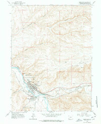
The Union Pacific railroad corridor and the high desert terrain of the Green River define this 1961 survey. The city of Green River is documented in detail, showing its mid-century civic infrastructure including Lincoln High Sch, Washington Sch, and Roosevelt Sch, alongside the Riverview Cem. Notable geologic formations dominate the northern landscape, where The Palisades, Tollgate Rock, and Castle Rock rise above the river valley.
Find a feature on this map
37 named features on this map. Tap any name to fly to it.
Don’t see what you’re looking for? This feature index may not catch every label — zoom into the map to look around manually.
Map Details
Editions of this 1961 Green River Map
4 editions found
Other maps of this area

1954 · Rock Springs
USGS Topo · 1:250,000

1957 · Mc Kinnon Junction
USGS Topo · 1:62,500

1957 · Firehole Basin
USGS Topo · 1:62,500

1958 · Rock Springs
USGS Topo · 1:250,000

1961 · Scott Spring
USGS Topo · 1:24,000

1961 · Peru
USGS Topo · 1:24,000

1961 · Pilot Butte
USGS Topo · 1:24,000

1961 · Austin Ranch
USGS Topo · 1:24,000

1961 · Kanda
USGS Topo · 1:24,000

1962 · Rock Springs
USGS Topo · 1:250,000