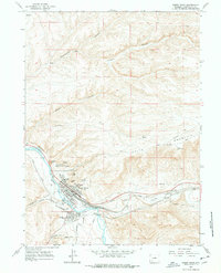
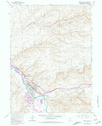
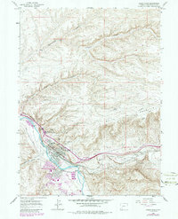
1961 Map of Green River
USGS Topo · Published 1978About this map
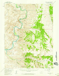
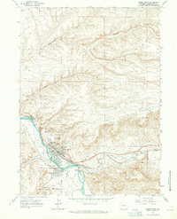
Green River serves as the focal point of this 1961 survey, where the Union Pacific railroad and the Union Pacific Overland Trail converge along the water's edge. The town's layout is well-defined, showing the core residential and civic structure including Lincoln High Sch, Washington Sch, and Roosevelt Sch. The topography is dominated by dramatic geological formations that frame the valley, such as The Palisades, Tollgate Rock, and Castle Rock.
Find a feature on this map
36 named features on this map. Tap any name to fly to it.
Don’t see what you’re looking for? This feature index may not catch every label — zoom into the map to look around manually.
Map Details
Editions of this 1961 Green River Map
4 editions found
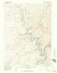
Other maps of this area

1954 · Rock Springs
USGS Topo · 1:250,000
1957 · Mc Kinnon Junction
USGS Topo · 1:62,500
1957 · Firehole Basin
USGS Topo · 1:62,500

1958 · Rock Springs
USGS Topo · 1:250,000
1961 · Scott Spring
USGS Topo · 1:24,000
1961 · Peru
USGS Topo · 1:24,000
1961 · Pilot Butte
USGS Topo · 1:24,000
1961 · Austin Ranch
USGS Topo · 1:24,000
1961 · Kanda
USGS Topo · 1:24,000
1961 · Green River
USGS Topo · 1:24,000