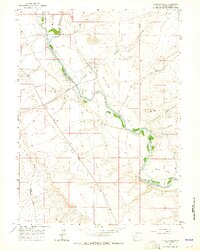
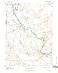
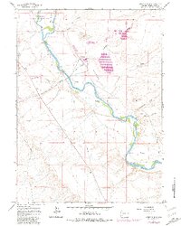
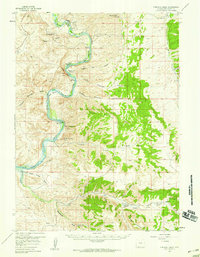
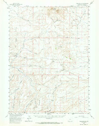
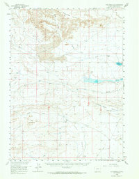
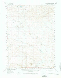
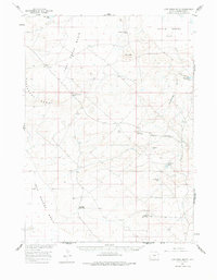
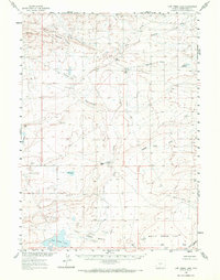
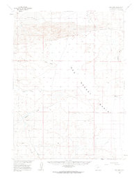
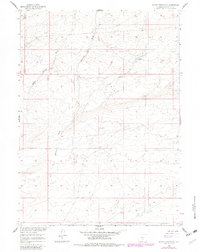
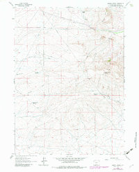
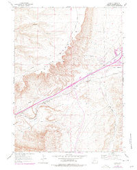
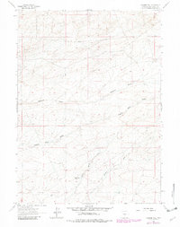
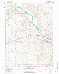
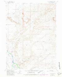
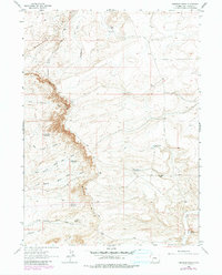
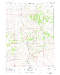
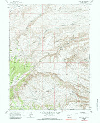
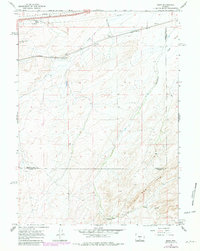
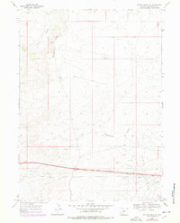
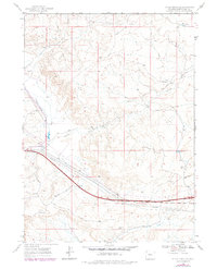
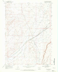
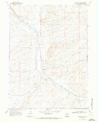
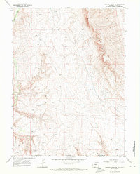
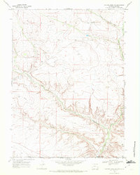
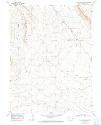
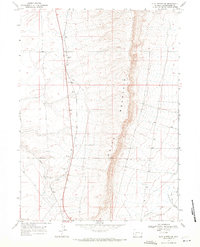
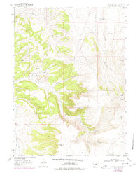
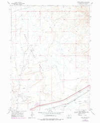
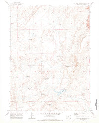
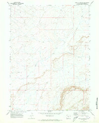
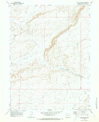
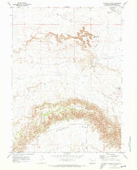
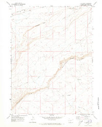
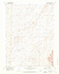
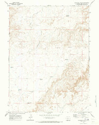
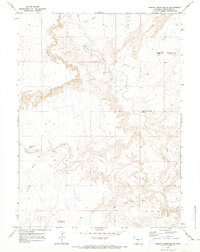
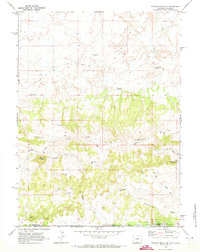
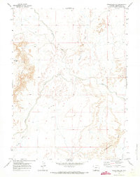
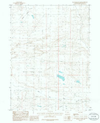
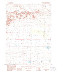
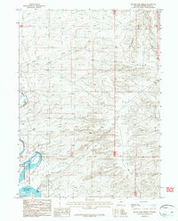
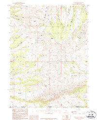
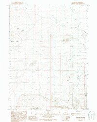
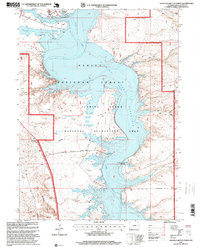
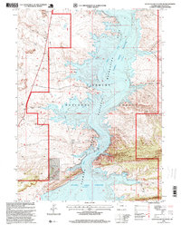
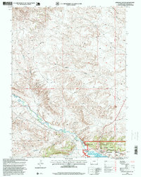
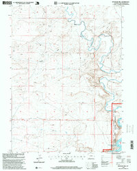
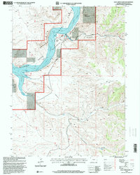
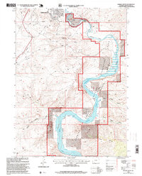
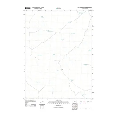
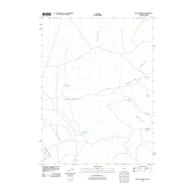
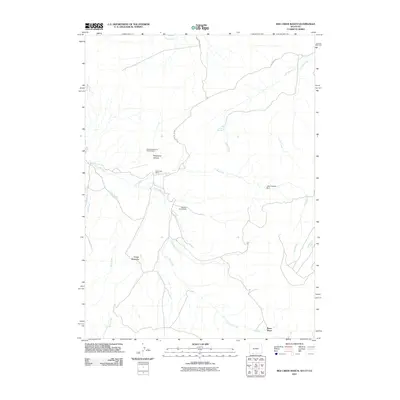
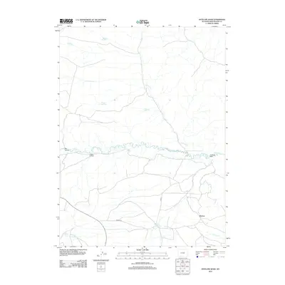
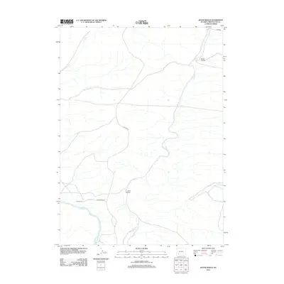
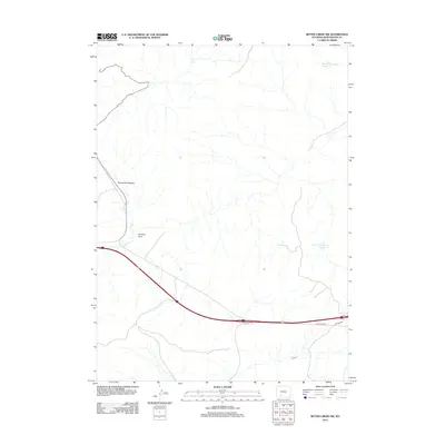
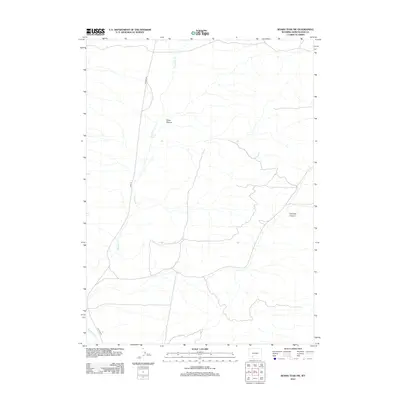
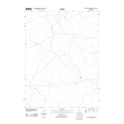
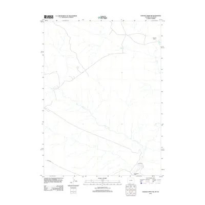
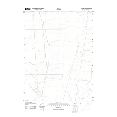
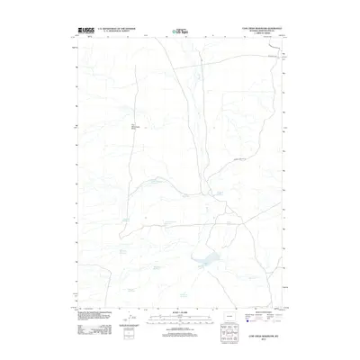
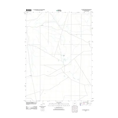
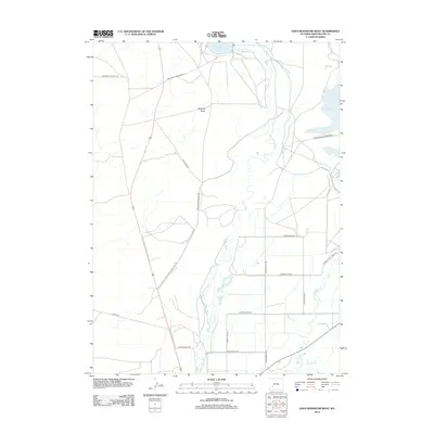
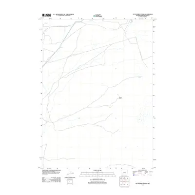
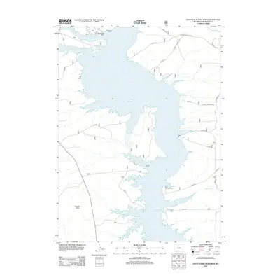
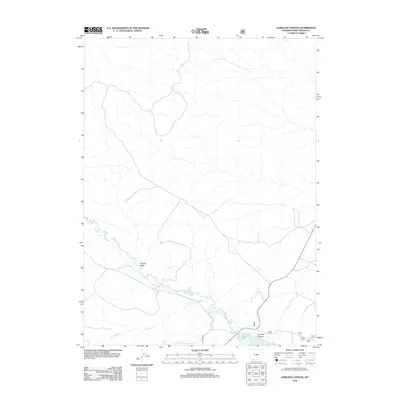
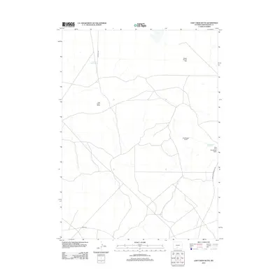
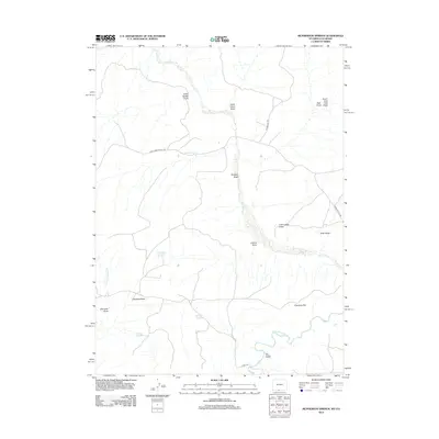
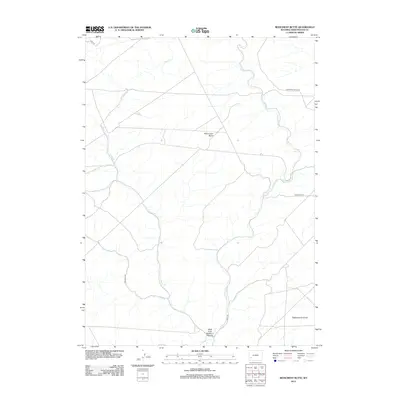
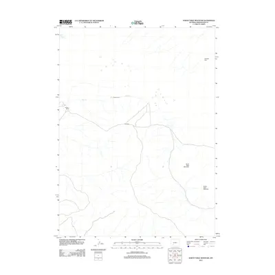
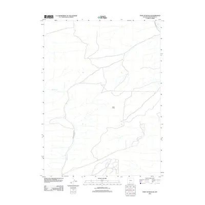
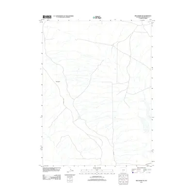
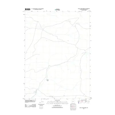
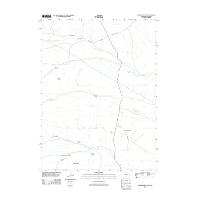
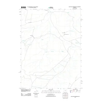
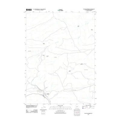
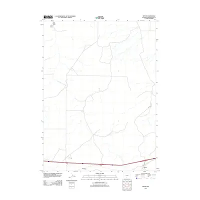
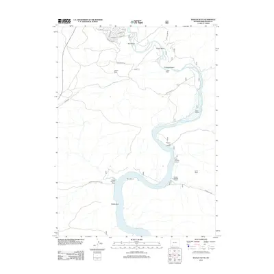
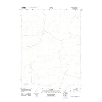
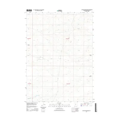
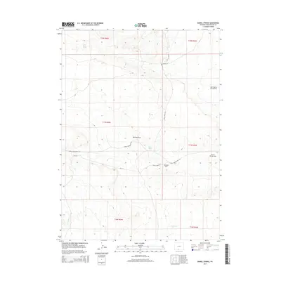
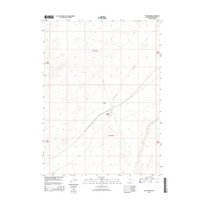
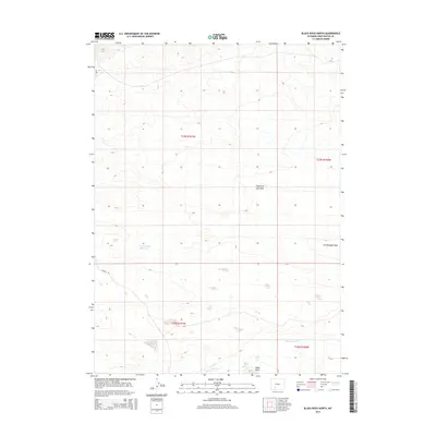
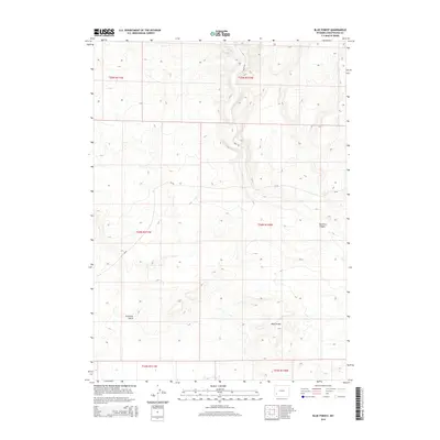
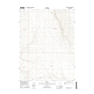
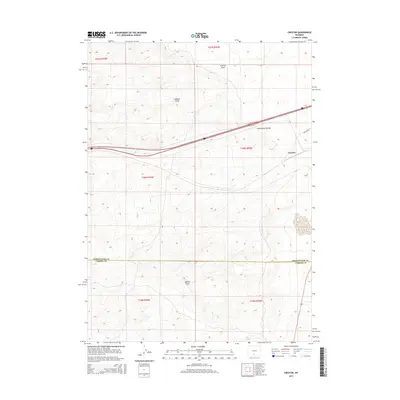
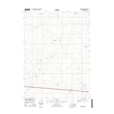
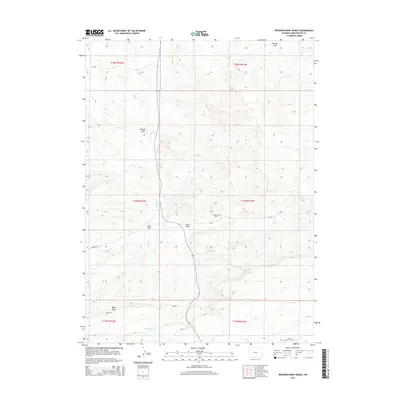
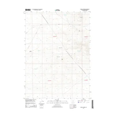
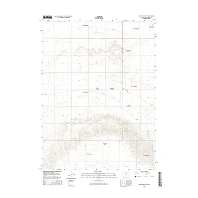
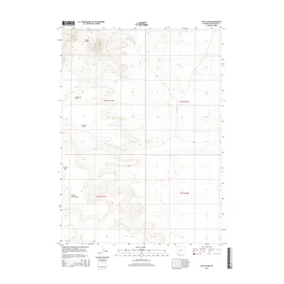
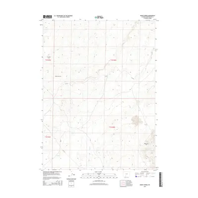
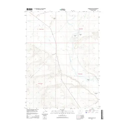
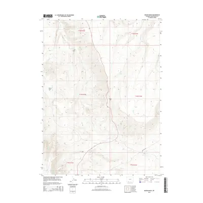
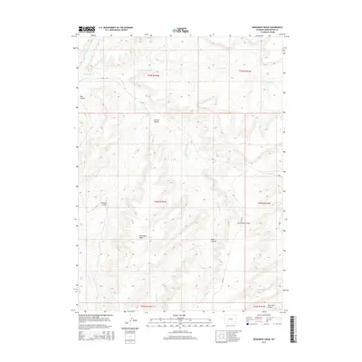
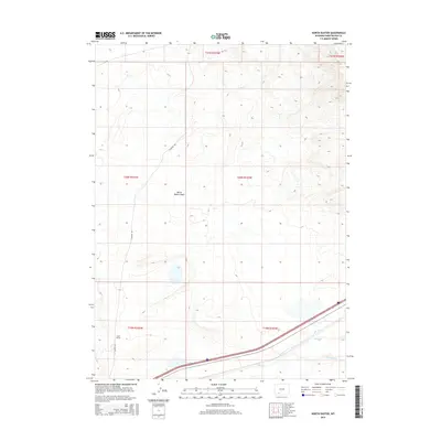
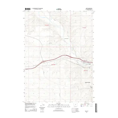
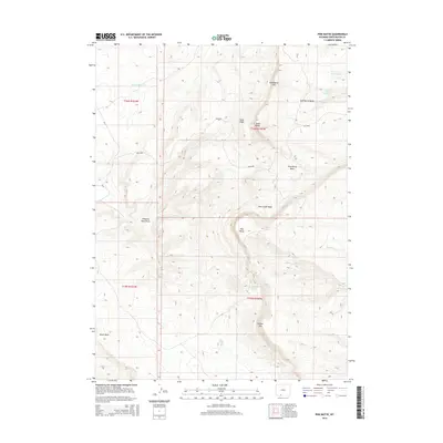
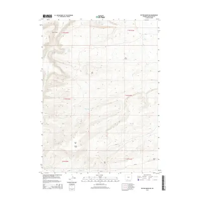
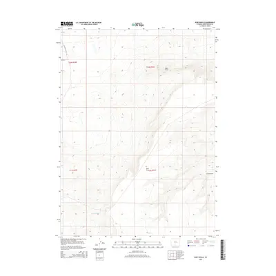
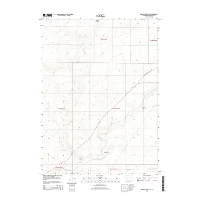
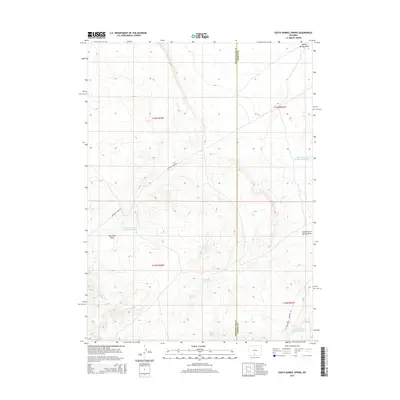
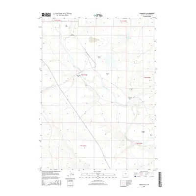
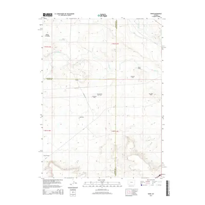
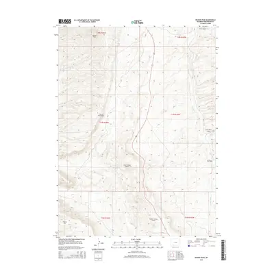
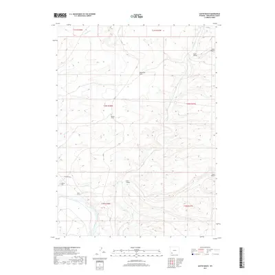
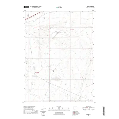
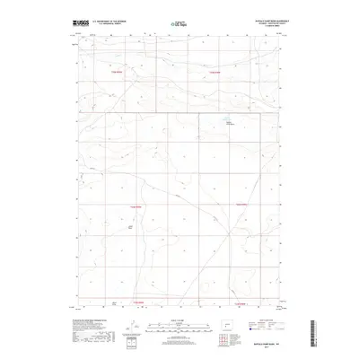
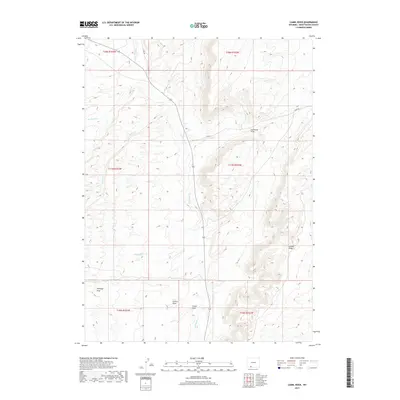
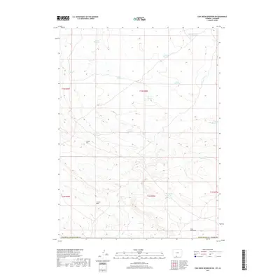
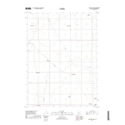
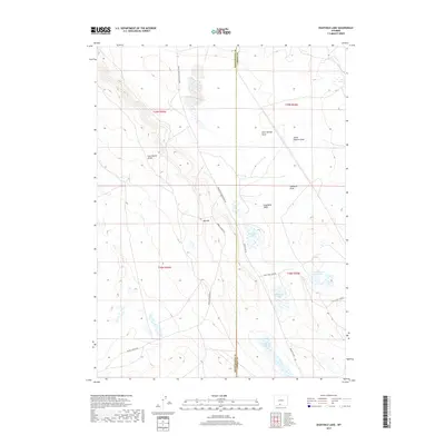
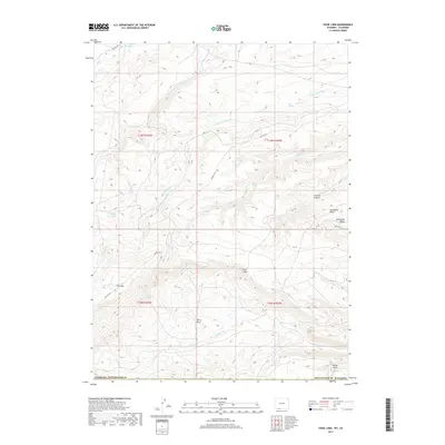
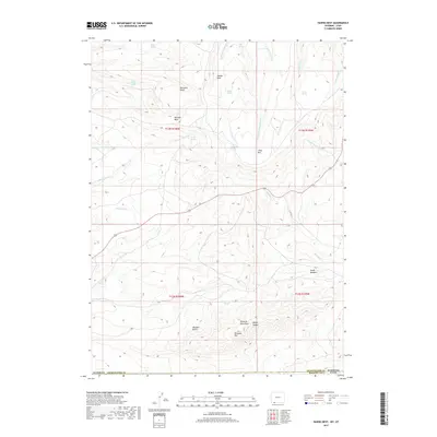
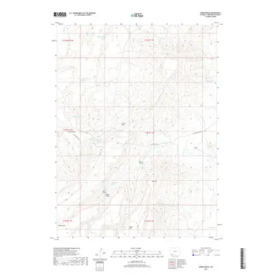
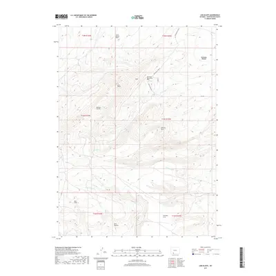
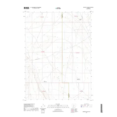
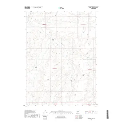
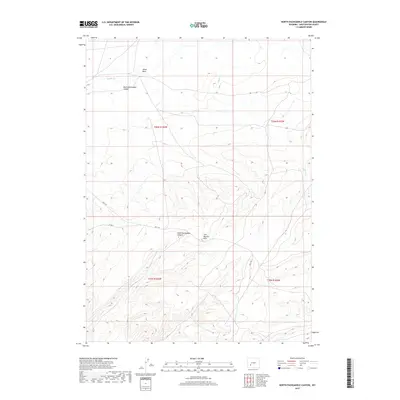
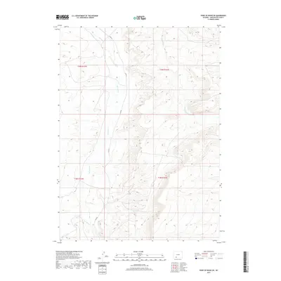
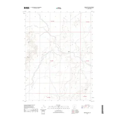
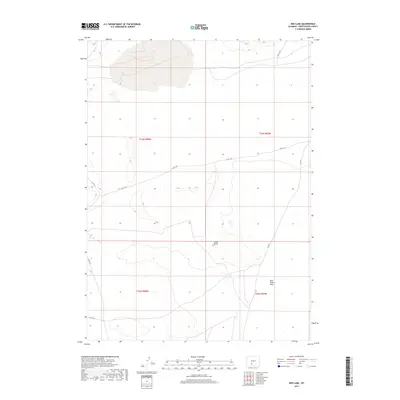
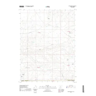
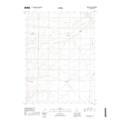
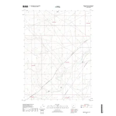
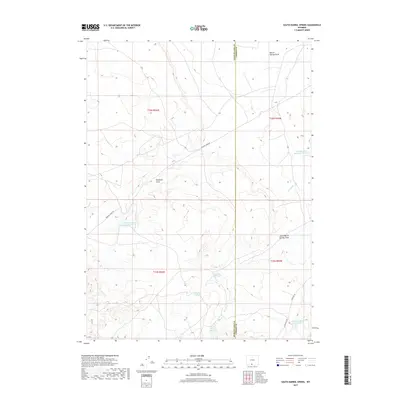
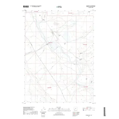
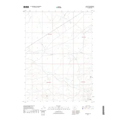
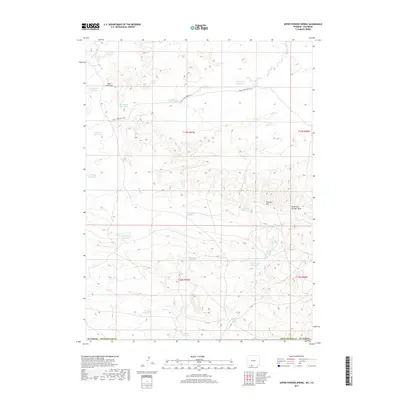
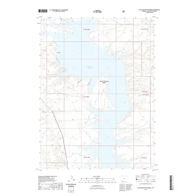
1961 Map of Stevens Flat
USGS Topo · Published 1964About this map
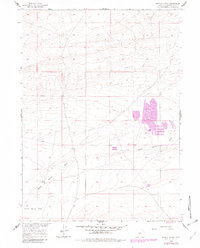
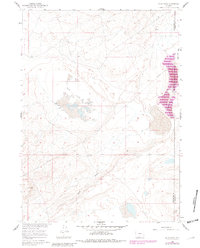
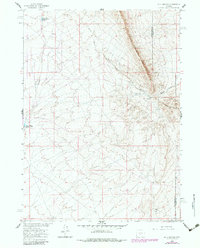
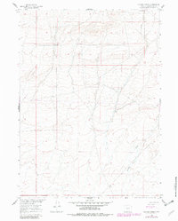
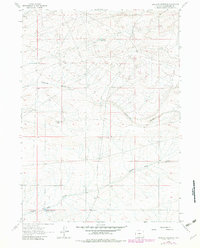
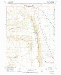
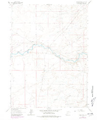
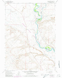
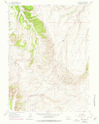
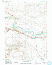
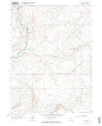
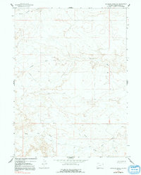
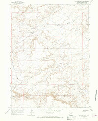
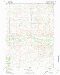
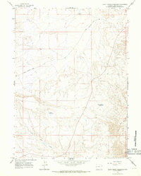
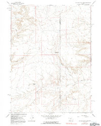
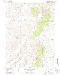
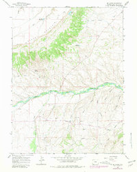
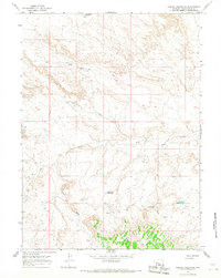
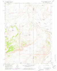
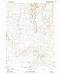
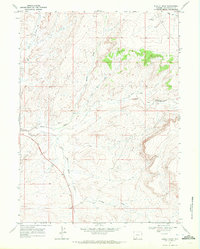
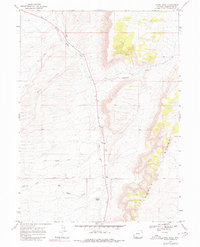
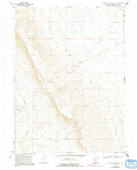
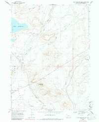
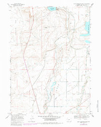
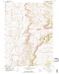
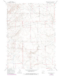
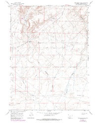
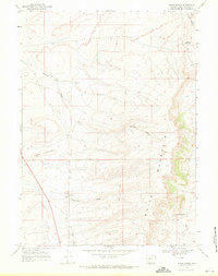
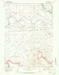
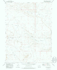
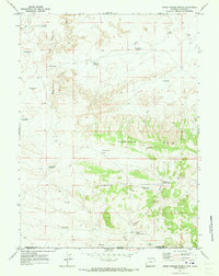
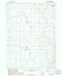
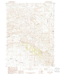
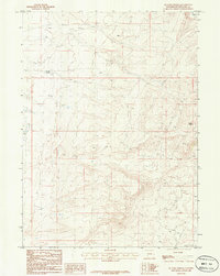
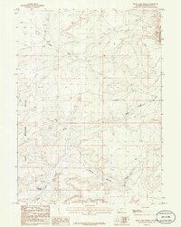
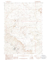
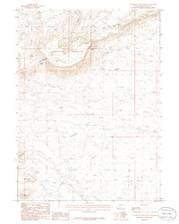
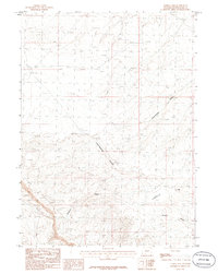
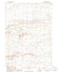
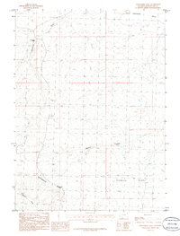
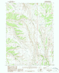
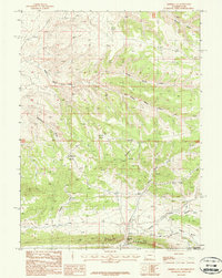
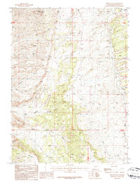
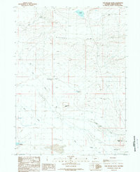
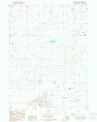
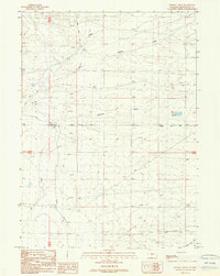
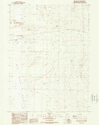
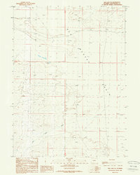
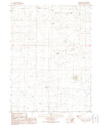
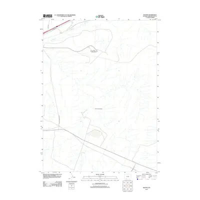
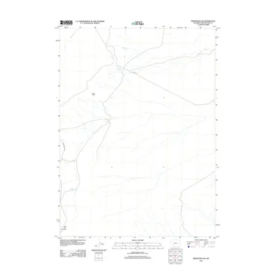
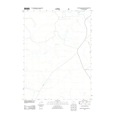
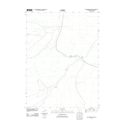
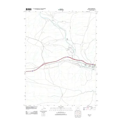
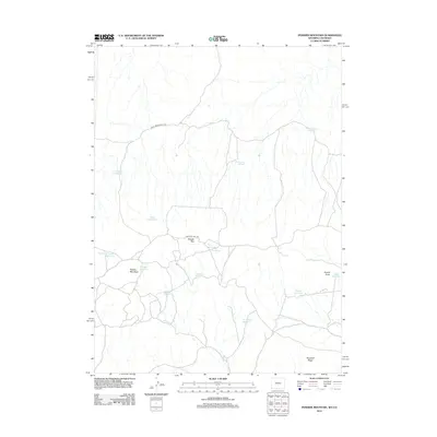
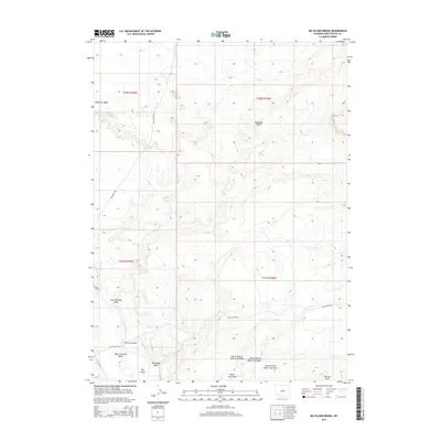
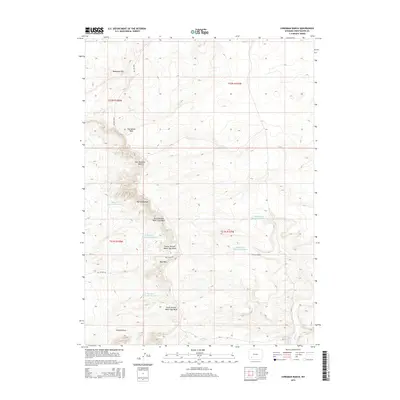
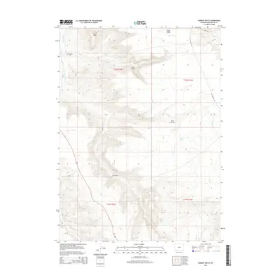
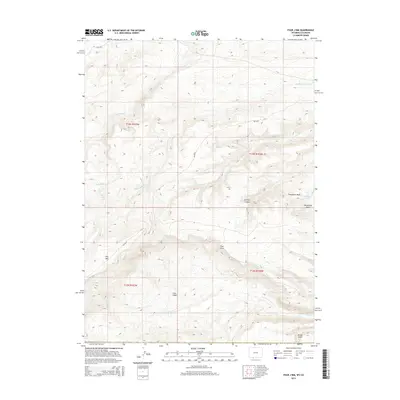
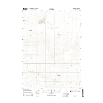
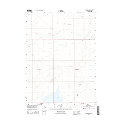
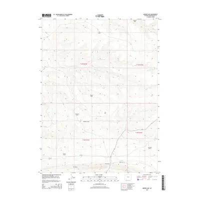
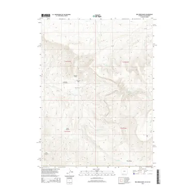
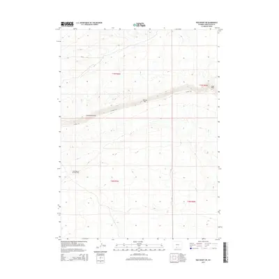
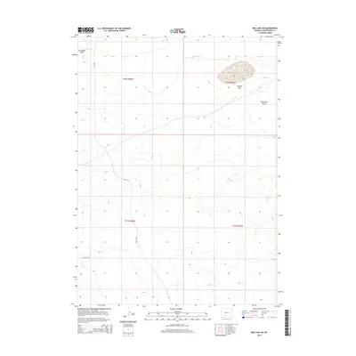
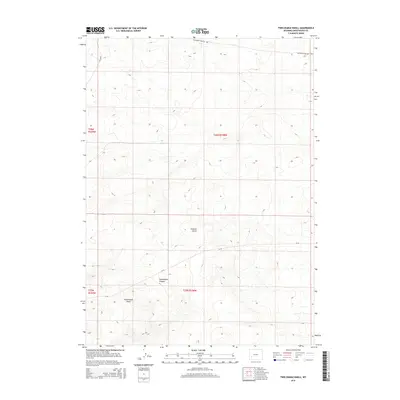
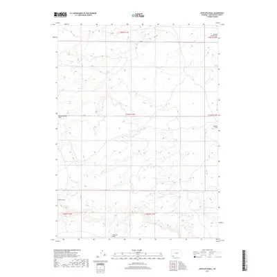
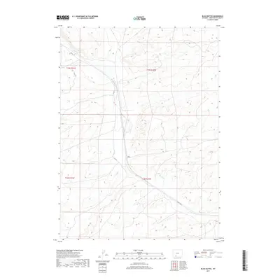
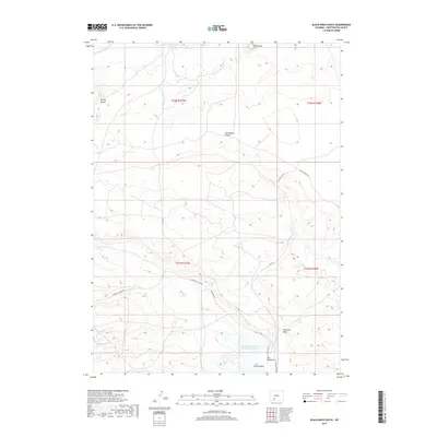
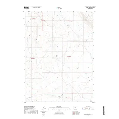
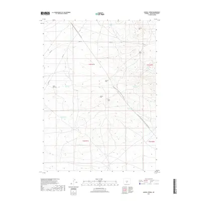
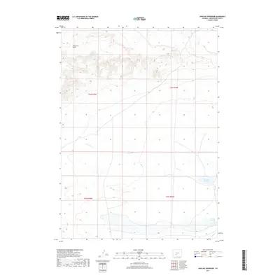
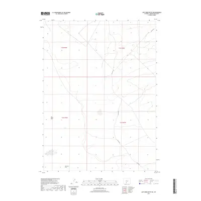
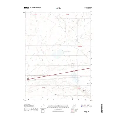
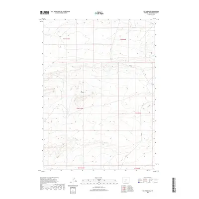
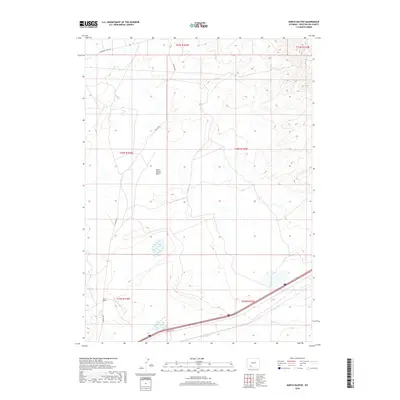
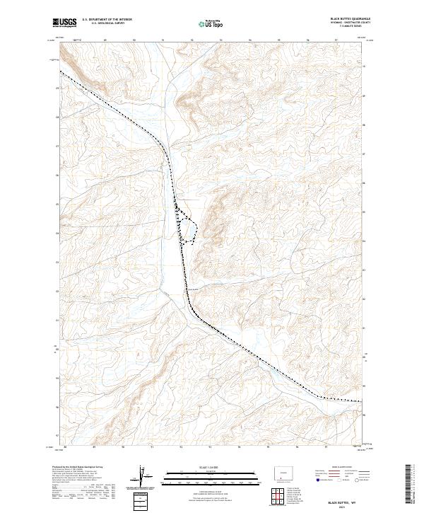
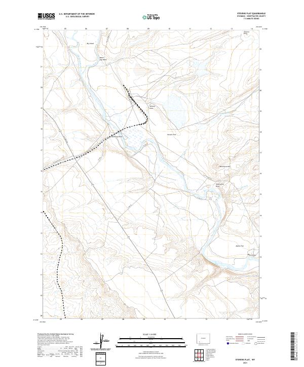
The Green River carves a winding path through this corner of Sweetwater County, creating a distinct riparian corridor punctuated by The Big Island and the broad bench of Stevens Flat. By the early 1960s, the landscape reflected a transition from traditional livestock operations like Pal Ranch and Hofeldt Ranch toward modern industrial development. A prominent Pipeline and the heavy infrastructure of a Chemical Plant, complete with its own Filtration Plant and Sewage Disposal system, stand in contrast to the natural drainages of Chris Draw and Twentyfive Mile Wash. The Union Pacific railroad tracks provide the primary transit artery through this arid terrain, following the river valley while several large-scale Gravel Pits indicate active construction or maintenance during this period. Local high points like Monument Hill and the expanse of Manns Flat define the high desert topography surrounding the river.
Find a feature on this map
21 named features on this map. Tap any name to fly to it.
Don’t see what you’re looking for? This feature index may not catch every label — zoom into the map to look around manually.
Map Details
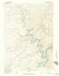
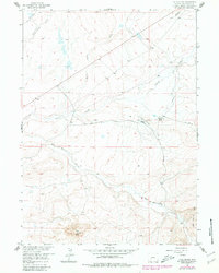
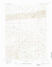
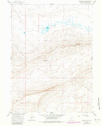
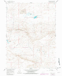
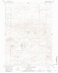
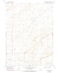
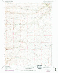
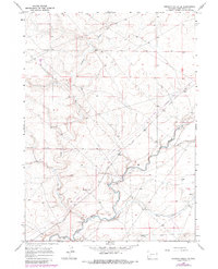
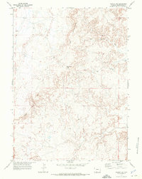
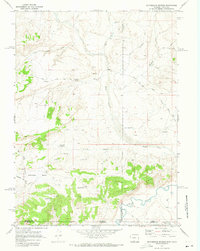
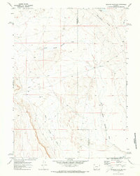
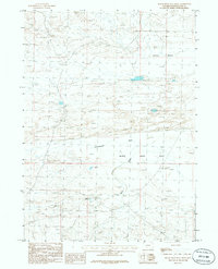
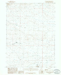
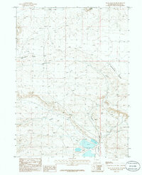
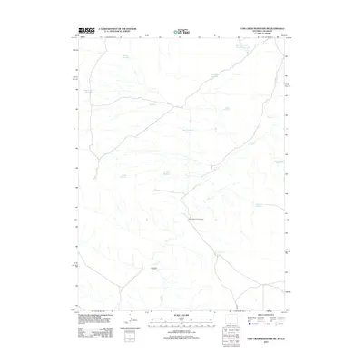
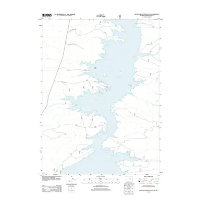
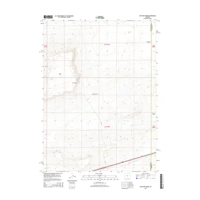
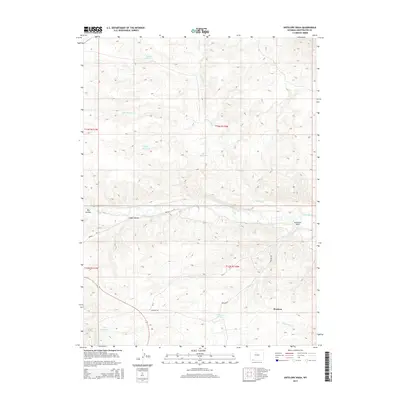
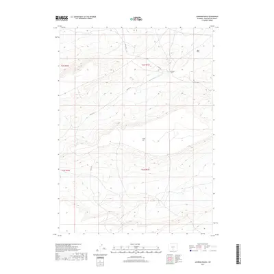
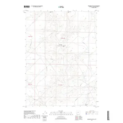
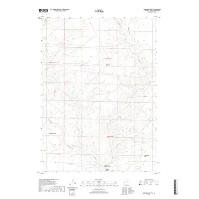
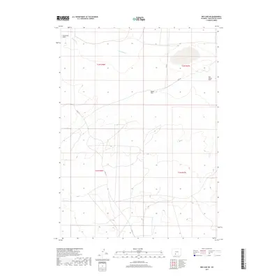
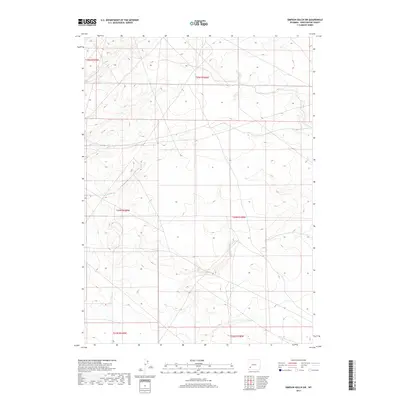
Editions of this 1961 Stevens Flat Map
4 editions found
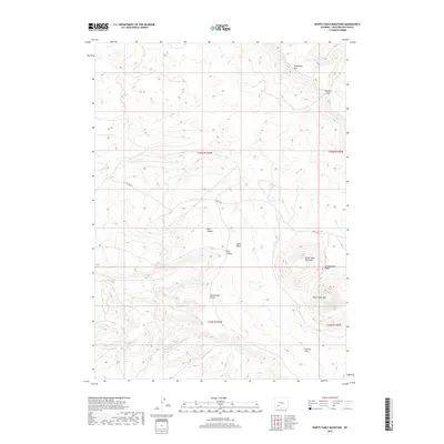
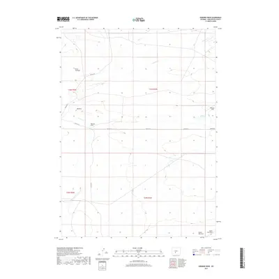
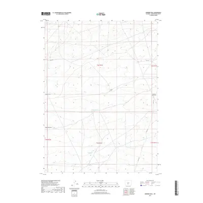
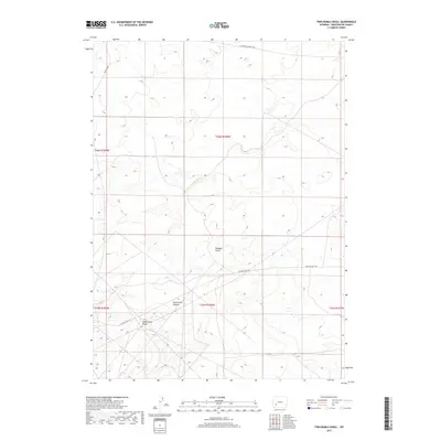
Historical Maps of Sweetwater County Through Time
929 maps found
1957 Currant Creek Ranch
Sweetwater County, WY
1957 Firehole Basin
Sweetwater County, WY
1957 Mc Kinnon Junction
Sweetwater County, WY
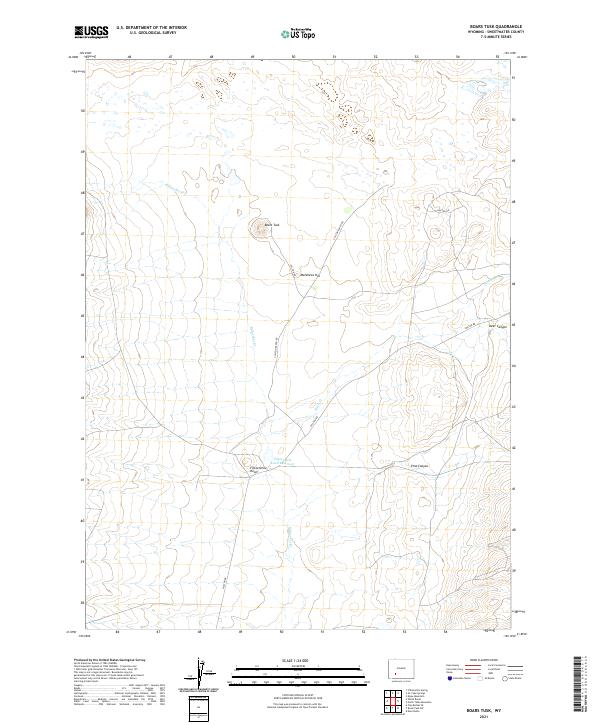
1958 Boars Tusk
Sweetwater County, WY
1958 Essex Mountain
Sweetwater County, WY
1958 Freighter Gap
Sweetwater County, WY
1958 The Pinnacles
Sweetwater County, WY
1958 Tule Butte
Sweetwater County, WY
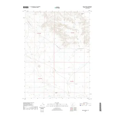
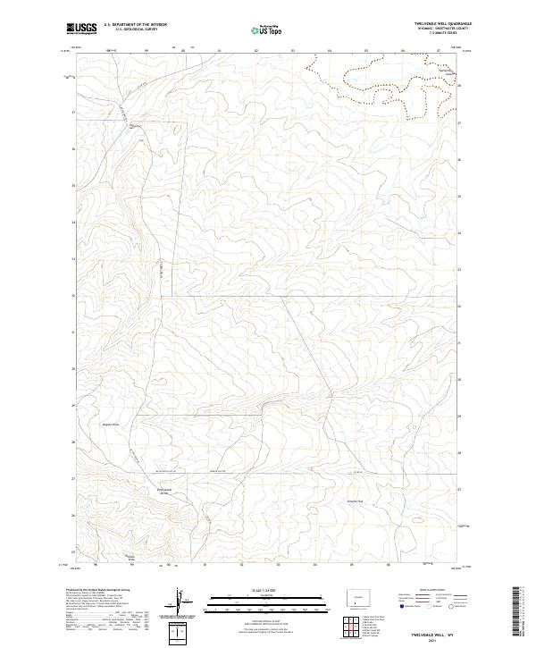
1958 Twelvemile Well
Sweetwater County, WY
1960 Battle Spring
Sweetwater County, WY
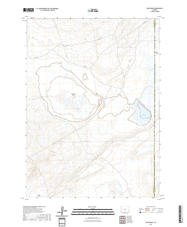
1960 Buck Draw
Sweetwater County, WY
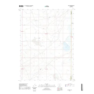
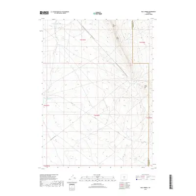
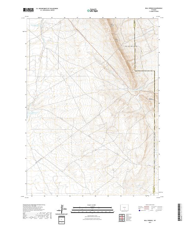
1960 Bull Springs
Sweetwater County, WY
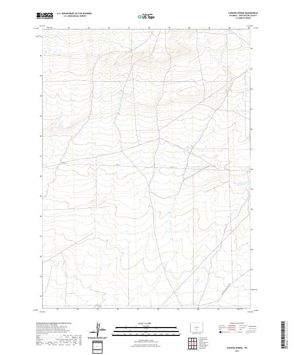
1960 Chicken Spring
Sweetwater County, WY
1960 Five Fingers Butte
Sweetwater County, WY
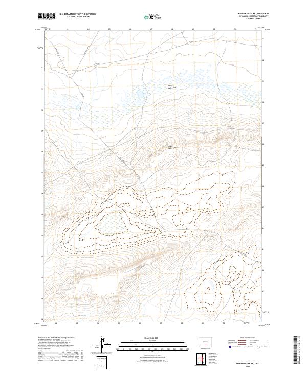
1960 Hansen Lake NE
Sweetwater County, WY
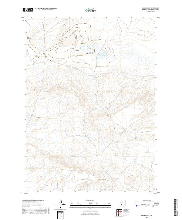
1960 Hansen Lake
Sweetwater County, WY
1960 Larsen Knoll
Sweetwater County, WY
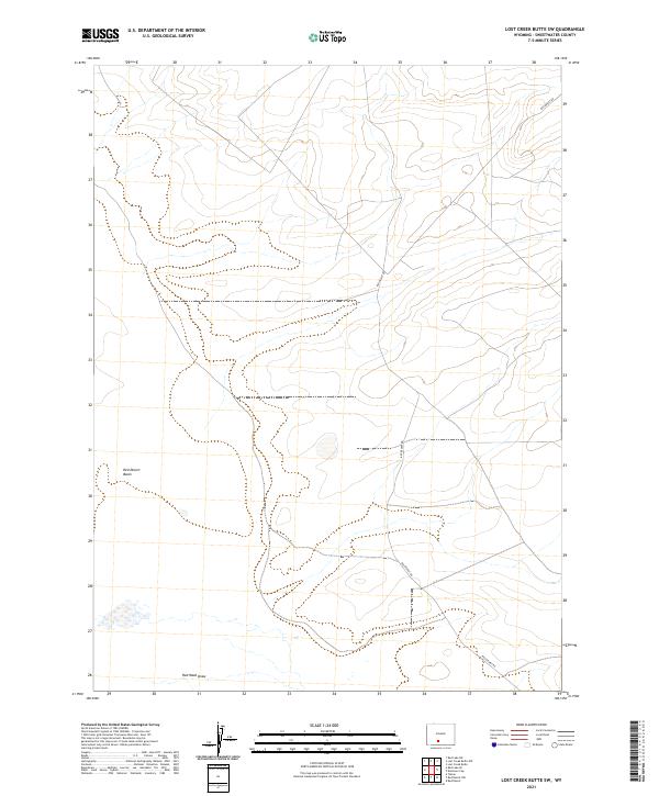
1960 Lost Creek Butte
Sweetwater County, WY
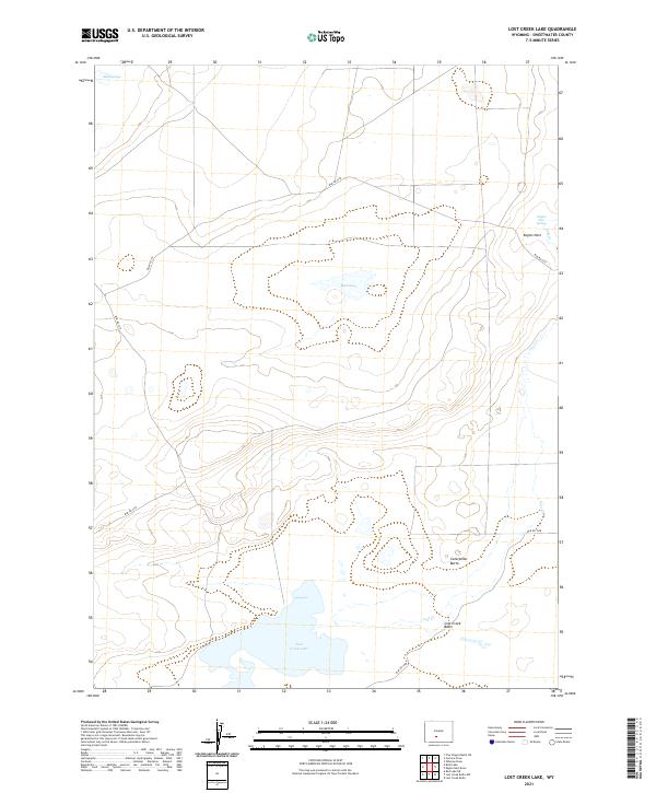
1960 Lost Creek Lake
Sweetwater County, WY
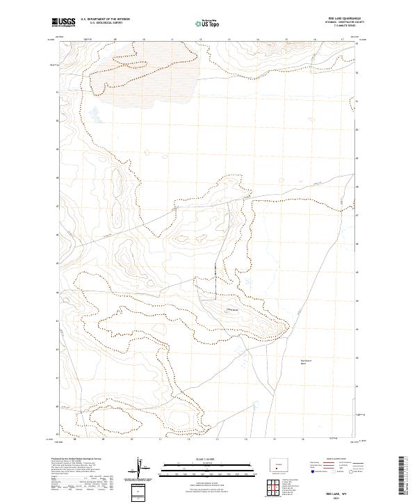
1960 Red Lake
Sweetwater County, WY
1960 Sooner Reservoir
Sweetwater County, WY
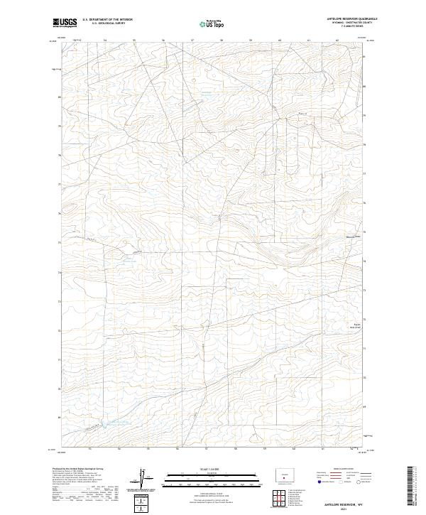
1961 Antelope Reservoir
Sweetwater County, WY
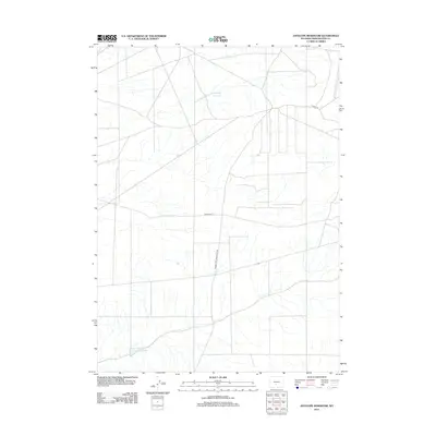
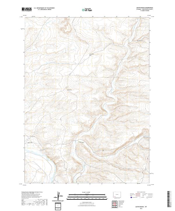
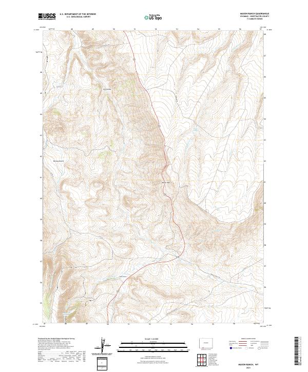
1961 Austin Ranch
Sweetwater County, WY
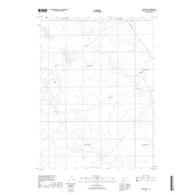
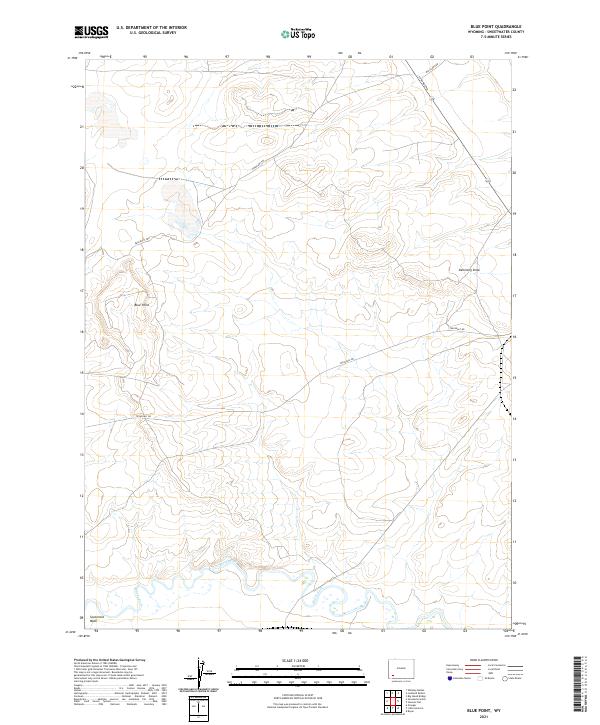
1961 Blue Point
Sweetwater County, WY
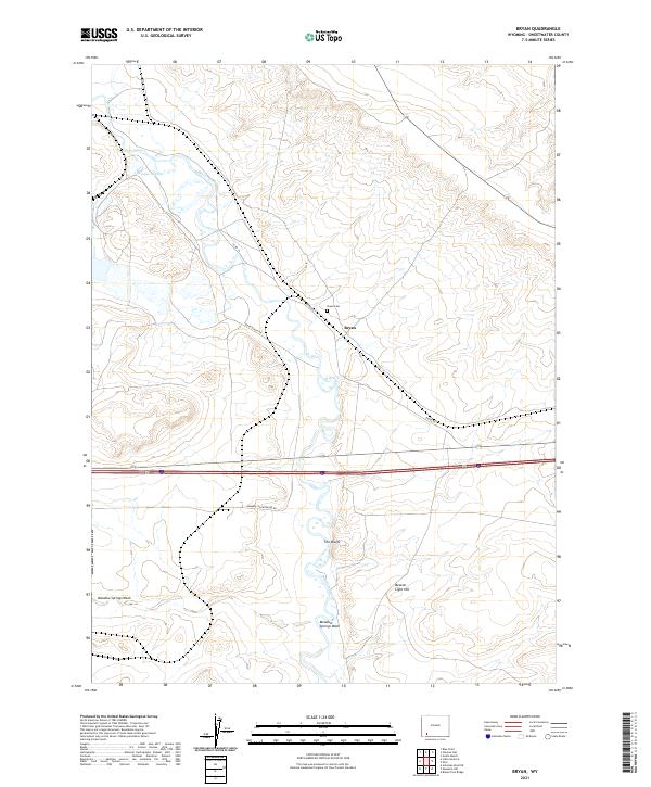
1961 Bryan
Sweetwater County, WY
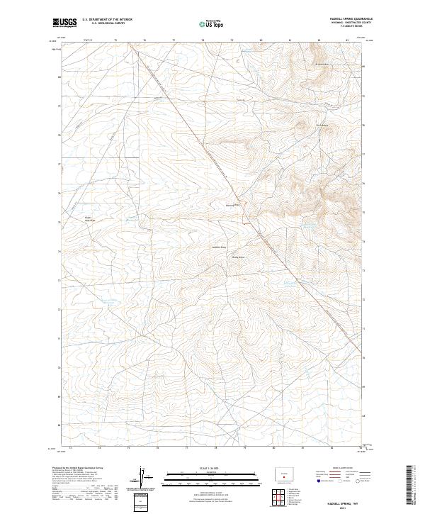
1961 Hadsell Spring
Sweetwater County, WY
1961 Kanda
Sweetwater County, WY
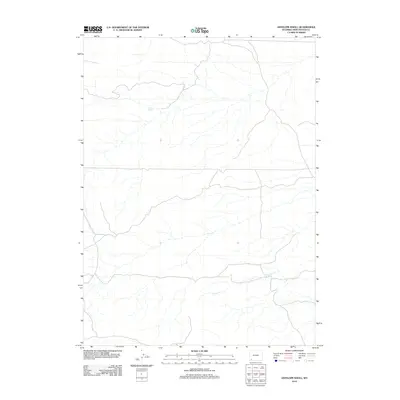
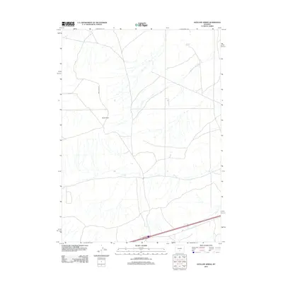
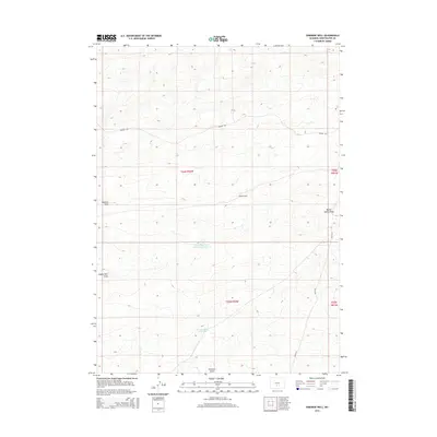
1961 Osborne Well
Sweetwater County, WY
1961 Peru
Sweetwater County, WY
1961 Pilot Butte
Sweetwater County, WY
1961 Scott Spring
Sweetwater County, WY
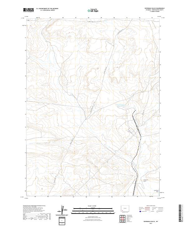
1961 Sevenmile Gulch
Sweetwater County, WY
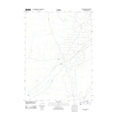
1961 Stevens Flat
Sweetwater County, WY
1963 Big Island Bridge
Sweetwater County, WY
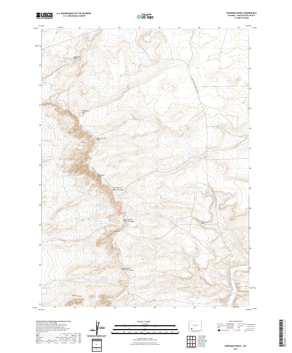
1963 Chrisman Ranch
Sweetwater County, WY
1963 Erickson-Kent Ranch
Sweetwater County, WY
1963 Four J Rim
Sweetwater County, WY
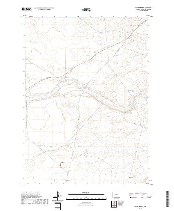
1963 Gasson Bridge
Sweetwater County, WY
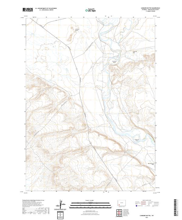
1963 Lombard Buttes
Sweetwater County, WY
1963 Maxon Ranch
Sweetwater County, WY
1963 Mc Cullen Bluff
Sweetwater County, WY
1963 Pittman Well
Sweetwater County, WY
1963 Potter Mountain
Sweetwater County, WY
1963 Red Creek Ranch
Sweetwater County, WY
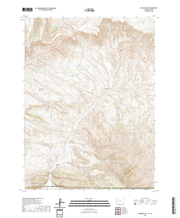
1963 Richards Gap
Sweetwater County, WY
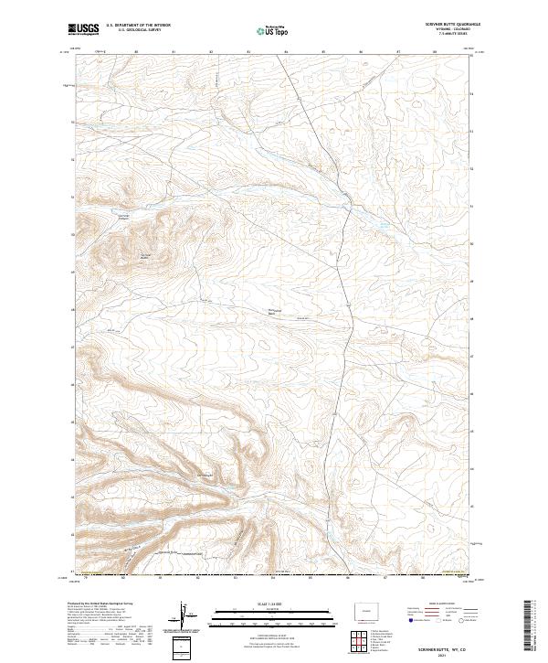
1963 Scrivner Butte
Sweetwater County, WY
1963 Thoman School
Sweetwater County, WY
1963 Titsworth Gap
Sweetwater County, WY
1963 Whiskey Buttes
Sweetwater County, WY
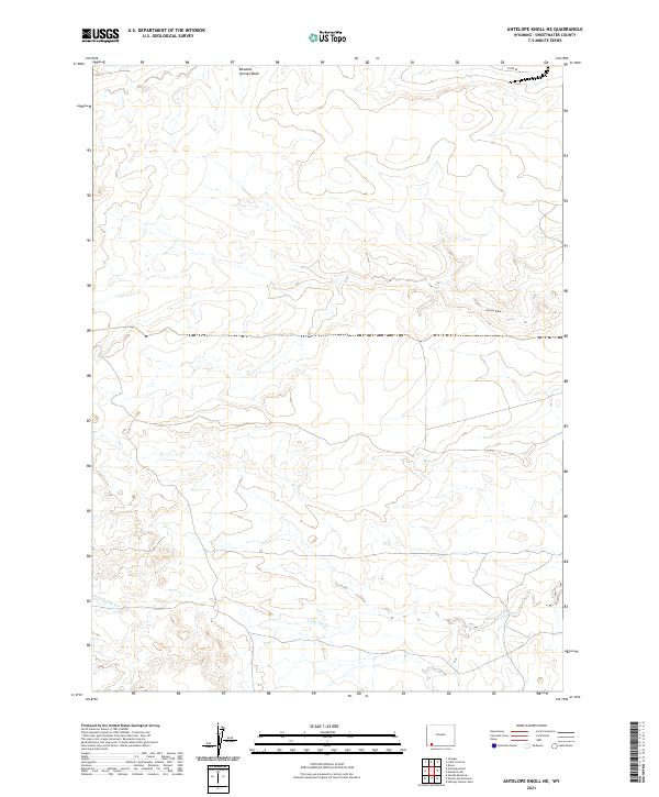
1964 Antelope Knoll NE
Sweetwater County, WY
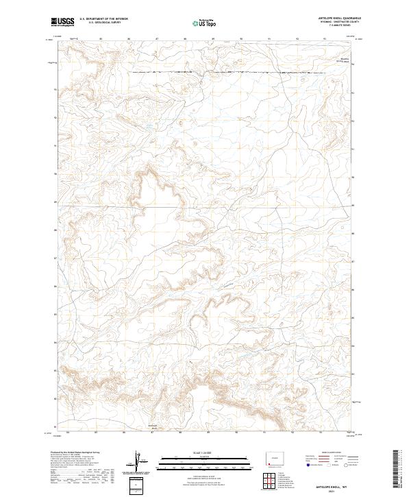
1964 Antelope Knoll
Sweetwater County, WY
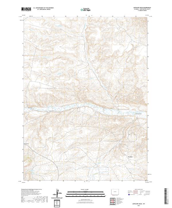
1964 Antelope Wash
Sweetwater County, WY
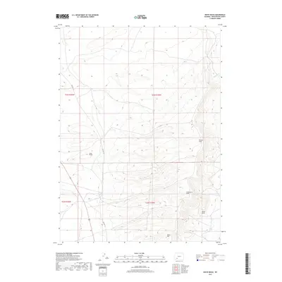
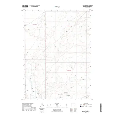
1964 Black Spring Reservoir
Sweetwater County, WY
1964 Butcher Knife Draw
Sweetwater County, WY
1964 Horse Ranch
Sweetwater County, WY
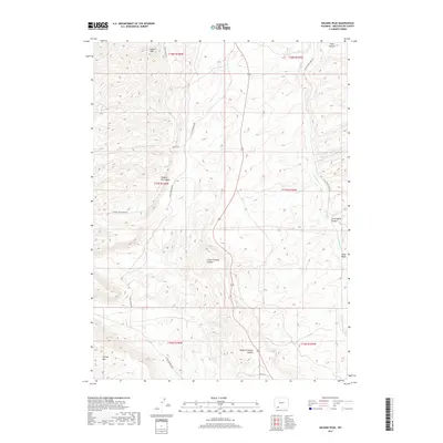
1964 Mc Kinnon
Sweetwater County, WY
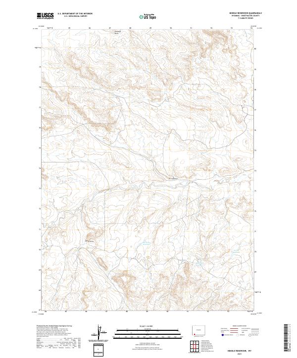
1964 Needle Reservoir
Sweetwater County, WY
1964 Soap Holes Reservoir
Sweetwater County, WY
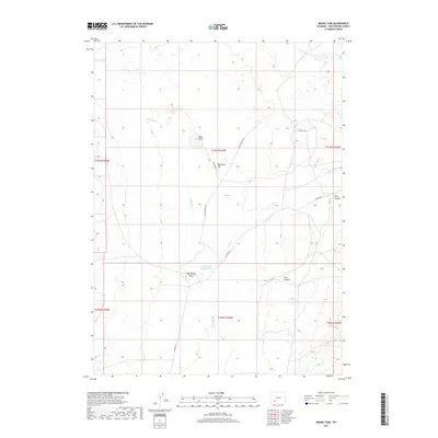
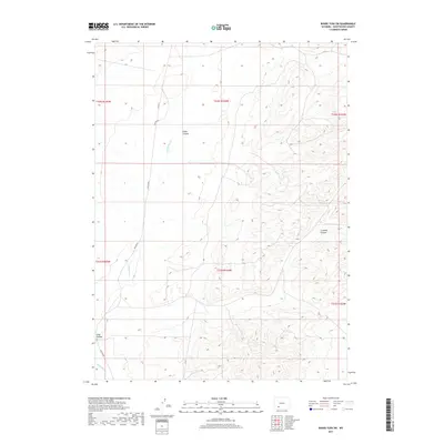
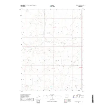
1964 Winter Fat Reservoir
Sweetwater County, WY
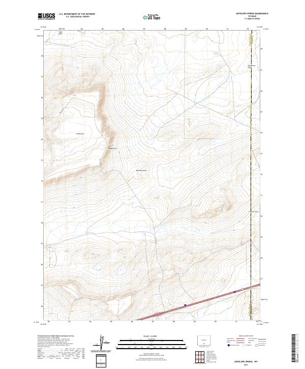
1966 Antelope Spring
Sweetwater County, WY
1966 Buckboard Crossing
Sweetwater County, WY
1966 Creston Junction
Sweetwater County, WY
1966 Creston
Sweetwater County, WY
1966 Currant Creek Ranch
Sweetwater County, WY
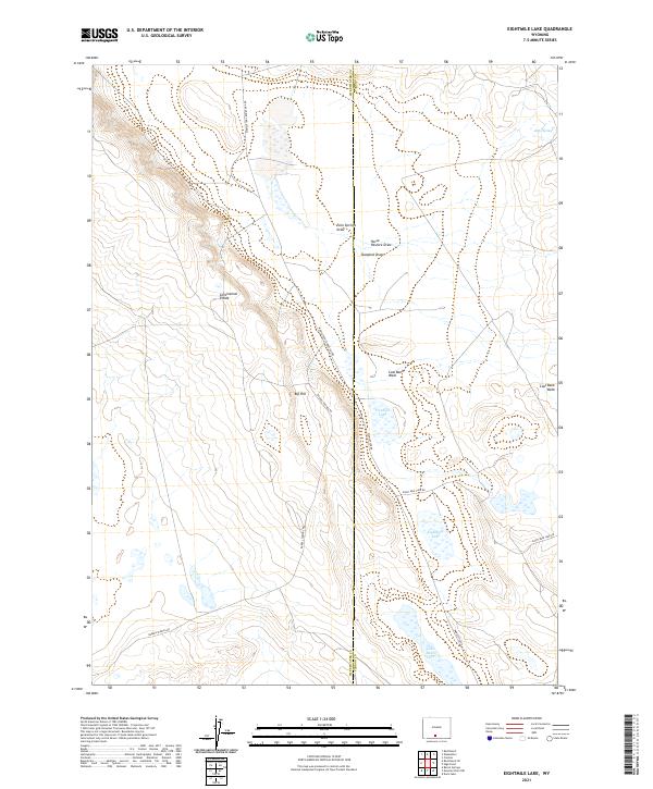
1966 Eightmile Lake
Sweetwater County, WY
1966 Firehole Basin
Sweetwater County, WY
1966 Jawbone Ranch
Sweetwater County, WY
1966 Mc Kinnon Junction
Sweetwater County, WY
1966 Monument Lake
Sweetwater County, WY
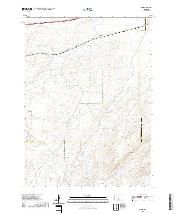
1966 Riner
Sweetwater County, WY
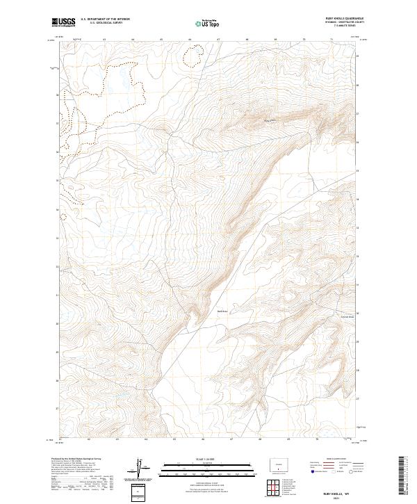
1966 Ruby Knolls
Sweetwater County, WY
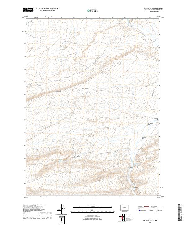
1968 Antelope Flats
Sweetwater County, WY
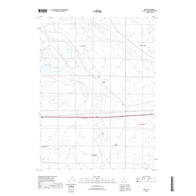
1968 Baxter
Sweetwater County, WY
1968 Bitter Creek NE
Sweetwater County, WY
1968 Bitter Creek NW
Sweetwater County, WY
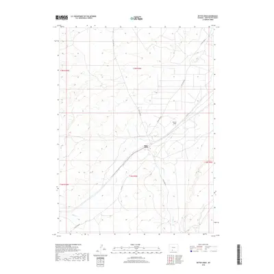
1968 Bitter Creek
Sweetwater County, WY
1968 Black Buttes
Sweetwater County, WY
1968 Blue Forest
Sweetwater County, WY
1968 Burley Draw
Sweetwater County, WY
1968 Camel Rock
Sweetwater County, WY
1968 Chicken Creek East
Sweetwater County, WY
1968 Chicken Creek SE
Sweetwater County, WY
1968 Chicken Creek SW
Sweetwater County, WY
1968 Chicken Creek West
Sweetwater County, WY
1968 Clay Buttes SE
Sweetwater County, WY
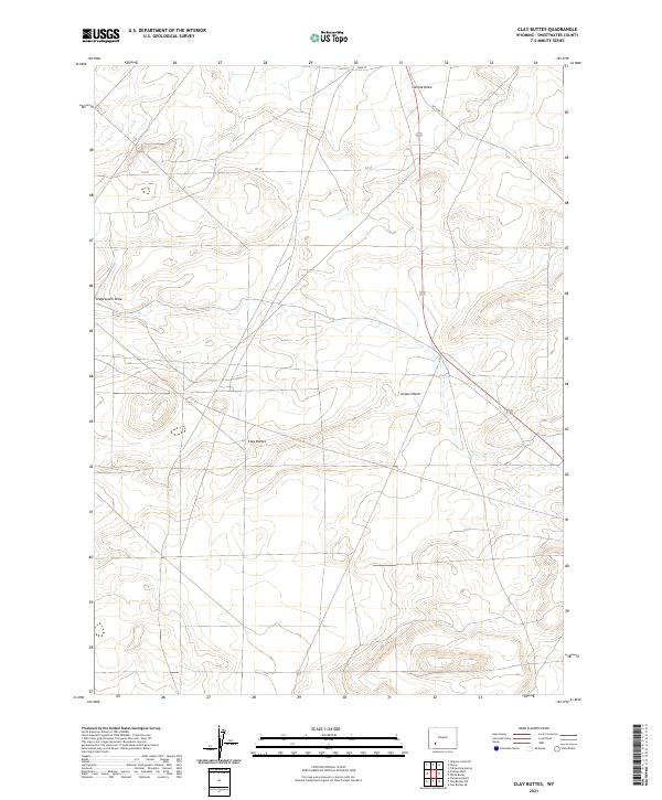
1968 Clay Buttes
Sweetwater County, WY
1968 Clay Buttes SW
Sweetwater County, WY
1968 Cooper Ridge NE
Sweetwater County, WY
1968 Earnest Butte
Sweetwater County, WY
1968 Eden Reservoir East
Sweetwater County, WY
1968 Eden Reservoir West
Sweetwater County, WY
1968 Fifteenmile Spring
Sweetwater County, WY
1968 Fourmile Knoll
Sweetwater County, WY
1968 Kappes Canyon
Sweetwater County, WY
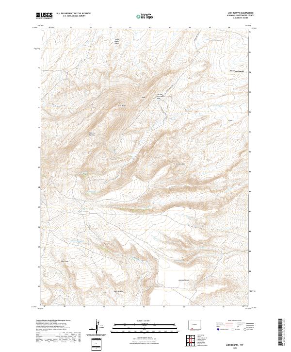
1968 Lion Bluffs
Sweetwater County, WY

1968 Monument Butte NE
Sweetwater County, WY
1968 Monument Butte
Sweetwater County, WY
1968 Mud Springs Ranch
Sweetwater County, WY
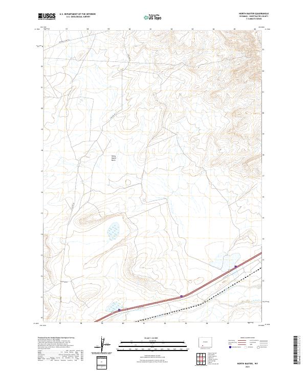
1968 North Baxter
Sweetwater County, WY
1968 Pine Butte
Sweetwater County, WY
1968 Point Of Rocks SE
Sweetwater County, WY
1968 Point Of Rocks
Sweetwater County, WY
1968 Point Of Rocks SW
Sweetwater County, WY
1968 Sand Butte Rim NW
Sweetwater County, WY
1968 Sand Butte Rim SE
Sweetwater County, WY
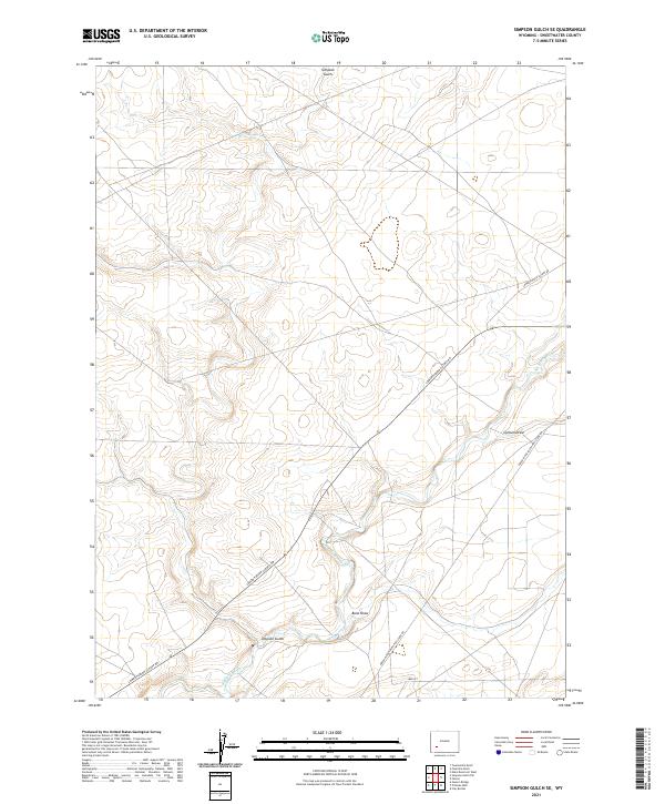
1968 Simpson Gulch SE
Sweetwater County, WY
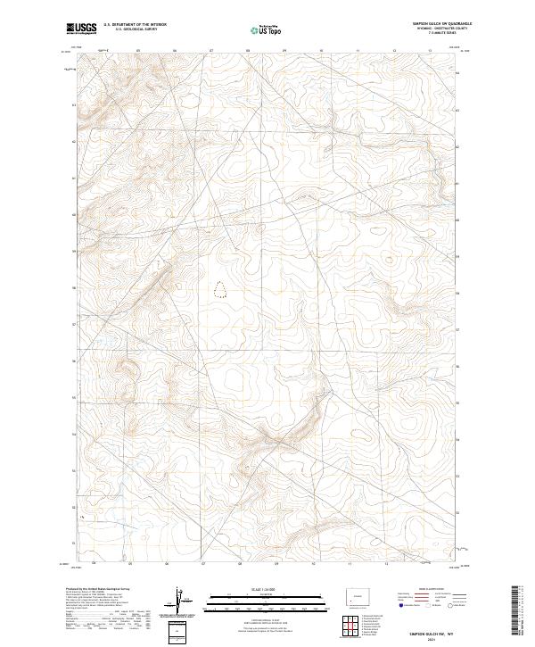
1968 Simpson Gulch SW
Sweetwater County, WY
1968 South Baxter
Sweetwater County, WY
1968 Thayer Junction
Sweetwater County, WY
1968 Twelvemile Knoll
Sweetwater County, WY
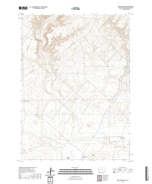
1968 Twelvemile Sink
Sweetwater County, WY
1968 White Rocks
Sweetwater County, WY
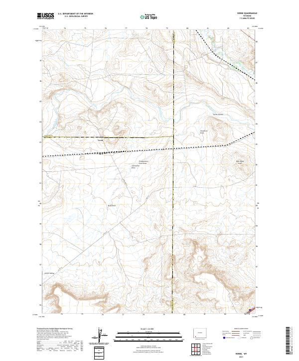
1969 Verne
Sweetwater County, WY
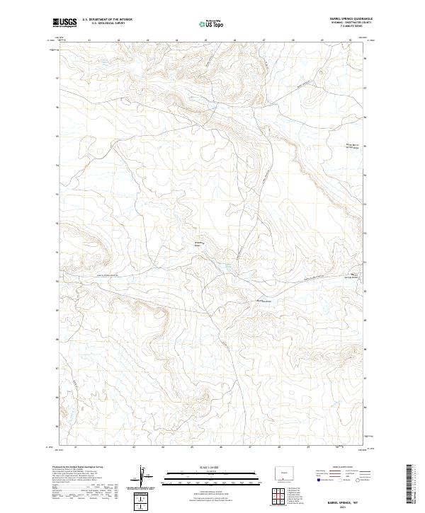
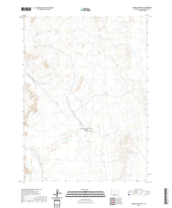
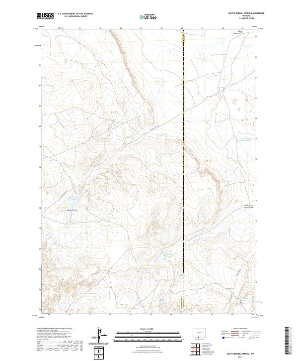
1970 Barrel Springs
Sweetwater County, WY

1970 Barrel Springs SW
Sweetwater County, WY
1970 Cow Creek Reservoir
Sweetwater County, WY
1970 Cow Creek Reservoir SW
Sweetwater County, WY
1970 Desert Springs
Sweetwater County, WY
1970 Dripping Rock Spring
Sweetwater County, WY
1970 Fort La Clede NE
Sweetwater County, WY
1970 Fort La Clede
Sweetwater County, WY
1970 Haystack Flats
Sweetwater County, WY
1970 J O Dugway
Sweetwater County, WY
1970 Kinney Spring
Sweetwater County, WY
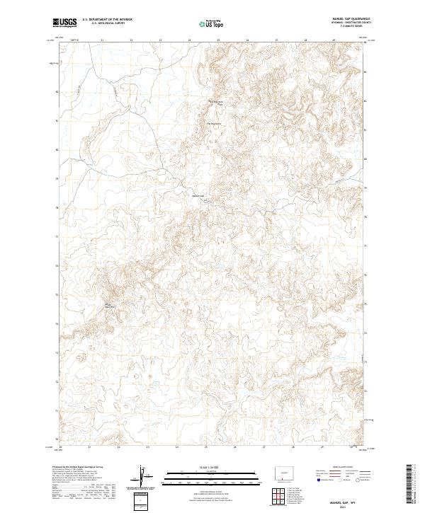
1970 Manuel Gap
Sweetwater County, WY
1970 Mc Pherson Springs
Sweetwater County, WY
1970 Mexican Flats NW
Sweetwater County, WY
1970 Monument Valley
Sweetwater County, WY
1970 Powder Mountain NE
Sweetwater County, WY
1970 Powder Mountain
Sweetwater County, WY
1970 Prehistoric Rim
Sweetwater County, WY
1970 Red Desert NW
Sweetwater County, WY
1970 Red Desert SE
Sweetwater County, WY
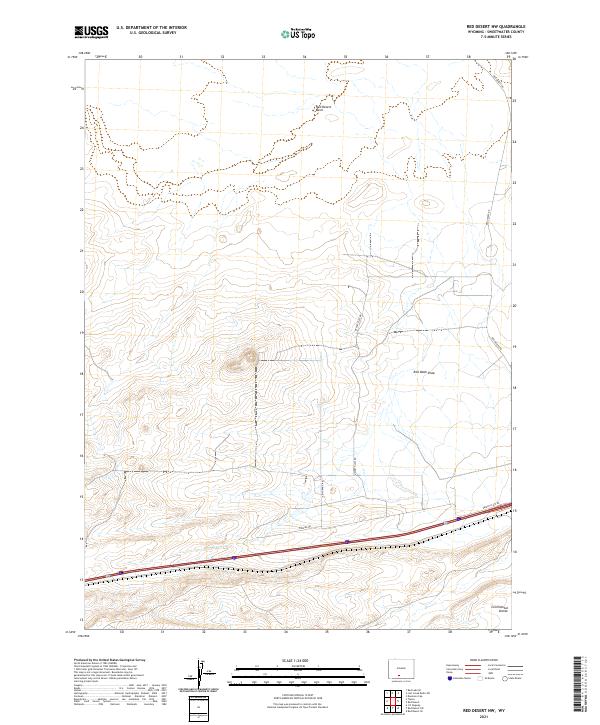
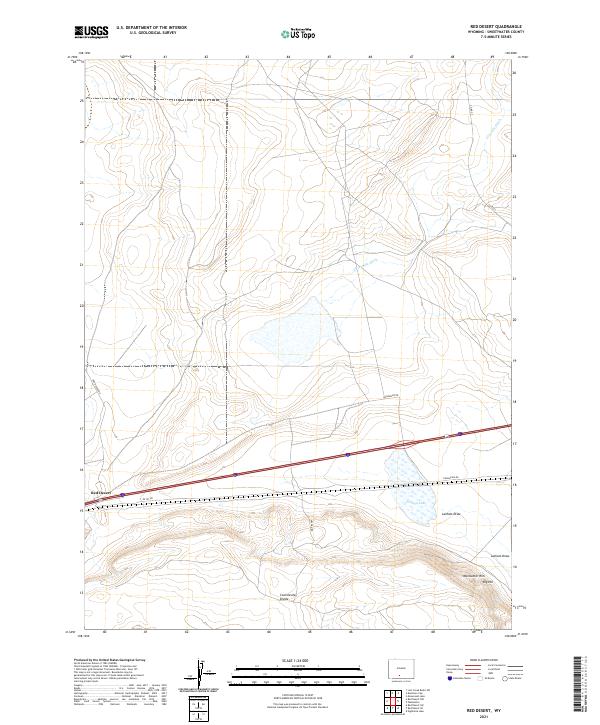
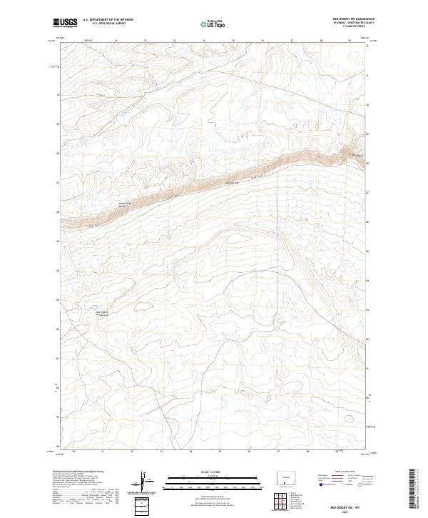
1970 Red Desert
Sweetwater County, WY
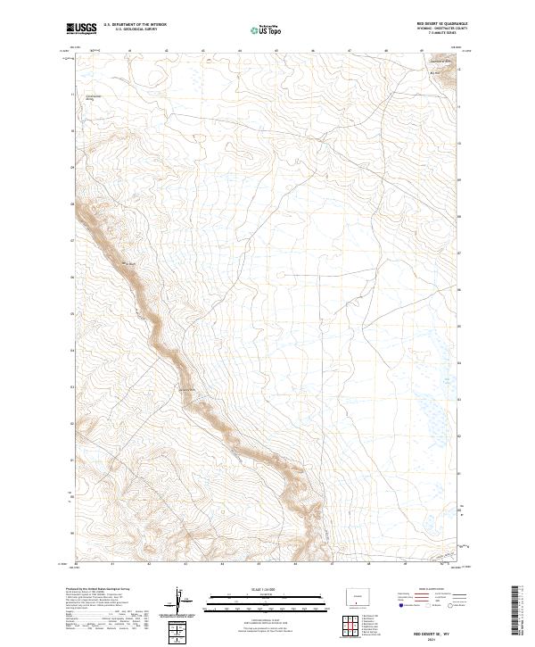
1970 Red Desert SW
Sweetwater County, WY
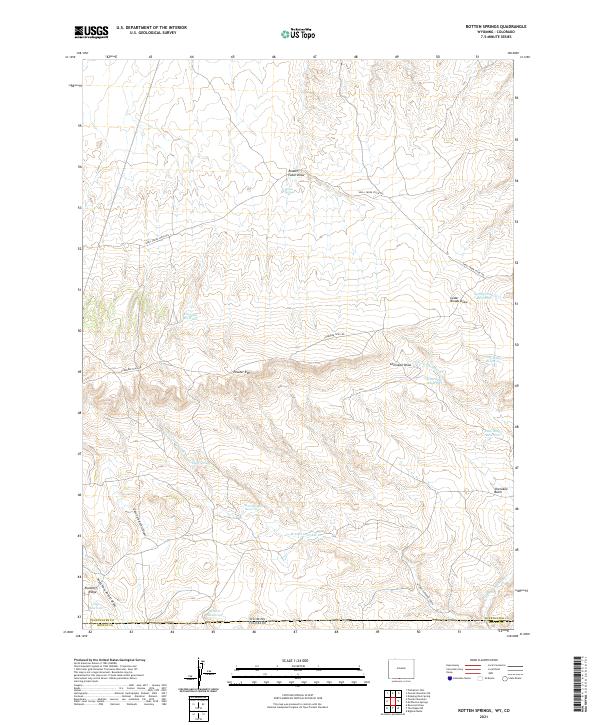
1970 Rotten Springs
Sweetwater County, WY
1970 Salazar Butte
Sweetwater County, WY
1970 South Barrel Spring
Sweetwater County, WY
1970 Tipton
Sweetwater County, WY
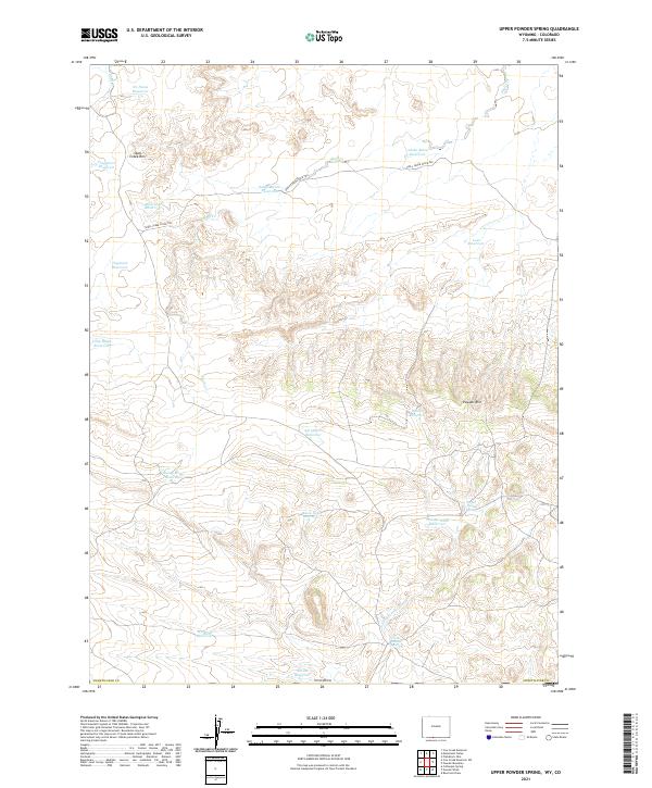
1970 Upper Powder Spring
Sweetwater County, WY
1980 Firehole Canyon
Sweetwater County, WY
1980 Red Desert Basin
Sweetwater County, WY
1984 South Pass
Sweetwater County, WY
1986 Black Rock Flat East
Sweetwater County, WY
1986 Black Rock Flat West
Sweetwater County, WY
1986 Black Rock North
Sweetwater County, WY
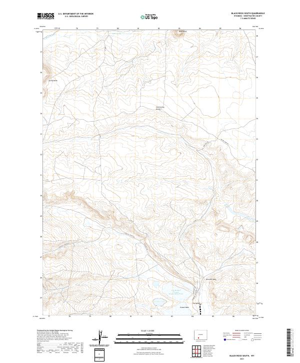
1986 Black Rock South
Sweetwater County, WY
1986 Boars Tusk
Sweetwater County, WY
1986 Boars Tusk SW
Sweetwater County, WY
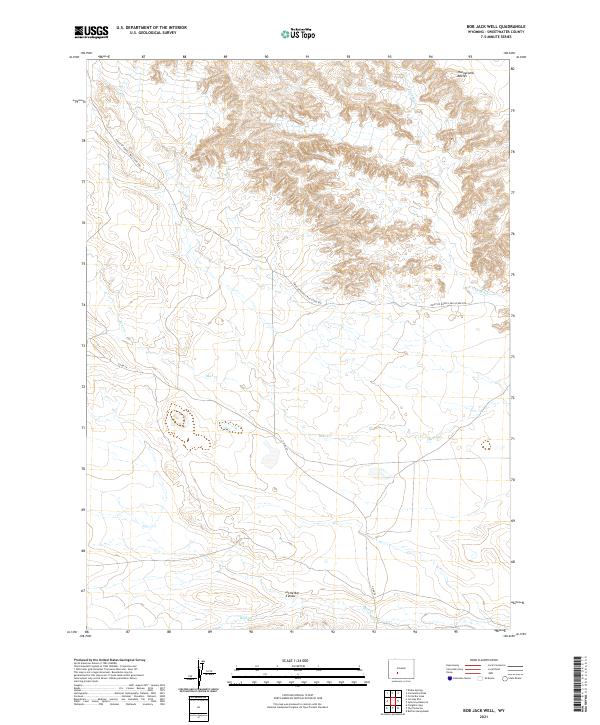
1986 Bob Jack Well
Sweetwater County, WY
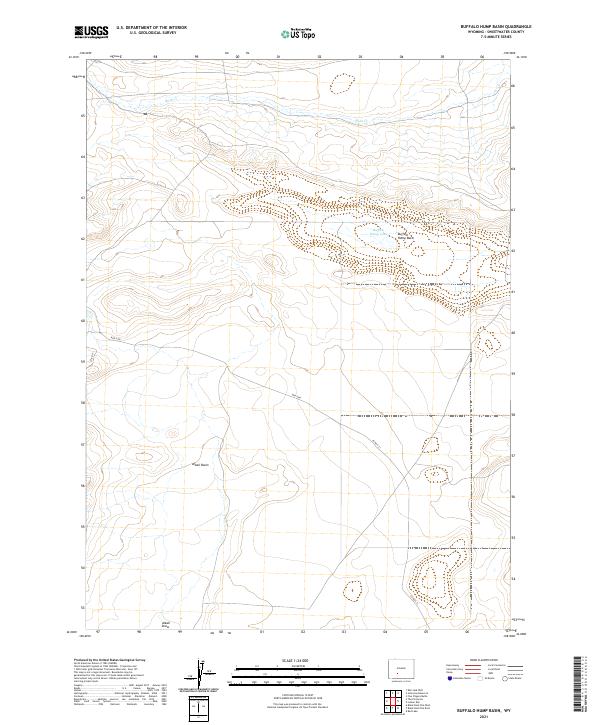
1986 Buffalo Hump Basin
Sweetwater County, WY
1986 Deer Butte
Sweetwater County, WY
1986 Essex Mountain
Sweetwater County, WY
1986 Freighter Gap
Sweetwater County, WY
1986 Joe Hay Rim
Sweetwater County, WY
1986 John Hay Reservoir
Sweetwater County, WY
1986 Monument Ridge
Sweetwater County, WY
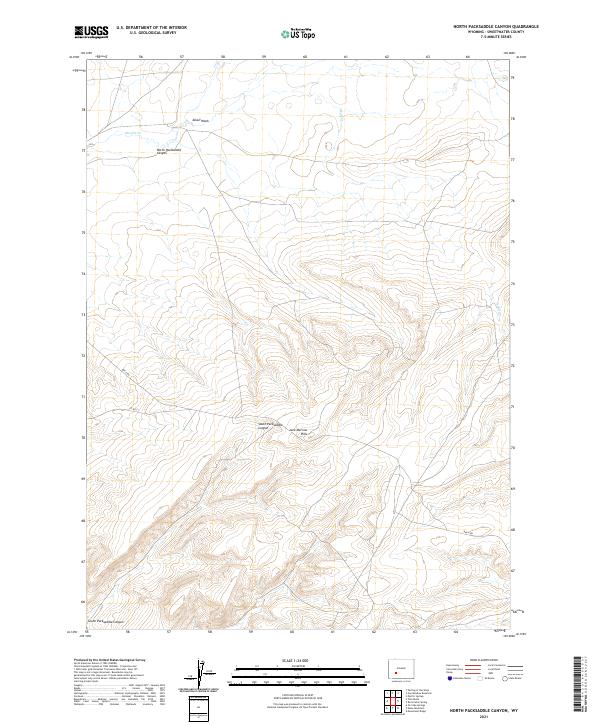
1986 North Packsaddle Canyon
Sweetwater County, WY
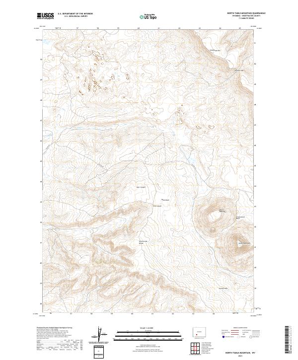
1986 North Table Mountain
Sweetwater County, WY
1986 Ox Yoke Springs
Sweetwater County, WY
1986 Rock Cabin Spring
Sweetwater County, WY
1986 South Superior
Sweetwater County, WY
1986 Steamboat Mountain
Sweetwater County, WY
1986 Tenmile Rim
Sweetwater County, WY
1986 The Pinnacles
Sweetwater County, WY
1986 Twelvemile Well
Sweetwater County, WY
1987 Big Ridge
Sweetwater County, WY
1987 Blacks Fork Bridge
Sweetwater County, WY
1987 Devils Playground
Sweetwater County, WY
1987 Firehole Basin
Sweetwater County, WY
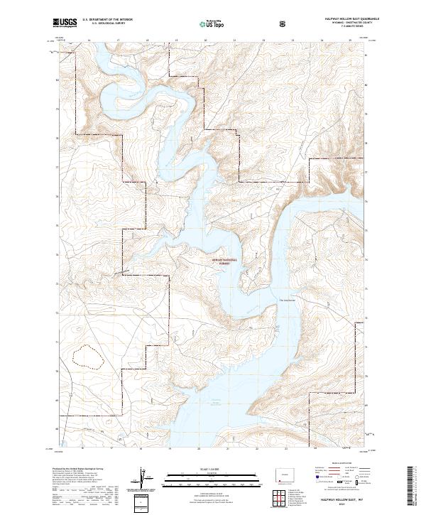
1987 Halfway Hollow East
Sweetwater County, WY

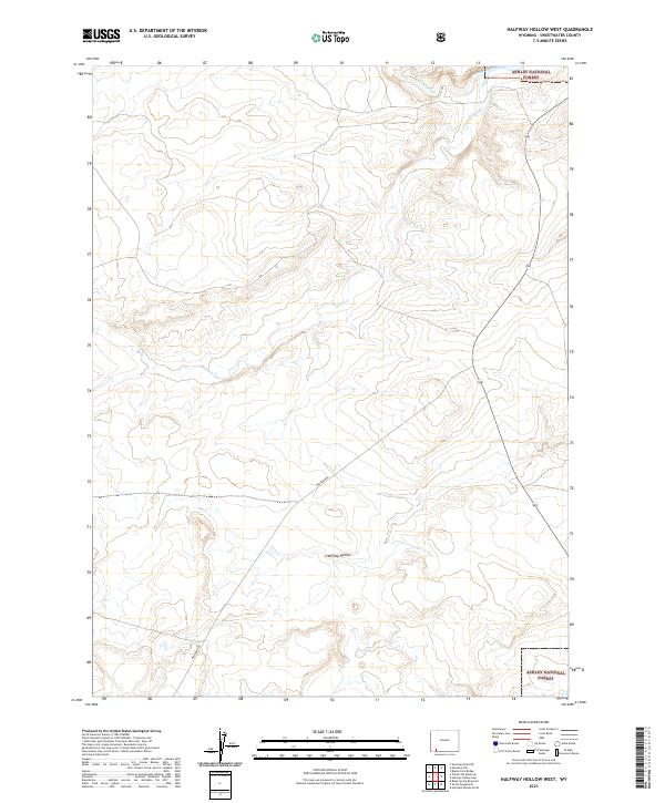
1987 Halfway Hollow West
Sweetwater County, WY
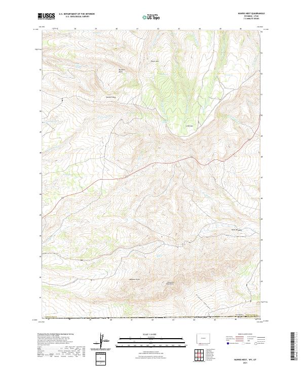
1987 Hawks Nest
Sweetwater County, WY
1987 Haystack Buttes South
Sweetwater County, WY
1987 Linwood Canyon
Sweetwater County, WY
1987 Massacre Hill
Sweetwater County, WY
1987 Minnies Gap
Sweetwater County, WY
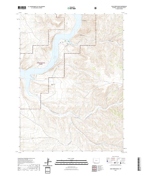
1987 Sage Creek Basin
Sweetwater County, WY
1987 Sugarloaf Basin
Sweetwater County, WY
1987 Whalen Butte
Sweetwater County, WY
1987 Wilkins Peak
Sweetwater County, WY
1988 Cyclone Draw
Sweetwater County, WY
1988 Eagles Nest Draw
Sweetwater County, WY
1988 Five Fingers Butte NE
Sweetwater County, WY
1988 Five Fingers Butte
Sweetwater County, WY
1988 Lost Creek Lake
Sweetwater County, WY
1988 Osborne Draw
Sweetwater County, WY
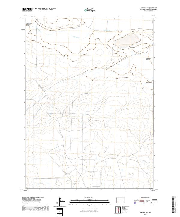
1988 Red Lake NE
Sweetwater County, WY
1988 Red Lake SE
Sweetwater County, WY
1988 Red Lake
Sweetwater County, WY
1988 Red Lake SW
Sweetwater County, WY
1989 Bush Lake
Sweetwater County, WY
1989 Dennison Cap
Sweetwater County, WY
1989 Lost Creek Butte NW
Sweetwater County, WY
1989 Lost Creek Butte
Sweetwater County, WY
1989 Lost Creek Butte SW
Sweetwater County, WY
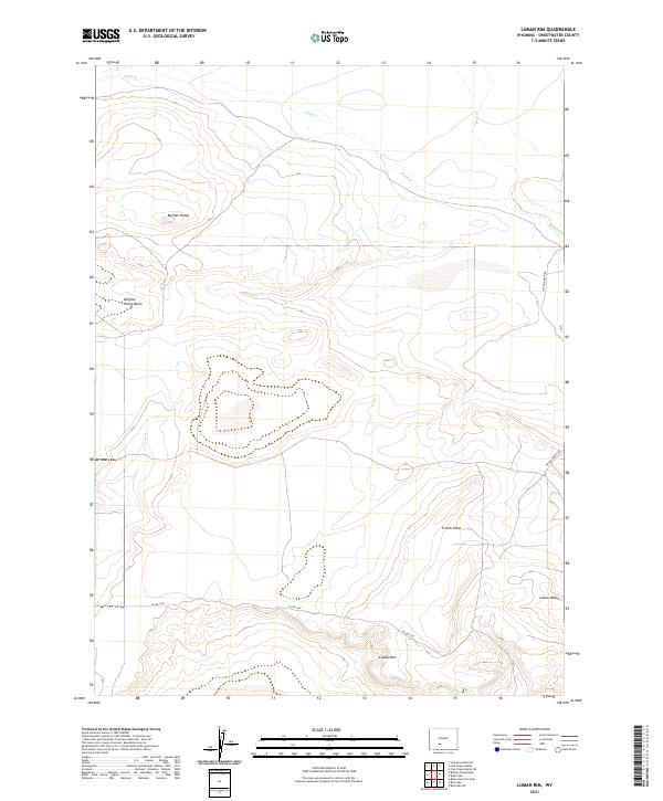
1989 Luman Rim
Sweetwater County, WY
1996 Blacks Fork Bridge
Sweetwater County, WY

1996 Devils Playground
Sweetwater County, WY
1996 Halfway Hollow East
Sweetwater County, WY
1996 Halfway Hollow West
Sweetwater County, WY
1996 Haystack Buttes North
Sweetwater County, WY
1996 Haystack Buttes South
Sweetwater County, WY
1996 Linwood Canyon
Sweetwater County, WY
1996 Massacre Hill
Sweetwater County, WY
1996 Sage Creek Basin
Sweetwater County, WY
1996 Whalen Butte
Sweetwater County, WY
2010 Chicken Creek SE
Sweetwater County, WY
2010 Chicken Creek SW
Sweetwater County, WY
2010 Cow Creek Reservoir SW
Sweetwater County, WY
2010 Four J Rim
Sweetwater County, WY
2010 McPherson Springs
Sweetwater County, WY
2010 Powder Mountain
Sweetwater County, WY
2010 Rotten Springs
Sweetwater County, WY
2010 Scrivner Butte
Sweetwater County, WY
2010 Upper Powder Spring
Sweetwater County, WY
2011 Hawks Nest
Sweetwater County, WY
2011 Red Creek Ranch
Sweetwater County, WY
2011 Richards Gap
Sweetwater County, WY
2012 Antelope Flats
Sweetwater County, WY
2012 Antelope Knoll NE
Sweetwater County, WY
2012 Antelope Knoll
Sweetwater County, WY
2012 Antelope Reservoir
Sweetwater County, WY
2012 Antelope Spring
Sweetwater County, WY
2012 Antelope Wash
Sweetwater County, WY
2012 Austin Ranch
Sweetwater County, WY
2012 Barrel Springs
Sweetwater County, WY
2012 Barrel Springs SW
Sweetwater County, WY
2012 Battle Spring
Sweetwater County, WY
2012 Baxter
Sweetwater County, WY
2012 Big Island Bridge
Sweetwater County, WY
2012 Big Ridge
Sweetwater County, WY
2012 Bitter Creek NE
Sweetwater County, WY
2012 Bitter Creek NW
Sweetwater County, WY
2012 Bitter Creek
Sweetwater County, WY
2012 Black Buttes
Sweetwater County, WY
2012 Black Rock Flat East
Sweetwater County, WY
2012 Black Rock Flat West
Sweetwater County, WY
2012 Black Rock North
Sweetwater County, WY
2012 Black Rock South
Sweetwater County, WY
2012 Blacks Fork Bridge
Sweetwater County, WY
2012 Black Spring Reservoir
Sweetwater County, WY
2012 Blue Forest
Sweetwater County, WY
2012 Blue Point
Sweetwater County, WY
2012 Boars Tusk
Sweetwater County, WY
2012 Boars Tusk SW
Sweetwater County, WY
2012 Bob Jack Well
Sweetwater County, WY
2012 Bryan
Sweetwater County, WY
2012 Buck Draw
Sweetwater County, WY
2012 Buffalo Hump Basin
Sweetwater County, WY
2012 Bull Springs
Sweetwater County, WY
2012 Burley Draw
Sweetwater County, WY
2012 Bush Lake
Sweetwater County, WY
2012 Butcher Knife Draw
Sweetwater County, WY
2012 Camel Rock
Sweetwater County, WY
2012 Chicken Creek East
Sweetwater County, WY
2012 Chicken Creek SE
Sweetwater County, WY
2012 Chicken Creek SW
Sweetwater County, WY
2012 Chicken Creek West
Sweetwater County, WY
2012 Chicken Spring
Sweetwater County, WY
2012 Chrisman Ranch
Sweetwater County, WY
2012 Clay Buttes SE
Sweetwater County, WY
2012 Clay Buttes
Sweetwater County, WY
2012 Clay Buttes SW
Sweetwater County, WY
2012 Cooper Ridge NE
Sweetwater County, WY
2012 Cow Creek Reservoir
Sweetwater County, WY
2012 Cow Creek Reservoir SW
Sweetwater County, WY
2012 Creston Junction
Sweetwater County, WY
2012 Creston
Sweetwater County, WY
2012 Cyclone Draw
Sweetwater County, WY
2012 Deer Butte
Sweetwater County, WY
2012 Dennison Cap
Sweetwater County, WY
2012 Desert Springs
Sweetwater County, WY

2012 Devils Playground
Sweetwater County, WY
2012 Dripping Rock Spring
Sweetwater County, WY
2012 Eagles Nest Draw
Sweetwater County, WY
2012 Earnest Butte
Sweetwater County, WY
2012 Eden Reservoir East
Sweetwater County, WY
2012 Eden Reservoir West
Sweetwater County, WY
2012 Eightmile Lake
Sweetwater County, WY
2012 Erickson-Kent Ranch
Sweetwater County, WY
2012 Essex Mountain
Sweetwater County, WY
2012 Fifteenmile Spring
Sweetwater County, WY
2012 Firehole Basin
Sweetwater County, WY
2012 Five Fingers Butte NE
Sweetwater County, WY
2012 Five Fingers Butte
Sweetwater County, WY
2012 Fort La Clede NE
Sweetwater County, WY
2012 Fort La Clede
Sweetwater County, WY
2012 Four J Rim
Sweetwater County, WY
2012 Fourmile Knoll
Sweetwater County, WY
2012 Freighter Gap
Sweetwater County, WY
2012 Gasson Bridge
Sweetwater County, WY
2012 Hadsell Spring
Sweetwater County, WY
2012 Halfway Hollow East
Sweetwater County, WY
2012 Halfway Hollow West
Sweetwater County, WY
2012 Hansen Lake NE
Sweetwater County, WY
2012 Hansen Lake
Sweetwater County, WY
2012 Hawks Nest
Sweetwater County, WY
2012 Haystack Buttes North
Sweetwater County, WY
2012 Haystack Buttes South
Sweetwater County, WY
2012 Haystack Flats
Sweetwater County, WY
2012 Horse Ranch
Sweetwater County, WY
2012 Jawbone Ranch
Sweetwater County, WY
2012 J O Dugway
Sweetwater County, WY
2012 Joe Hay Rim
Sweetwater County, WY
2012 John Hay Reservoir
Sweetwater County, WY
2012 Kanda
Sweetwater County, WY
2012 Kappes Canyon
Sweetwater County, WY
2012 Kinney Spring
Sweetwater County, WY
2012 Larsen Knoll
Sweetwater County, WY
2012 Linwood Canyon
Sweetwater County, WY
2012 Lion Bluffs
Sweetwater County, WY
2012 Lombard Buttes
Sweetwater County, WY
2012 Lost Creek Butte NW
Sweetwater County, WY
2012 Lost Creek Butte
Sweetwater County, WY
2012 Lost Creek Butte SW
Sweetwater County, WY
2012 Lost Creek Lake
Sweetwater County, WY
2012 Luman Rim
Sweetwater County, WY
2012 Manuel Gap
Sweetwater County, WY
2012 Massacre Hill
Sweetwater County, WY
2012 Maxon Ranch
Sweetwater County, WY
2012 McCullen Bluff
Sweetwater County, WY
2012 McPherson Springs
Sweetwater County, WY
2012 Mexican Flats NW
Sweetwater County, WY
2012 Minnies Gap
Sweetwater County, WY
2012 Monument Butte NE
Sweetwater County, WY
2012 Monument Butte
Sweetwater County, WY
2012 Monument Lake
Sweetwater County, WY
2012 Monument Ridge
Sweetwater County, WY
2012 Monument Valley
Sweetwater County, WY
2012 Mud Springs Ranch
Sweetwater County, WY
2012 Needle Reservoir
Sweetwater County, WY
2012 North Baxter
Sweetwater County, WY
2012 North Packsaddle Canyon
Sweetwater County, WY
2012 North Table Mountain
Sweetwater County, WY
2012 Osborne Draw
Sweetwater County, WY
2012 Osborne Well
Sweetwater County, WY
2012 Ox Yoke Springs
Sweetwater County, WY
2012 Peru
Sweetwater County, WY
2012 Pilot Butte
Sweetwater County, WY
2012 Pine Butte
Sweetwater County, WY
2012 Pittman Well
Sweetwater County, WY
2012 Point of Rocks SE
Sweetwater County, WY
2012 Point of Rocks SW
Sweetwater County, WY
2012 Potter Mountain
Sweetwater County, WY
2012 Powder Mountain NE
Sweetwater County, WY
2012 Powder Mountain
Sweetwater County, WY
2012 Prehistoric Rim
Sweetwater County, WY
2012 Red Creek Ranch
Sweetwater County, WY
2012 Red Desert NW
Sweetwater County, WY
2012 Red Desert SE
Sweetwater County, WY
2012 Red Desert
Sweetwater County, WY
2012 Red Desert SW
Sweetwater County, WY
2012 Red Lake NE
Sweetwater County, WY

2012 Red Lake SE
Sweetwater County, WY
2012 Red Lake
Sweetwater County, WY
2012 Red Lake SW
Sweetwater County, WY
2012 Richards Gap
Sweetwater County, WY
2012 Riner
Sweetwater County, WY
2012 Rock Cabin Spring
Sweetwater County, WY
2012 Rotten Springs
Sweetwater County, WY
2012 Ruby Knolls
Sweetwater County, WY
2012 Sage Creek Basin
Sweetwater County, WY
2012 Salazar Butte
Sweetwater County, WY
2012 Sand Butte Rim NW
Sweetwater County, WY
2012 Sand Butte Rim SE
Sweetwater County, WY
2012 Scott Spring
Sweetwater County, WY
2012 Scrivner Butte
Sweetwater County, WY
2012 Sevenmile Gulch
Sweetwater County, WY
2012 Simpson Gulch SE
Sweetwater County, WY
2012 Simpson Gulch SW
Sweetwater County, WY
2012 Soap Holes Reservoir
Sweetwater County, WY
2012 Sooner Reservoir
Sweetwater County, WY
2012 South Barrel Spring
Sweetwater County, WY
2012 South Baxter
Sweetwater County, WY
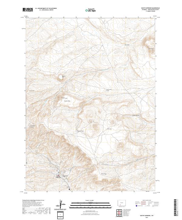
2012 South Superior
Sweetwater County, WY
2012 Steamboat Mountain
Sweetwater County, WY
2012 Stevens Flat
Sweetwater County, WY
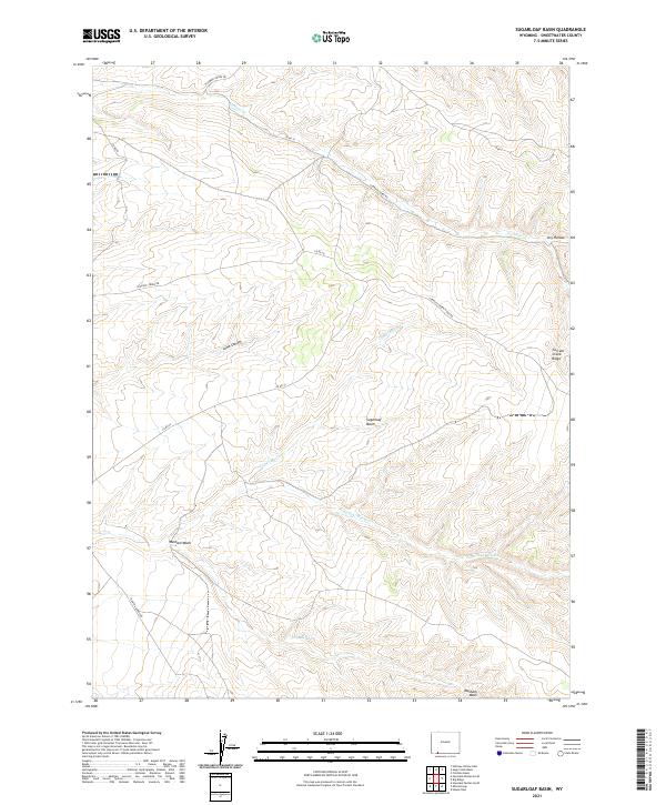
2012 Sugarloaf Basin
Sweetwater County, WY
2012 Tenmile Rim
Sweetwater County, WY
2012 Thayer Junction
Sweetwater County, WY
2012 The Pinnacles
Sweetwater County, WY
2012 Thoman School
Sweetwater County, WY
2012 Tipton
Sweetwater County, WY
2012 Titsworth Gap
Sweetwater County, WY
2012 Tule Butte
Sweetwater County, WY
2012 Twelvemile Knoll
Sweetwater County, WY
2012 Twelvemile Sink
Sweetwater County, WY
2012 Twelvemile Well
Sweetwater County, WY
2012 Upper Powder Spring
Sweetwater County, WY
2012 Verne
Sweetwater County, WY
2012 Whalen Butte
Sweetwater County, WY
2012 Whiskey Buttes
Sweetwater County, WY
2012 White Rocks
Sweetwater County, WY
2012 Wilkins Peak
Sweetwater County, WY
2012 Winter Fat Reservoir
Sweetwater County, WY
2015 Antelope Flats
Sweetwater County, WY
2015 Antelope Knoll NE
Sweetwater County, WY
2015 Antelope Knoll
Sweetwater County, WY
2015 Antelope Reservoir
Sweetwater County, WY
2015 Antelope Spring
Sweetwater County, WY
2015 Antelope Wash
Sweetwater County, WY
2015 Austin Ranch
Sweetwater County, WY
2015 Barrel Springs
Sweetwater County, WY
2015 Barrel Springs SW
Sweetwater County, WY
2015 Battle Spring
Sweetwater County, WY
2015 Baxter
Sweetwater County, WY
2015 Big Island Bridge
Sweetwater County, WY
2015 Big Ridge
Sweetwater County, WY
2015 Bitter Creek NE
Sweetwater County, WY
2015 Bitter Creek NW
Sweetwater County, WY
2015 Bitter Creek
Sweetwater County, WY
2015 Black Buttes
Sweetwater County, WY
2015 Black Rock Flat East
Sweetwater County, WY
2015 Black Rock Flat West
Sweetwater County, WY
2015 Black Rock North
Sweetwater County, WY
2015 Black Rock South
Sweetwater County, WY
2015 Blacks Fork Bridge
Sweetwater County, WY
2015 Black Spring Reservoir
Sweetwater County, WY
2015 Blue Forest
Sweetwater County, WY
2015 Blue Point
Sweetwater County, WY

2015 Boars Tusk
Sweetwater County, WY
2015 Boars Tusk SW
Sweetwater County, WY
2015 Bob Jack Well
Sweetwater County, WY
2015 Bryan
Sweetwater County, WY
2015 Buck Draw
Sweetwater County, WY
2015 Buffalo Hump Basin
Sweetwater County, WY
2015 Bull Springs
Sweetwater County, WY

2015 Burley Draw
Sweetwater County, WY
2015 Bush Lake
Sweetwater County, WY
2015 Butcher Knife Draw
Sweetwater County, WY
2015 Camel Rock
Sweetwater County, WY
2015 Chicken Creek East
Sweetwater County, WY
2015 Chicken Creek SE
Sweetwater County, WY
2015 Chicken Creek SW
Sweetwater County, WY
2015 Chicken Creek West
Sweetwater County, WY
2015 Chicken Spring
Sweetwater County, WY
2015 Chrisman Ranch
Sweetwater County, WY
2015 Clay Buttes SE
Sweetwater County, WY
2015 Clay Buttes
Sweetwater County, WY
2015 Clay Buttes SW
Sweetwater County, WY
2015 Cooper Ridge NE
Sweetwater County, WY
2015 Cow Creek Reservoir
Sweetwater County, WY
2015 Cow Creek Reservoir SW
Sweetwater County, WY
2015 Creston Junction
Sweetwater County, WY
2015 Creston
Sweetwater County, WY
2015 Cyclone Draw
Sweetwater County, WY
2015 Deer Butte
Sweetwater County, WY
2015 Dennison Cap
Sweetwater County, WY
2015 Desert Springs
Sweetwater County, WY
2015 Devils Playground
Sweetwater County, WY
2015 Dripping Rock Spring
Sweetwater County, WY
2015 Eagles Nest Draw
Sweetwater County, WY
2015 Earnest Butte
Sweetwater County, WY
2015 Eden Reservoir East
Sweetwater County, WY
2015 Eden Reservoir West
Sweetwater County, WY
2015 Eightmile Lake
Sweetwater County, WY
2015 Erickson-Kent Ranch
Sweetwater County, WY
2015 Essex Mountain
Sweetwater County, WY
2015 Fifteenmile Spring
Sweetwater County, WY
2015 Firehole Basin
Sweetwater County, WY
2015 Five Fingers Butte NE
Sweetwater County, WY
2015 Five Fingers Butte
Sweetwater County, WY
2015 Fort La Clede NE
Sweetwater County, WY
2015 Fort La Clede
Sweetwater County, WY
2015 Four J Rim
Sweetwater County, WY
2015 Fourmile Knoll
Sweetwater County, WY
2015 Freighter Gap
Sweetwater County, WY
2015 Gasson Bridge
Sweetwater County, WY
2015 Hadsell Spring
Sweetwater County, WY
2015 Halfway Hollow East
Sweetwater County, WY
2015 Halfway Hollow West
Sweetwater County, WY
2015 Hansen Lake NE
Sweetwater County, WY
2015 Hansen Lake
Sweetwater County, WY
2015 Hawks Nest
Sweetwater County, WY
2015 Haystack Buttes North
Sweetwater County, WY
2015 Haystack Buttes South
Sweetwater County, WY
2015 Haystack Flats
Sweetwater County, WY
2015 Horse Ranch
Sweetwater County, WY
2015 Jawbone Ranch
Sweetwater County, WY
2015 J O Dugway
Sweetwater County, WY
2015 Joe Hay Rim
Sweetwater County, WY
2015 John Hay Reservoir
Sweetwater County, WY
2015 Kanda
Sweetwater County, WY
2015 Kappes Canyon
Sweetwater County, WY
2015 Kinney Spring
Sweetwater County, WY
2015 Larsen Knoll
Sweetwater County, WY
2015 Linwood Canyon
Sweetwater County, WY
2015 Lion Bluffs
Sweetwater County, WY
2015 Lombard Buttes
Sweetwater County, WY
2015 Lost Creek Butte NW
Sweetwater County, WY
2015 Lost Creek Butte
Sweetwater County, WY
2015 Lost Creek Butte SW
Sweetwater County, WY
2015 Lost Creek Lake
Sweetwater County, WY
2015 Luman Rim
Sweetwater County, WY
2015 Manuel Gap
Sweetwater County, WY
2015 Massacre Hill
Sweetwater County, WY
2015 Maxon Ranch
Sweetwater County, WY
2015 McCullen Bluff
Sweetwater County, WY
2015 McPherson Springs
Sweetwater County, WY
2015 Mexican Flats NW
Sweetwater County, WY
2015 Minnies Gap
Sweetwater County, WY
2015 Monument Butte NE
Sweetwater County, WY
2015 Monument Butte
Sweetwater County, WY
2015 Monument Lake
Sweetwater County, WY
2015 Monument Ridge
Sweetwater County, WY
2015 Monument Valley
Sweetwater County, WY
2015 Mud Springs Ranch
Sweetwater County, WY
2015 Needle Reservoir
Sweetwater County, WY
2015 North Baxter
Sweetwater County, WY
2015 North Packsaddle Canyon
Sweetwater County, WY
2015 North Table Mountain
Sweetwater County, WY
2015 Osborne Draw
Sweetwater County, WY
2015 Osborne Well
Sweetwater County, WY
2015 Ox Yoke Springs
Sweetwater County, WY
2015 Peru
Sweetwater County, WY
2015 Pilot Butte
Sweetwater County, WY
2015 Pine Butte
Sweetwater County, WY
2015 Pittman Well
Sweetwater County, WY
2015 Point of Rocks SE
Sweetwater County, WY
2015 Point of Rocks SW
Sweetwater County, WY
2015 Potter Mountain
Sweetwater County, WY
2015 Powder Mountain NE
Sweetwater County, WY
2015 Powder Mountain
Sweetwater County, WY
2015 Prehistoric Rim
Sweetwater County, WY
2015 Red Creek Ranch
Sweetwater County, WY
2015 Red Desert NW
Sweetwater County, WY
2015 Red Desert SE
Sweetwater County, WY
2015 Red Desert
Sweetwater County, WY
2015 Red Desert SW
Sweetwater County, WY
2015 Red Lake NE
Sweetwater County, WY
2015 Red Lake SE
Sweetwater County, WY
2015 Red Lake
Sweetwater County, WY
2015 Red Lake SW
Sweetwater County, WY

2015 Richards Gap
Sweetwater County, WY
2015 Riner
Sweetwater County, WY
2015 Rock Cabin Spring
Sweetwater County, WY
2015 Rotten Springs
Sweetwater County, WY
2015 Ruby Knolls
Sweetwater County, WY
2015 Sage Creek Basin
Sweetwater County, WY
2015 Salazar Butte
Sweetwater County, WY
2015 Sand Butte Rim NW
Sweetwater County, WY
2015 Sand Butte Rim SE
Sweetwater County, WY
2015 Scott Spring
Sweetwater County, WY
2015 Scrivner Butte
Sweetwater County, WY
2015 Sevenmile Gulch
Sweetwater County, WY
2015 Simpson Gulch SE
Sweetwater County, WY
2015 Simpson Gulch SW
Sweetwater County, WY
2015 Soap Holes Reservoir
Sweetwater County, WY
2015 Sooner Reservoir
Sweetwater County, WY
2015 South Barrel Spring
Sweetwater County, WY
2015 South Baxter
Sweetwater County, WY
2015 South Superior
Sweetwater County, WY
2015 Steamboat Mountain
Sweetwater County, WY
2015 Stevens Flat
Sweetwater County, WY
2015 Sugarloaf Basin
Sweetwater County, WY
2015 Tenmile Rim
Sweetwater County, WY
2015 Thayer Junction
Sweetwater County, WY
2015 The Pinnacles
Sweetwater County, WY
2015 Thoman School
Sweetwater County, WY
2015 Tipton
Sweetwater County, WY

2015 Titsworth Gap
Sweetwater County, WY
2015 Tule Butte
Sweetwater County, WY
2015 Twelvemile Knoll
Sweetwater County, WY
2015 Twelvemile Sink
Sweetwater County, WY
2015 Twelvemile Well
Sweetwater County, WY
2015 Upper Powder Spring
Sweetwater County, WY
2015 Verne
Sweetwater County, WY
2015 Whalen Butte
Sweetwater County, WY
2015 Whiskey Buttes
Sweetwater County, WY
2015 White Rocks
Sweetwater County, WY
2015 Wilkins Peak
Sweetwater County, WY
2015 Winter Fat Reservoir
Sweetwater County, WY
2017 Antelope Flats
Sweetwater County, WY
2017 Antelope Knoll NE
Sweetwater County, WY
2017 Antelope Knoll
Sweetwater County, WY
2017 Antelope Reservoir
Sweetwater County, WY
2017 Antelope Spring
Sweetwater County, WY
2017 Antelope Wash
Sweetwater County, WY
2017 Austin Ranch
Sweetwater County, WY
2017 Barrel Springs
Sweetwater County, WY
2017 Barrel Springs SW
Sweetwater County, WY
2017 Battle Spring
Sweetwater County, WY
2017 Baxter
Sweetwater County, WY
2017 Big Ridge
Sweetwater County, WY
2017 Bitter Creek NE
Sweetwater County, WY
2017 Bitter Creek NW
Sweetwater County, WY
2017 Black Buttes
Sweetwater County, WY
2017 Black Rock Flat East
Sweetwater County, WY
2017 Black Rock Flat West
Sweetwater County, WY
2017 Black Rock North
Sweetwater County, WY
2017 Black Rock South
Sweetwater County, WY
2017 Blacks Fork Bridge
Sweetwater County, WY
2017 Black Spring Reservoir
Sweetwater County, WY
2017 Blue Forest
Sweetwater County, WY
2017 Blue Point
Sweetwater County, WY
2017 Boars Tusk
Sweetwater County, WY
2017 Boars Tusk SW
Sweetwater County, WY
2017 Bob Jack Well
Sweetwater County, WY
2017 Buffalo Hump Basin
Sweetwater County, WY
2017 Burley Draw
Sweetwater County, WY
2017 Bush Lake
Sweetwater County, WY
2017 Butcher Knife Draw
Sweetwater County, WY
2017 Camel Rock
Sweetwater County, WY
2017 Chicken Creek East
Sweetwater County, WY
2017 Chicken Creek SE
Sweetwater County, WY
2017 Chicken Creek SW
Sweetwater County, WY
2017 Chicken Creek West
Sweetwater County, WY
2017 Chicken Spring
Sweetwater County, WY
2017 Chrisman Ranch
Sweetwater County, WY
2017 Clay Buttes SE
Sweetwater County, WY
2017 Clay Buttes
Sweetwater County, WY
2017 Clay Buttes SW
Sweetwater County, WY
2017 Cooper Ridge NE
Sweetwater County, WY
2017 Cow Creek Reservoir
Sweetwater County, WY
2017 Cow Creek Reservoir SW
Sweetwater County, WY
2017 Creston Junction
Sweetwater County, WY
2017 Creston
Sweetwater County, WY
2017 Cyclone Draw
Sweetwater County, WY
2017 Deer Butte
Sweetwater County, WY
2017 Dennison Cap
Sweetwater County, WY
2017 Desert Springs
Sweetwater County, WY

2017 Devils Playground
Sweetwater County, WY
2017 Dripping Rock Spring
Sweetwater County, WY
2017 Eagles Nest Draw
Sweetwater County, WY
2017 Earnest Butte
Sweetwater County, WY
2017 Eden Reservoir East
Sweetwater County, WY
2017 Eden Reservoir West
Sweetwater County, WY
2017 Eightmile Lake
Sweetwater County, WY
2017 Erickson-Kent Ranch
Sweetwater County, WY
2017 Essex Mountain
Sweetwater County, WY
2017 Fifteenmile Spring
Sweetwater County, WY
2017 Firehole Basin
Sweetwater County, WY
2017 Five Fingers Butte NE
Sweetwater County, WY

2017 Five Fingers Butte
Sweetwater County, WY
2017 Fort La Clede NE
Sweetwater County, WY
2017 Fort La Clede
Sweetwater County, WY
2017 Four J Rim
Sweetwater County, WY
2017 Fourmile Knoll
Sweetwater County, WY
2017 Freighter Gap
Sweetwater County, WY
2017 Gasson Bridge
Sweetwater County, WY
2017 Hadsell Spring
Sweetwater County, WY
2017 Halfway Hollow West
Sweetwater County, WY
2017 Hansen Lake NE
Sweetwater County, WY
2017 Hansen Lake
Sweetwater County, WY
2017 Hawks Nest
Sweetwater County, WY
2017 Haystack Buttes North
Sweetwater County, WY
2017 Haystack Buttes South
Sweetwater County, WY
2017 Haystack Flats
Sweetwater County, WY
2017 Horse Ranch
Sweetwater County, WY
2017 Jawbone Ranch
Sweetwater County, WY
2017 J O Dugway
Sweetwater County, WY
2017 Joe Hay Rim
Sweetwater County, WY
2017 John Hay Reservoir
Sweetwater County, WY
2017 Kappes Canyon
Sweetwater County, WY
2017 Kinney Spring
Sweetwater County, WY
2017 Larsen Knoll
Sweetwater County, WY
2017 Lion Bluffs
Sweetwater County, WY
2017 Lombard Buttes
Sweetwater County, WY
2017 Lost Creek Butte NW
Sweetwater County, WY
2017 Lost Creek Butte
Sweetwater County, WY
2017 Lost Creek Butte SW
Sweetwater County, WY
2017 Lost Creek Lake
Sweetwater County, WY
2017 Luman Rim
Sweetwater County, WY
2017 Manuel Gap
Sweetwater County, WY
2017 Massacre Hill
Sweetwater County, WY
2017 Maxon Ranch
Sweetwater County, WY
2017 McCullen Bluff
Sweetwater County, WY
2017 McPherson Springs
Sweetwater County, WY
2017 Mexican Flats NW
Sweetwater County, WY
2017 Monument Butte NE
Sweetwater County, WY
2017 Monument Butte
Sweetwater County, WY
2017 Monument Lake
Sweetwater County, WY
2017 Monument Ridge
Sweetwater County, WY
2017 Monument Valley
Sweetwater County, WY
2017 Mud Springs Ranch
Sweetwater County, WY
2017 Needle Reservoir
Sweetwater County, WY
2017 North Packsaddle Canyon
Sweetwater County, WY
2017 North Table Mountain
Sweetwater County, WY
2017 Osborne Draw
Sweetwater County, WY
2017 Osborne Well
Sweetwater County, WY
2017 Ox Yoke Springs
Sweetwater County, WY
2017 Pine Butte
Sweetwater County, WY
2017 Pittman Well
Sweetwater County, WY
2017 Point of Rocks SE
Sweetwater County, WY
2017 Point of Rocks SW
Sweetwater County, WY
2017 Potter Mountain
Sweetwater County, WY
2017 Powder Mountain NE
Sweetwater County, WY
2017 Powder Mountain
Sweetwater County, WY
2017 Prehistoric Rim
Sweetwater County, WY
2017 Red Creek Ranch
Sweetwater County, WY
2017 Red Desert NW
Sweetwater County, WY
2017 Red Desert SE
Sweetwater County, WY
2017 Red Desert
Sweetwater County, WY
2017 Red Desert SW
Sweetwater County, WY
2017 Red Lake NE
Sweetwater County, WY
2017 Red Lake SE
Sweetwater County, WY
2017 Red Lake
Sweetwater County, WY
2017 Red Lake SW
Sweetwater County, WY
2017 Riner
Sweetwater County, WY
2017 Rock Cabin Spring
Sweetwater County, WY
2017 Rotten Springs
Sweetwater County, WY
2017 Ruby Knolls
Sweetwater County, WY
2017 Sage Creek Basin
Sweetwater County, WY
2017 Salazar Butte
Sweetwater County, WY

2017 Sand Butte Rim NW
Sweetwater County, WY
2017 Sand Butte Rim SE
Sweetwater County, WY
2017 Scott Spring
Sweetwater County, WY
2017 Scrivner Butte
Sweetwater County, WY
2017 Sevenmile Gulch
Sweetwater County, WY
2017 Simpson Gulch SE
Sweetwater County, WY
2017 Simpson Gulch SW
Sweetwater County, WY
2017 Soap Holes Reservoir
Sweetwater County, WY
2017 Sooner Reservoir
Sweetwater County, WY
2017 South Barrel Spring
Sweetwater County, WY
2017 South Baxter
Sweetwater County, WY
2017 South Superior
Sweetwater County, WY
2017 Steamboat Mountain
Sweetwater County, WY
2017 Stevens Flat
Sweetwater County, WY
2017 Sugarloaf Basin
Sweetwater County, WY
2017 Tenmile Rim
Sweetwater County, WY
2017 Thayer Junction
Sweetwater County, WY
2017 The Pinnacles
Sweetwater County, WY
2017 Thoman School
Sweetwater County, WY
2017 Tipton
Sweetwater County, WY
2017 Titsworth Gap
Sweetwater County, WY
2017 Tule Butte
Sweetwater County, WY
2017 Twelvemile Knoll
Sweetwater County, WY
2017 Twelvemile Sink
Sweetwater County, WY
2017 Twelvemile Well
Sweetwater County, WY
2017 Upper Powder Spring
Sweetwater County, WY
2017 Verne
Sweetwater County, WY
2017 Whalen Butte
Sweetwater County, WY
2017 Whiskey Buttes
Sweetwater County, WY
2017 White Rocks
Sweetwater County, WY
2017 Wilkins Peak
Sweetwater County, WY
2017 Winter Fat Reservoir
Sweetwater County, WY
2018 Big Island Bridge
Sweetwater County, WY
2018 Bitter Creek
Sweetwater County, WY
2018 Bryan
Sweetwater County, WY
2018 Buck Draw
Sweetwater County, WY
2018 Bull Springs
Sweetwater County, WY
2018 Halfway Hollow East
Sweetwater County, WY
2018 Kanda
Sweetwater County, WY
2018 Linwood Canyon
Sweetwater County, WY
2018 Minnies Gap
Sweetwater County, WY
2018 North Baxter
Sweetwater County, WY
2018 Peru
Sweetwater County, WY
2018 Pilot Butte
Sweetwater County, WY
2018 Richards Gap
Sweetwater County, WY
2021 Antelope Flats
Sweetwater County, WY
2021 Antelope Knoll NE
Sweetwater County, WY
2021 Antelope Knoll
Sweetwater County, WY
2021 Antelope Reservoir
Sweetwater County, WY
2021 Antelope Spring
Sweetwater County, WY
2021 Antelope Wash
Sweetwater County, WY
2021 Austin Ranch
Sweetwater County, WY
2021 Barrel Springs
Sweetwater County, WY
2021 Barrel Springs SW
Sweetwater County, WY
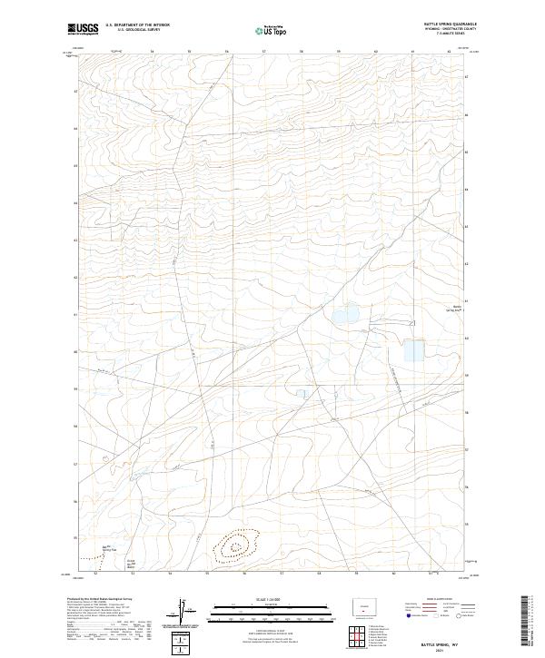
2021 Battle Spring
Sweetwater County, WY
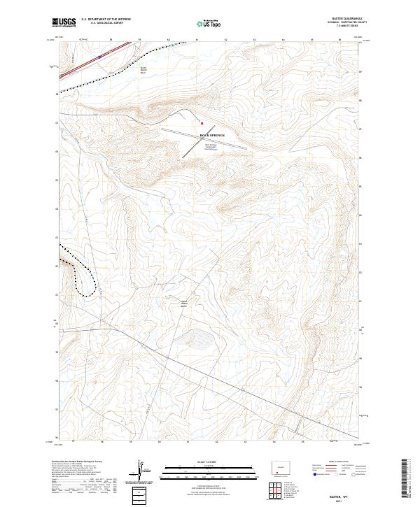
2021 Baxter
Sweetwater County, WY
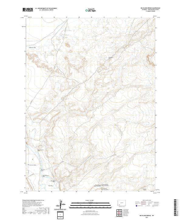
2021 Big Island Bridge
Sweetwater County, WY
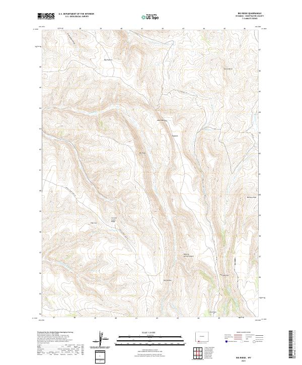
2021 Big Ridge
Sweetwater County, WY
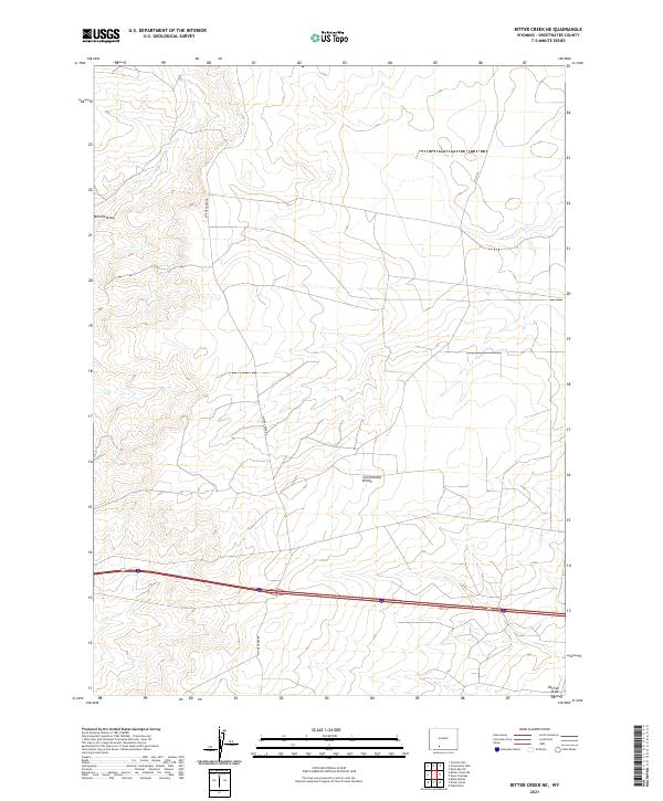
2021 Bitter Creek NE
Sweetwater County, WY
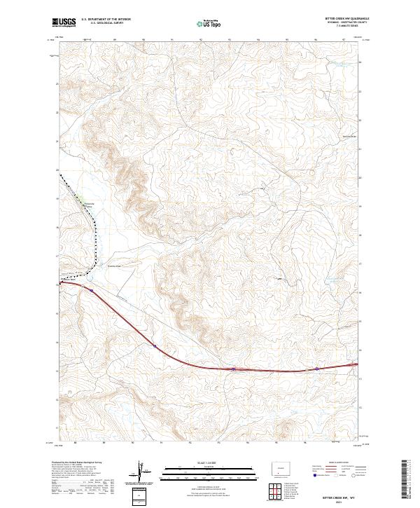
2021 Bitter Creek NW
Sweetwater County, WY
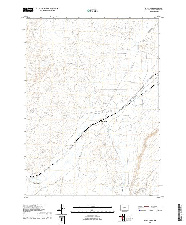
2021 Bitter Creek
Sweetwater County, WY
2021 Black Buttes
Sweetwater County, WY
2021 Black Rock Flat East
Sweetwater County, WY
2021 Black Rock Flat West
Sweetwater County, WY
2021 Black Rock North
Sweetwater County, WY
2021 Black Rock South
Sweetwater County, WY
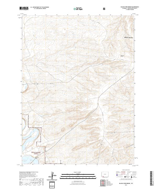
2021 Blacks Fork Bridge
Sweetwater County, WY
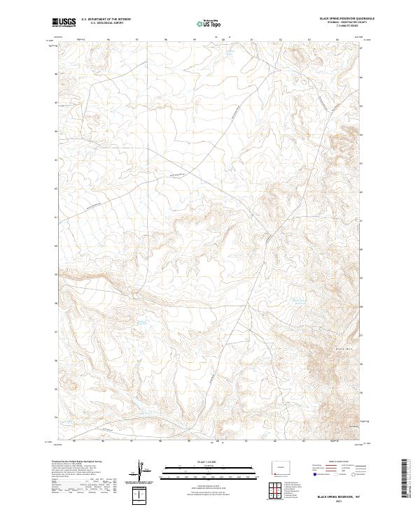
2021 Black Spring Reservoir
Sweetwater County, WY
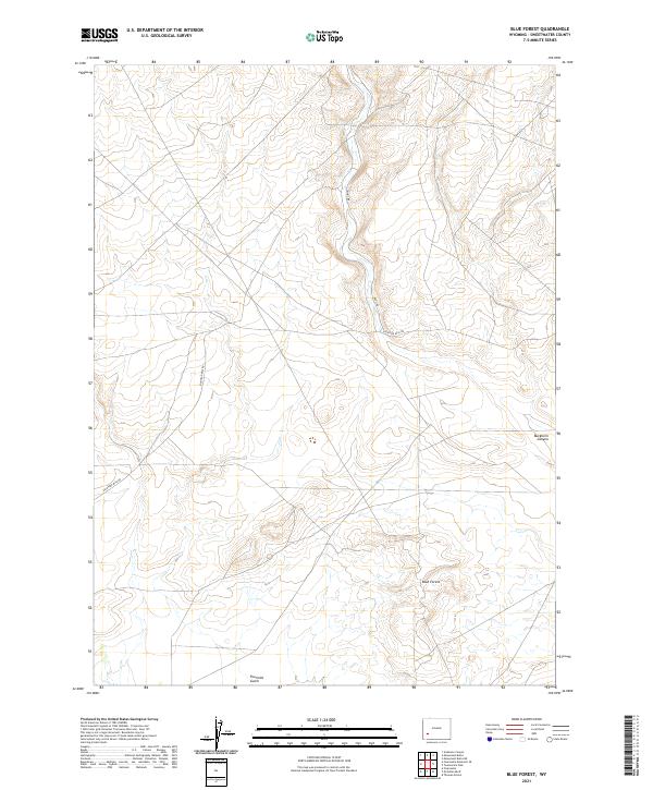
2021 Blue Forest
Sweetwater County, WY
2021 Blue Point
Sweetwater County, WY
2021 Boars Tusk
Sweetwater County, WY
2021 Boars Tusk SW
Sweetwater County, WY
2021 Bob Jack Well
Sweetwater County, WY
2021 Bryan
Sweetwater County, WY
2021 Buck Draw
Sweetwater County, WY
2021 Buffalo Hump Basin
Sweetwater County, WY
2021 Bull Springs
Sweetwater County, WY
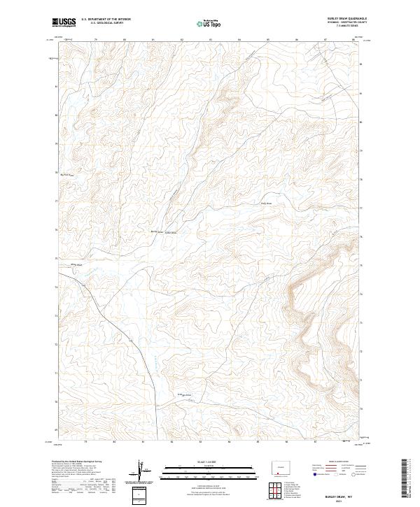
2021 Burley Draw
Sweetwater County, WY
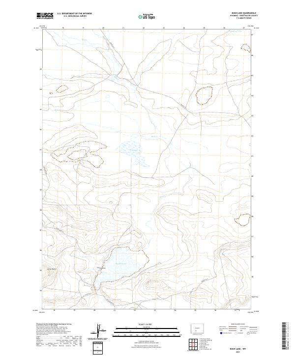
2021 Bush Lake
Sweetwater County, WY
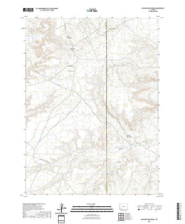
2021 Butcher Knife Draw
Sweetwater County, WY
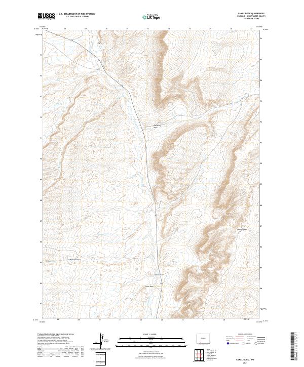
2021 Camel Rock
Sweetwater County, WY
2021 Chicken Creek East
Sweetwater County, WY
2021 Chicken Creek SE
Sweetwater County, WY
2021 Chicken Creek SW
Sweetwater County, WY
2021 Chicken Creek West
Sweetwater County, WY
2021 Chicken Spring
Sweetwater County, WY
2021 Chrisman Ranch
Sweetwater County, WY
2021 Clay Buttes SE
Sweetwater County, WY
2021 Clay Buttes
Sweetwater County, WY
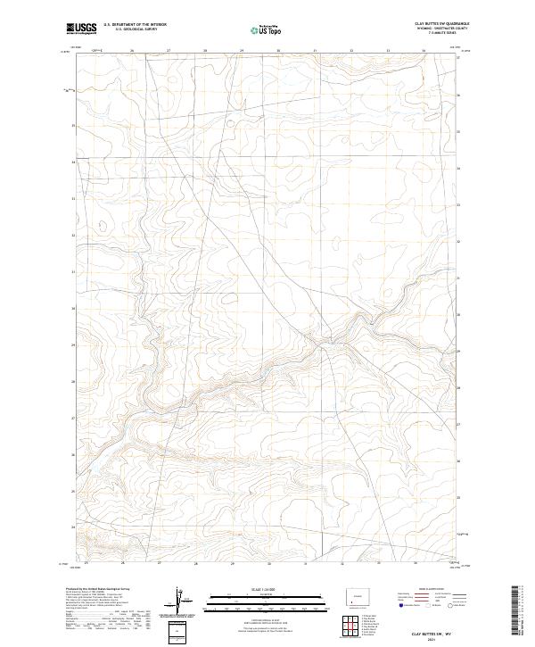
2021 Clay Buttes SW
Sweetwater County, WY
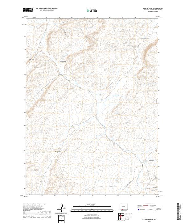
2021 Cooper Ridge NE
Sweetwater County, WY
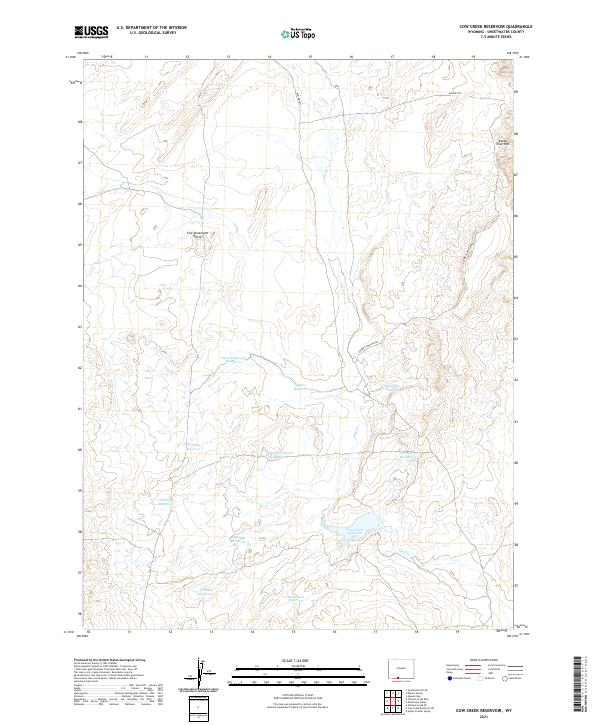
2021 Cow Creek Reservoir
Sweetwater County, WY
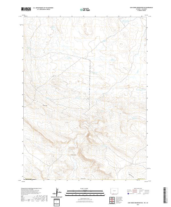
2021 Cow Creek Reservoir SW
Sweetwater County, WY
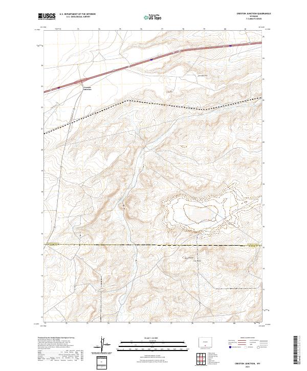
2021 Creston Junction
Sweetwater County, WY
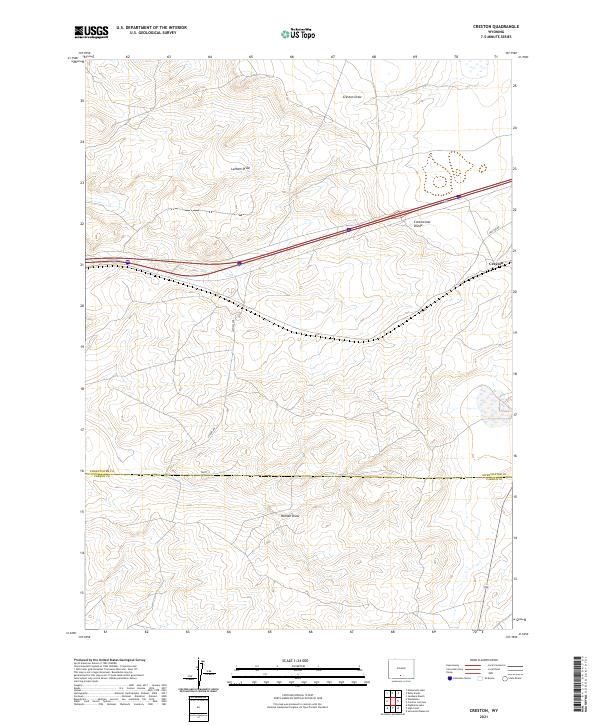
2021 Creston
Sweetwater County, WY
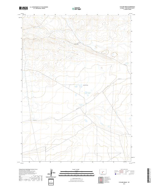
2021 Cyclone Draw
Sweetwater County, WY
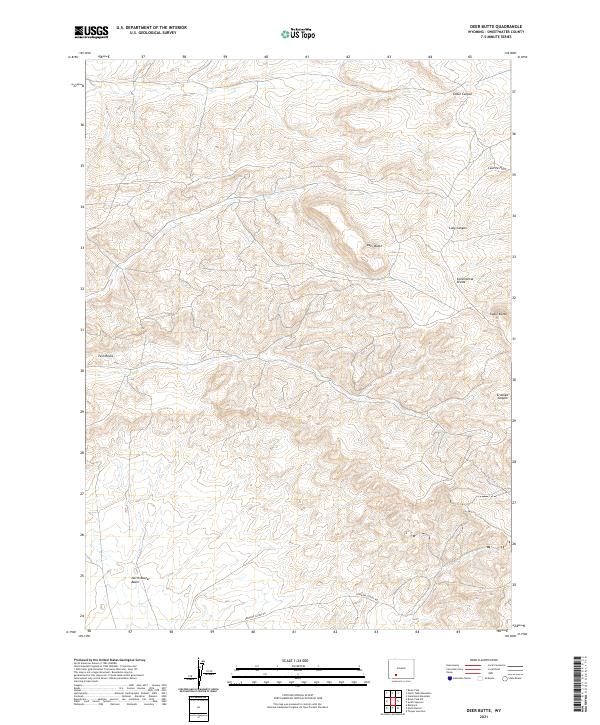
2021 Deer Butte
Sweetwater County, WY
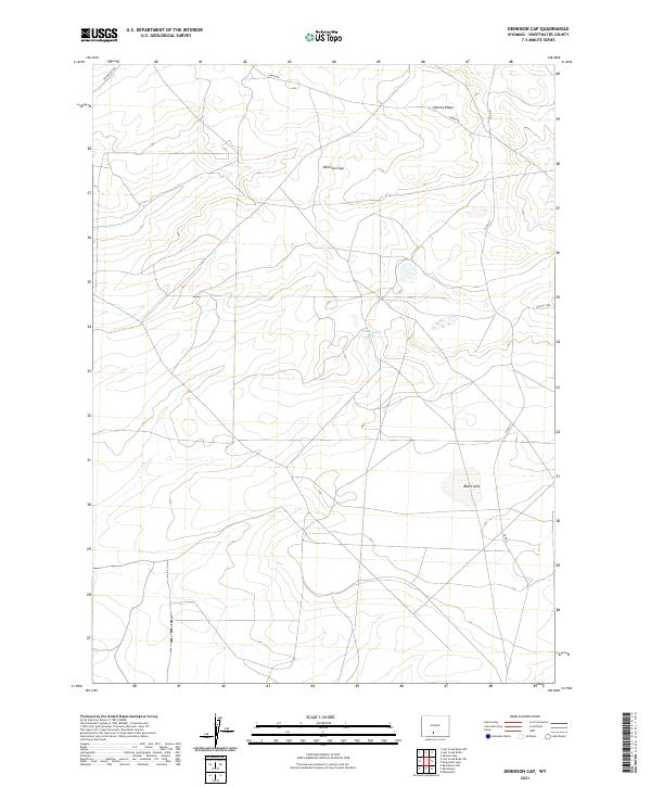
2021 Dennison Cap
Sweetwater County, WY
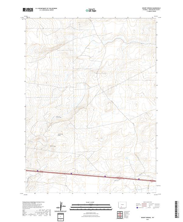
2021 Desert Springs
Sweetwater County, WY
2021 Devils Playground
Sweetwater County, WY
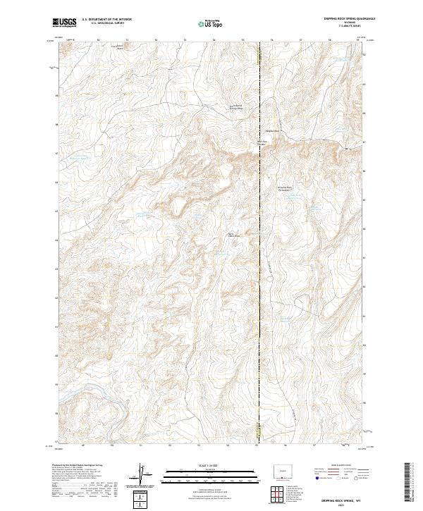
2021 Dripping Rock Spring
Sweetwater County, WY
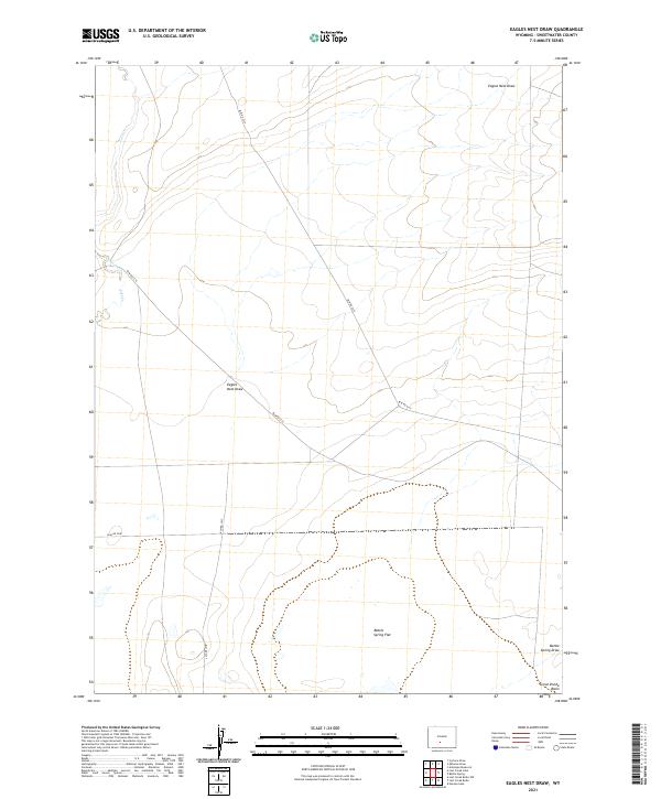
2021 Eagles Nest Draw
Sweetwater County, WY
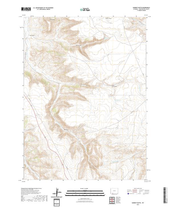
2021 Earnest Butte
Sweetwater County, WY
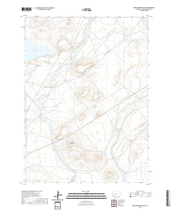
2021 Eden Reservoir East
Sweetwater County, WY
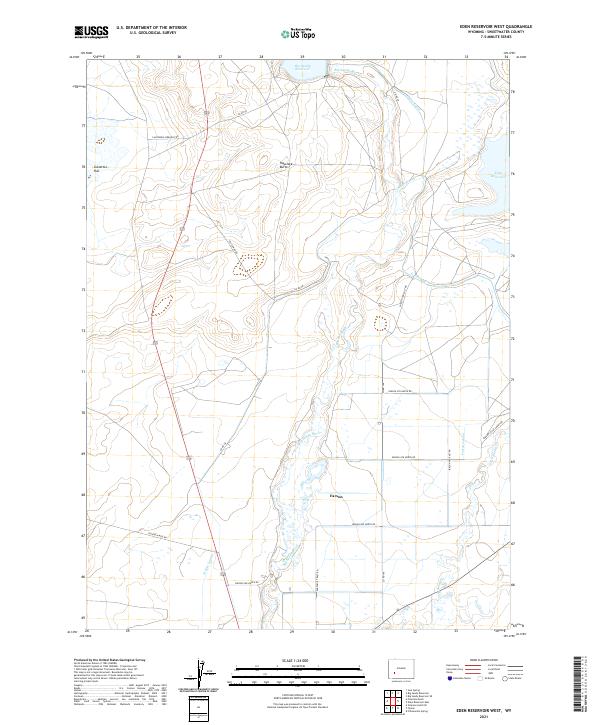
2021 Eden Reservoir West
Sweetwater County, WY
2021 Eightmile Lake
Sweetwater County, WY
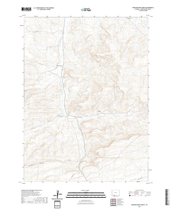
2021 Erickson-Kent Ranch
Sweetwater County, WY
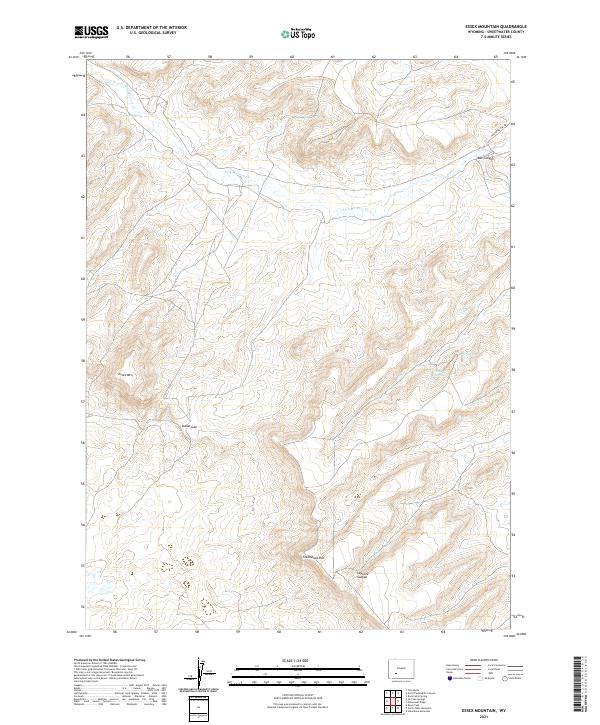
2021 Essex Mountain
Sweetwater County, WY
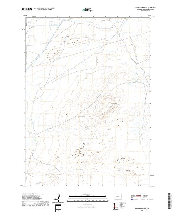
2021 Fifteenmile Spring
Sweetwater County, WY
2021 Firehole Basin
Sweetwater County, WY
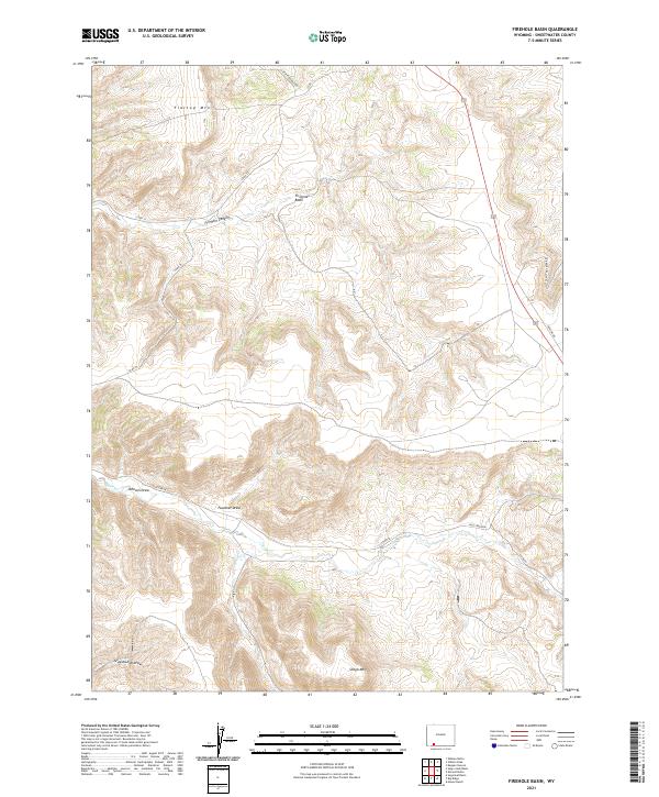
2021 Five Fingers Butte NE
Sweetwater County, WY
2021 Five Fingers Butte
Sweetwater County, WY
2021 Fort La Clede NE
Sweetwater County, WY
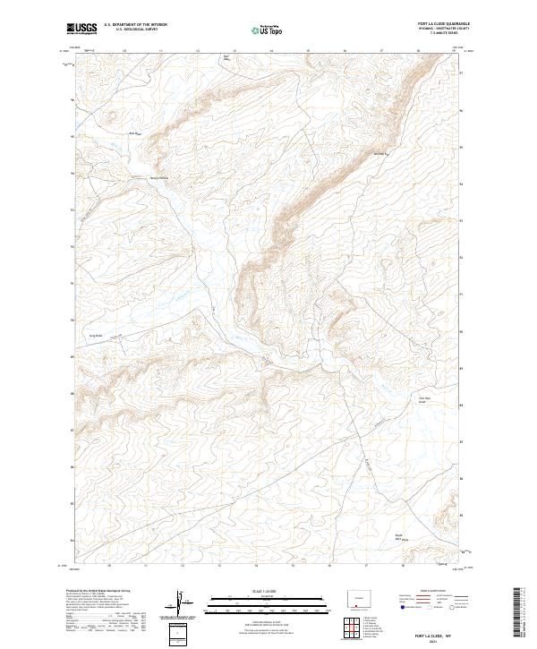
2021 Fort La Clede
Sweetwater County, WY
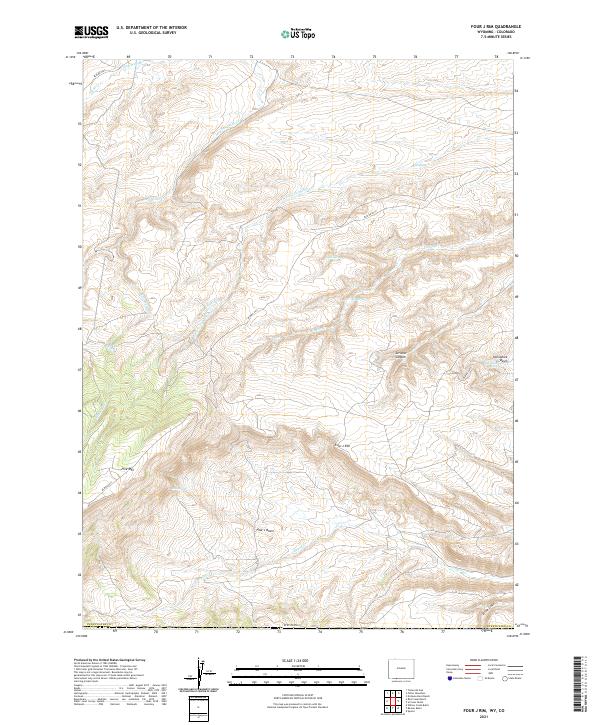
2021 Four J Rim
Sweetwater County, WY
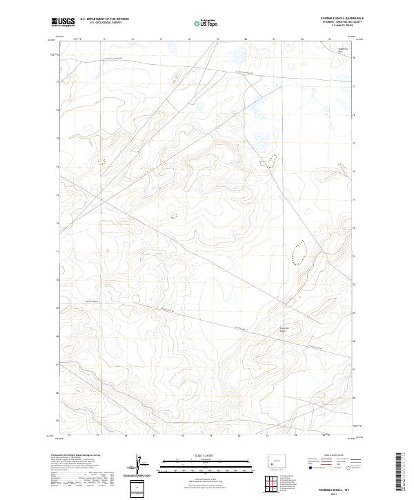
2021 Fourmile Knoll
Sweetwater County, WY
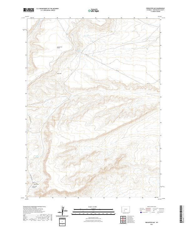
2021 Freighter Gap
Sweetwater County, WY
2021 Gasson Bridge
Sweetwater County, WY
2021 Hadsell Spring
Sweetwater County, WY
2021 Halfway Hollow East
Sweetwater County, WY
2021 Halfway Hollow West
Sweetwater County, WY
2021 Hansen Lake NE
Sweetwater County, WY
2021 Hansen Lake
Sweetwater County, WY
2021 Hawks Nest
Sweetwater County, WY
2021 Haystack Buttes North
Sweetwater County, WY
2021 Haystack Buttes South
Sweetwater County, WY
2021 Haystack Flats
Sweetwater County, WY
2021 Horse Ranch
Sweetwater County, WY
2021 Jawbone Ranch
Sweetwater County, WY
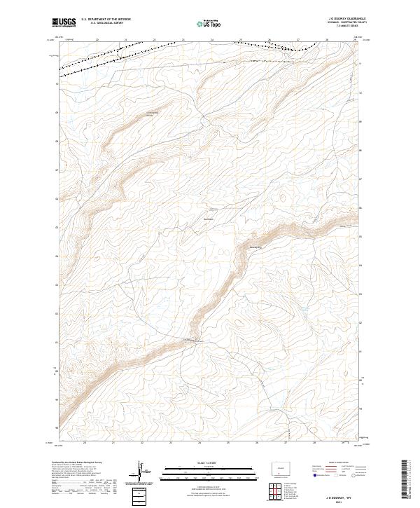
2021 J O Dugway
Sweetwater County, WY
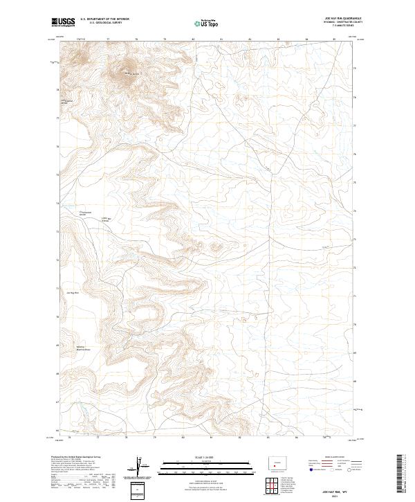
2021 Joe Hay Rim
Sweetwater County, WY
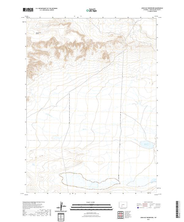
2021 John Hay Reservoir
Sweetwater County, WY
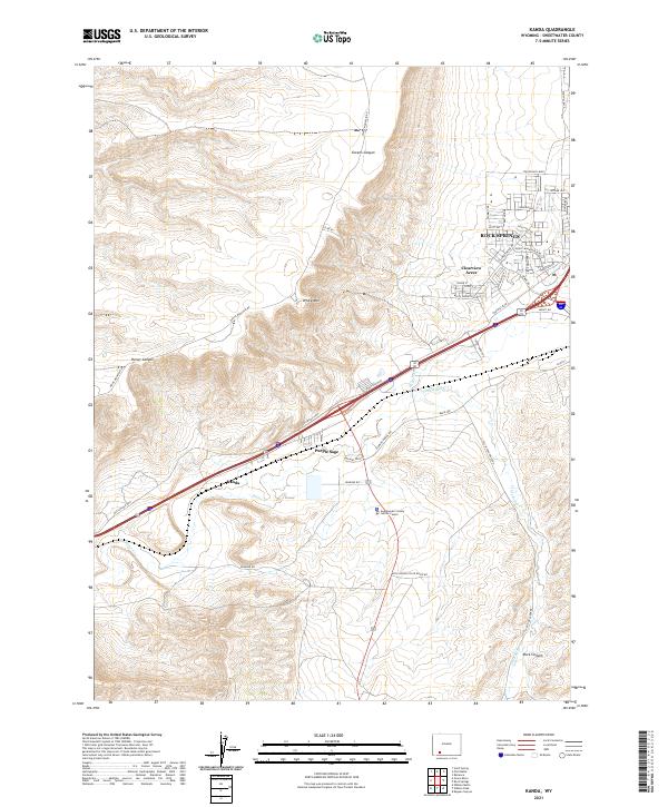
2021 Kanda
Sweetwater County, WY
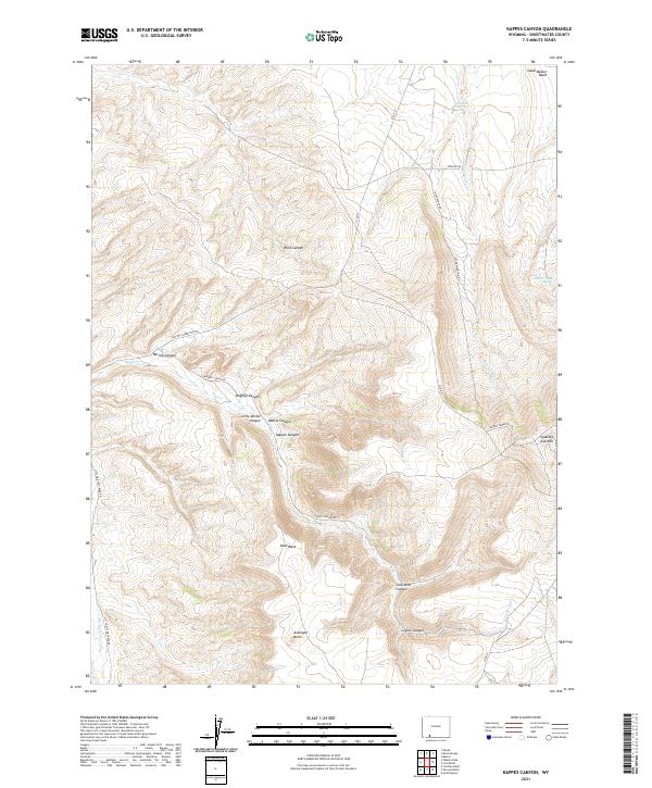
2021 Kappes Canyon
Sweetwater County, WY
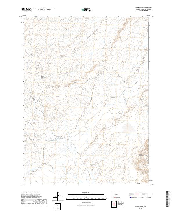
2021 Kinney Spring
Sweetwater County, WY
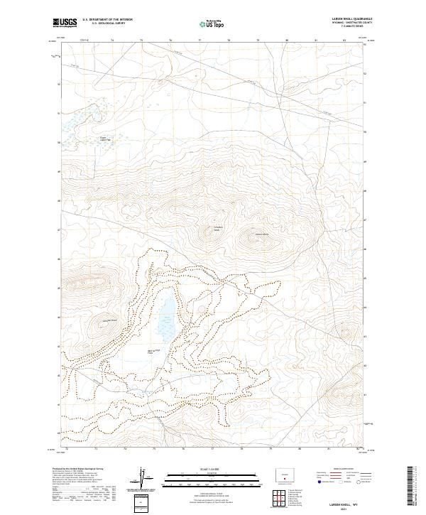
2021 Larsen Knoll
Sweetwater County, WY
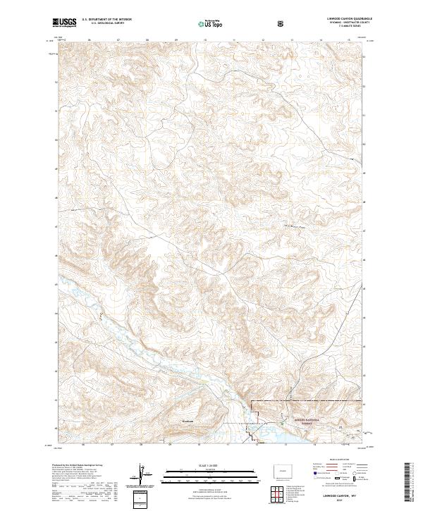
2021 Linwood Canyon
Sweetwater County, WY
2021 Lion Bluffs
Sweetwater County, WY
2021 Lombard Buttes
Sweetwater County, WY
2021 Lost Creek Butte NW
Sweetwater County, WY
2021 Lost Creek Butte
Sweetwater County, WY
2021 Lost Creek Butte SW
Sweetwater County, WY
2021 Lost Creek Lake
Sweetwater County, WY
2021 Luman Rim
Sweetwater County, WY
2021 Manuel Gap
Sweetwater County, WY
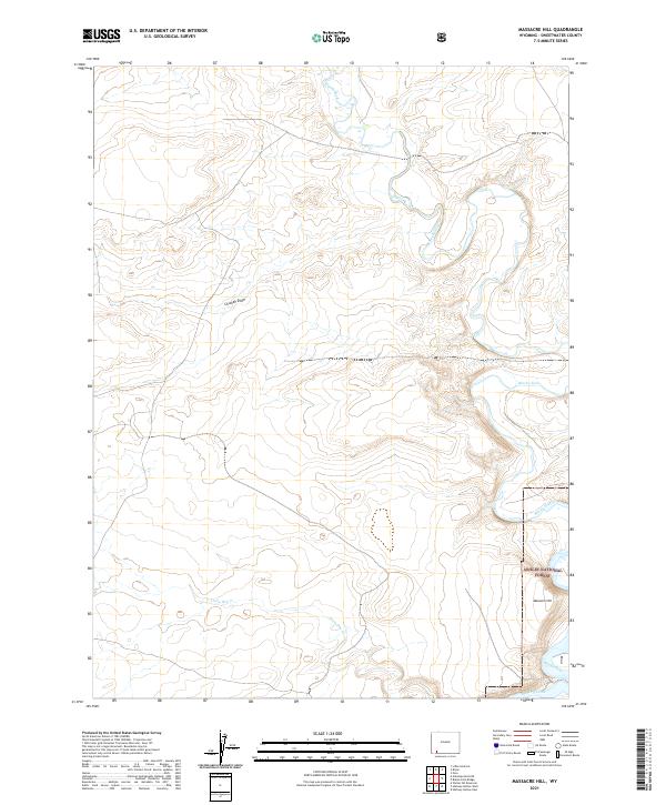
2021 Massacre Hill
Sweetwater County, WY
2021 Maxon Ranch
Sweetwater County, WY
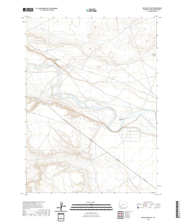
2021 McCullen Bluff
Sweetwater County, WY
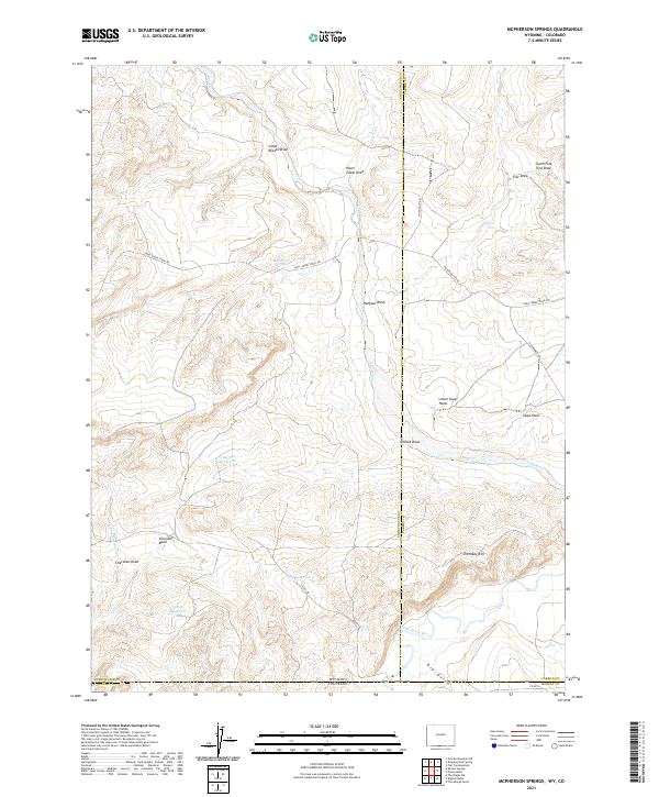
2021 McPherson Springs
Sweetwater County, WY
2021 Mexican Flats NW
Sweetwater County, WY
2021 Minnies Gap
Sweetwater County, WY
2021 Monument Butte NE
Sweetwater County, WY
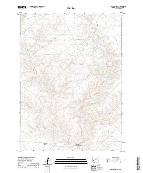
2021 Monument Butte
Sweetwater County, WY
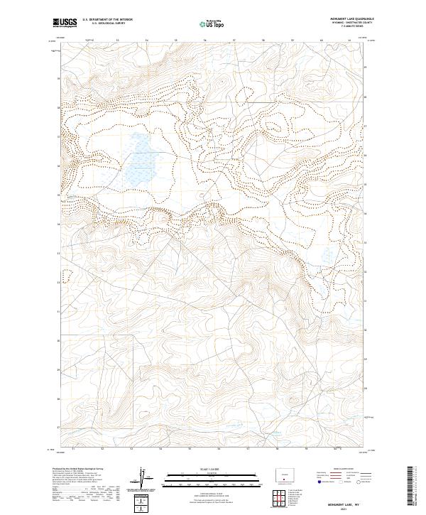
2021 Monument Lake
Sweetwater County, WY
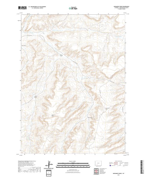
2021 Monument Ridge
Sweetwater County, WY
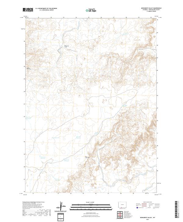
2021 Monument Valley
Sweetwater County, WY
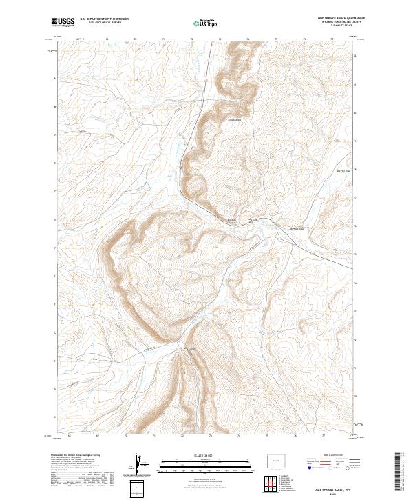
2021 Mud Springs Ranch
Sweetwater County, WY
2021 Needle Reservoir
Sweetwater County, WY
2021 North Baxter
Sweetwater County, WY
2021 North Packsaddle Canyon
Sweetwater County, WY
2021 North Table Mountain
Sweetwater County, WY
2021 Osborne Draw
Sweetwater County, WY
2021 Osborne Well
Sweetwater County, WY
2021 Ox Yoke Springs
Sweetwater County, WY
2021 Peru
Sweetwater County, WY
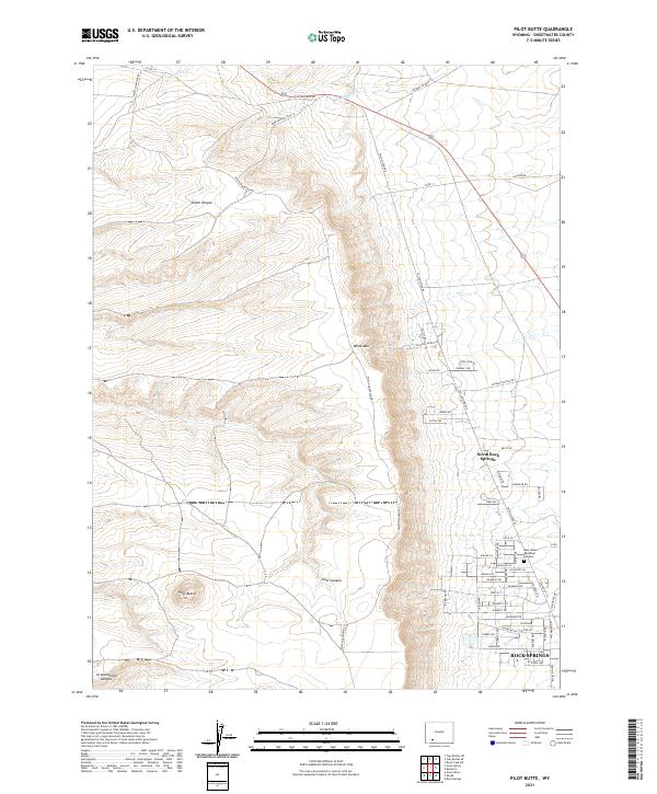
2021 Pilot Butte
Sweetwater County, WY
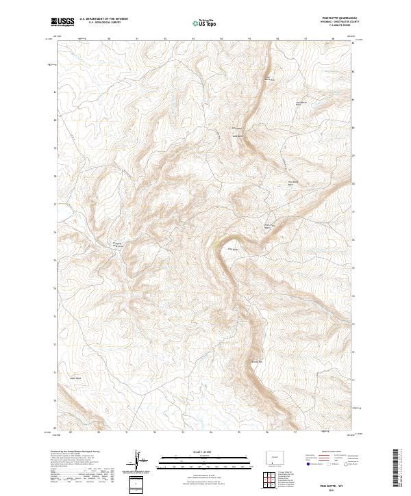
2021 Pine Butte
Sweetwater County, WY
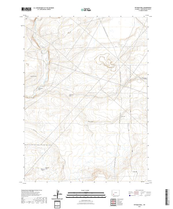
2021 Pittman Well
Sweetwater County, WY
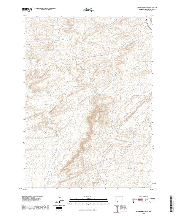
2021 Point of Rocks SE
Sweetwater County, WY
2021 Point of Rocks SW
Sweetwater County, WY
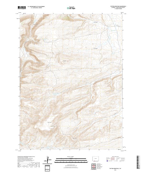
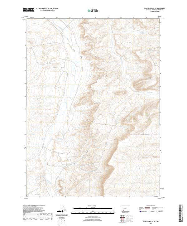
2021 Potter Mountain
Sweetwater County, WY
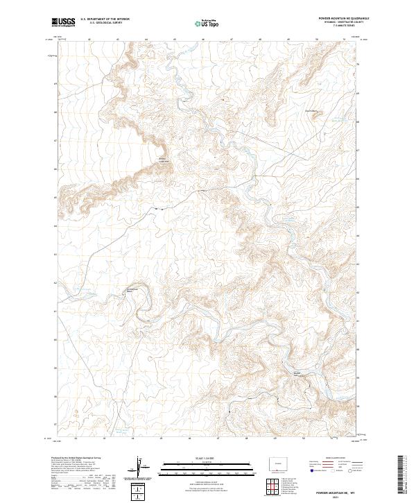
2021 Powder Mountain NE
Sweetwater County, WY
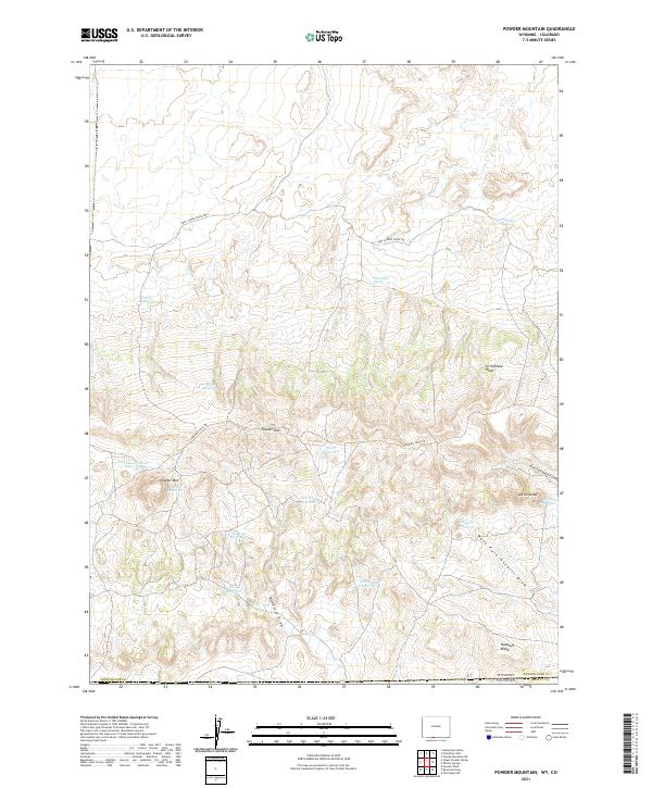
2021 Powder Mountain
Sweetwater County, WY
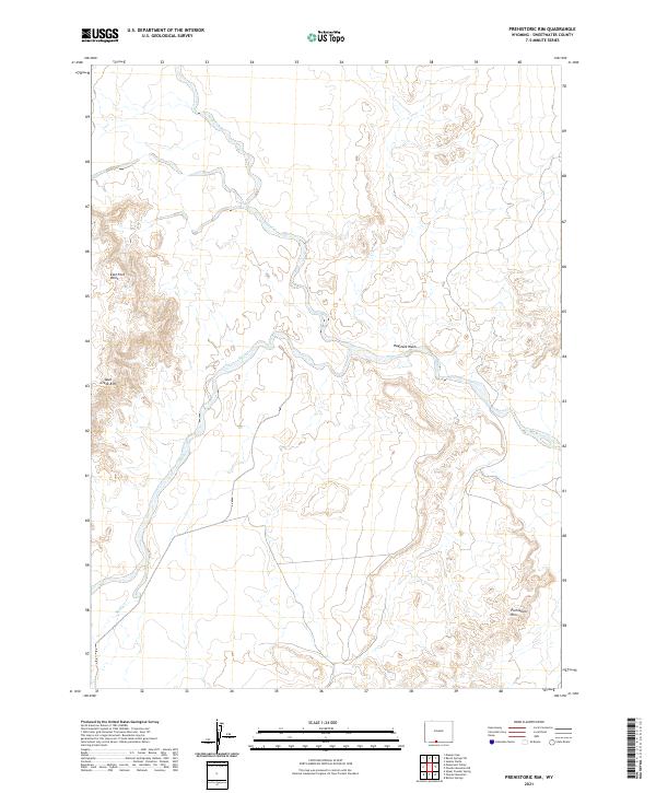
2021 Prehistoric Rim
Sweetwater County, WY
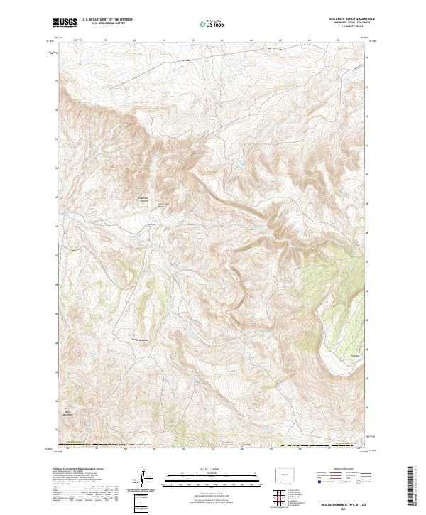
2021 Red Creek Ranch
Sweetwater County, WY
2021 Red Desert NW
Sweetwater County, WY
2021 Red Desert SE
Sweetwater County, WY
2021 Red Desert
Sweetwater County, WY
2021 Red Desert SW
Sweetwater County, WY
2021 Red Lake NE
Sweetwater County, WY
2021 Red Lake SE
Sweetwater County, WY
2021 Red Lake
Sweetwater County, WY
2021 Red Lake SW
Sweetwater County, WY
2021 Richards Gap
Sweetwater County, WY
2021 Riner
Sweetwater County, WY
2021 Rock Cabin Spring
Sweetwater County, WY
2021 Rotten Springs
Sweetwater County, WY
2021 Ruby Knolls
Sweetwater County, WY
2021 Sage Creek Basin
Sweetwater County, WY
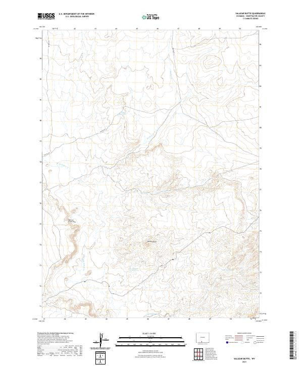
2021 Salazar Butte
Sweetwater County, WY
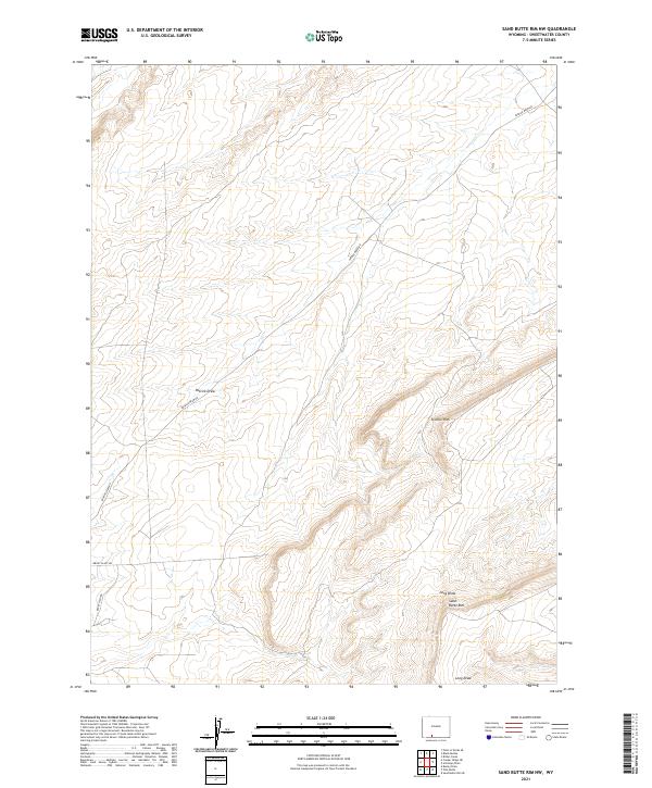
2021 Sand Butte Rim NW
Sweetwater County, WY
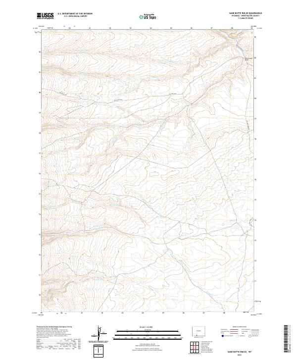
2021 Sand Butte Rim SE
Sweetwater County, WY
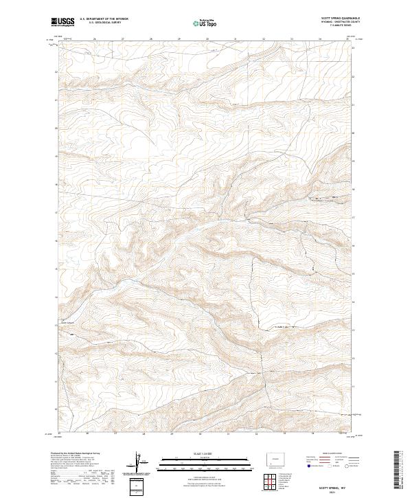
2021 Scott Spring
Sweetwater County, WY
2021 Scrivner Butte
Sweetwater County, WY
2021 Sevenmile Gulch
Sweetwater County, WY
2021 Simpson Gulch SE
Sweetwater County, WY
2021 Simpson Gulch SW
Sweetwater County, WY
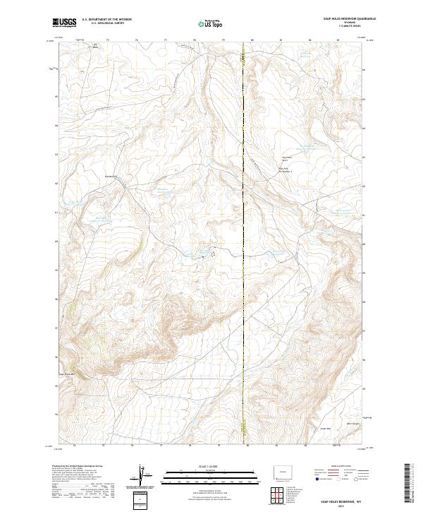
2021 Soap Holes Reservoir
Sweetwater County, WY
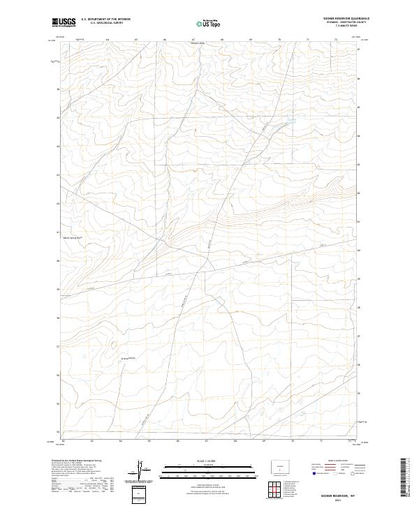
2021 Sooner Reservoir
Sweetwater County, WY
2021 South Barrel Spring
Sweetwater County, WY
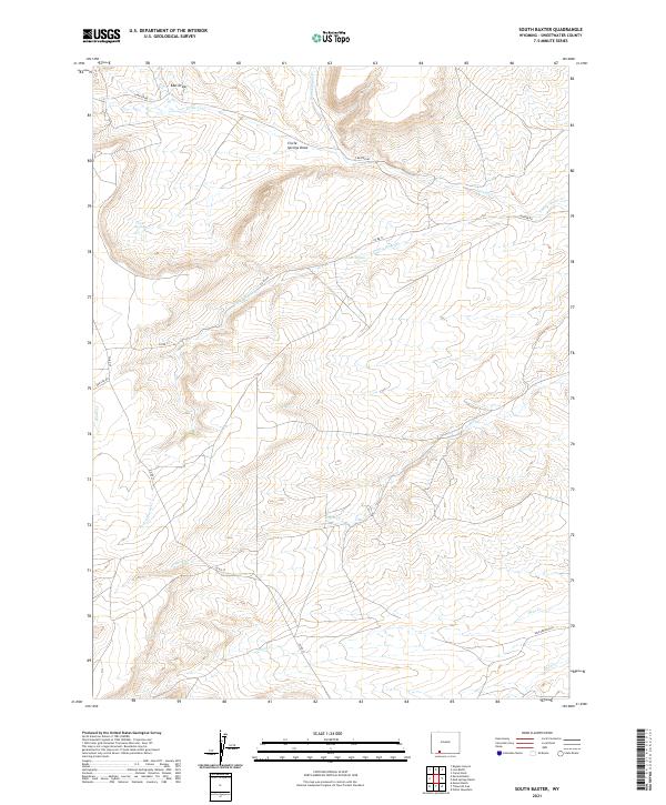
2021 South Baxter
Sweetwater County, WY
2021 South Superior
Sweetwater County, WY
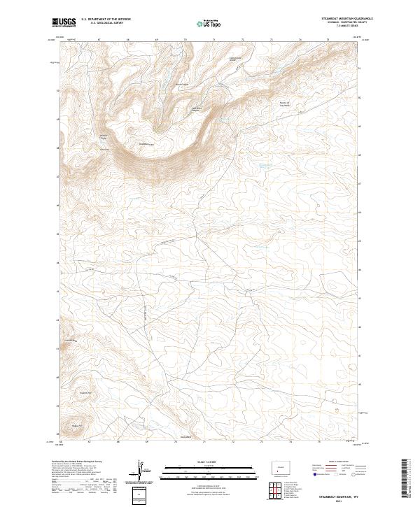
2021 Steamboat Mountain
Sweetwater County, WY
2021 Stevens Flat
Sweetwater County, WY
2021 Sugarloaf Basin
Sweetwater County, WY
2021 Tenmile Rim
Sweetwater County, WY
2021 Thayer Junction
Sweetwater County, WY
2021 The Pinnacles
Sweetwater County, WY
2021 Thoman School
Sweetwater County, WY
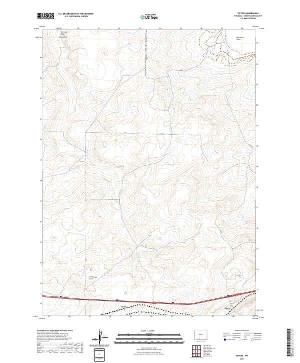
2021 Tipton
Sweetwater County, WY
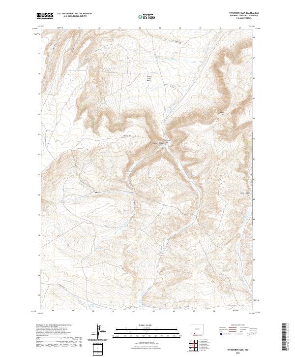
2021 Titsworth Gap
Sweetwater County, WY
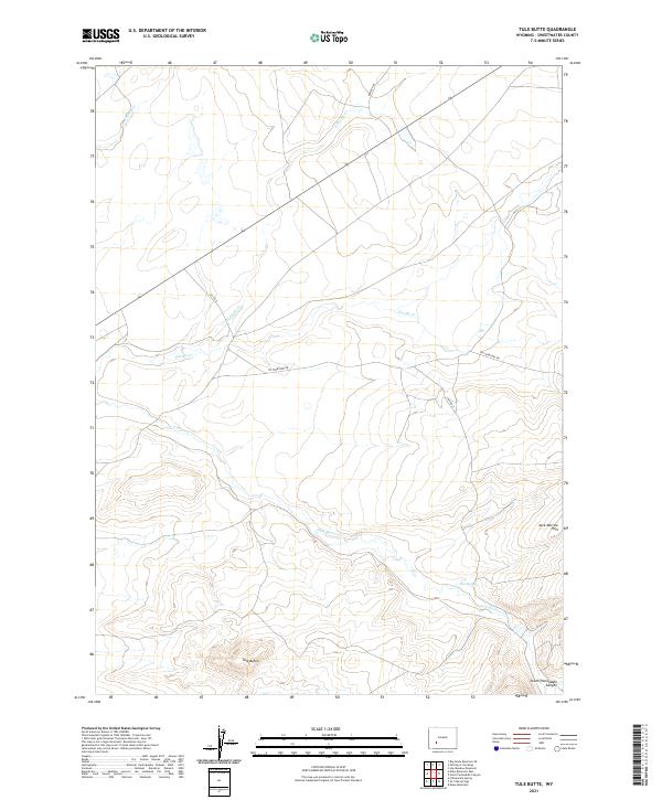
2021 Tule Butte
Sweetwater County, WY
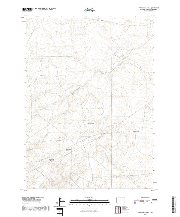
2021 Twelvemile Knoll
Sweetwater County, WY
2021 Twelvemile Sink
Sweetwater County, WY
2021 Twelvemile Well
Sweetwater County, WY
2021 Upper Powder Spring
Sweetwater County, WY
2021 Verne
Sweetwater County, WY
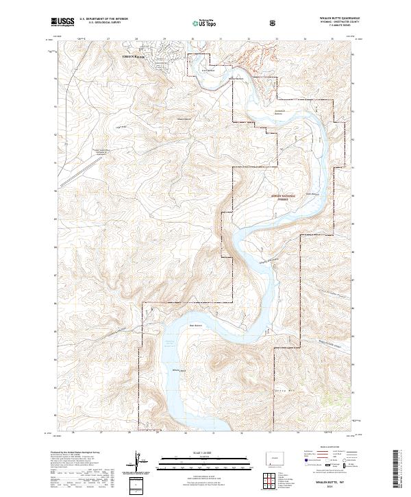
2021 Whalen Butte
Sweetwater County, WY
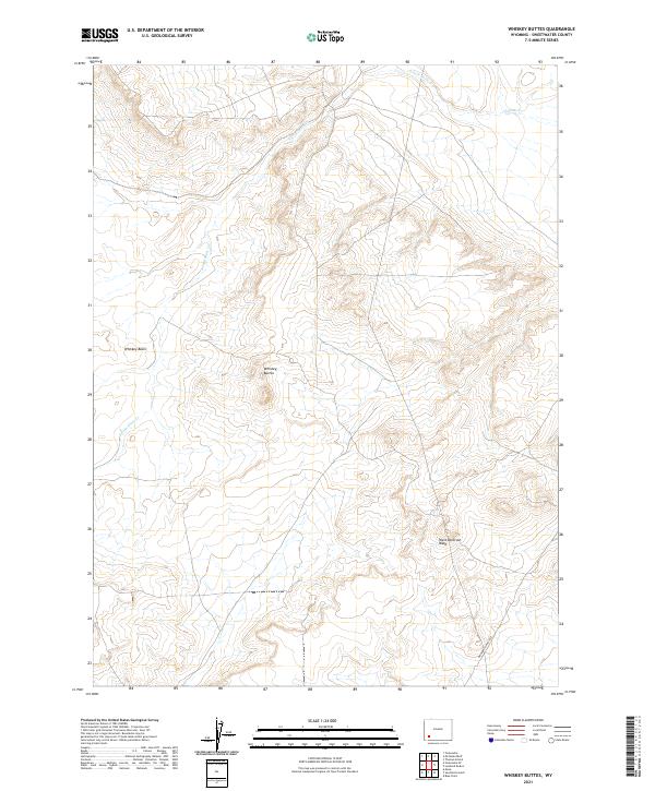
2021 Whiskey Buttes
Sweetwater County, WY
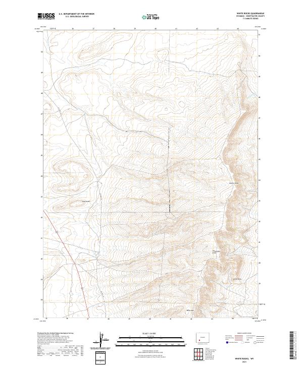
2021 White Rocks
Sweetwater County, WY
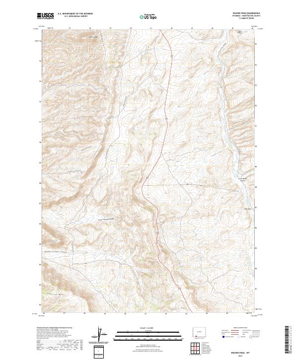
2021 Wilkins Peak
Sweetwater County, WY
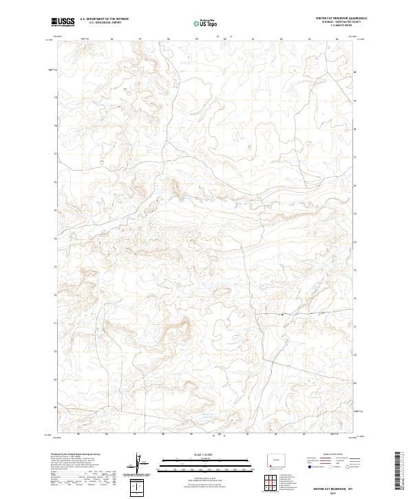
2021 Winter Fat Reservoir
Sweetwater County, WY
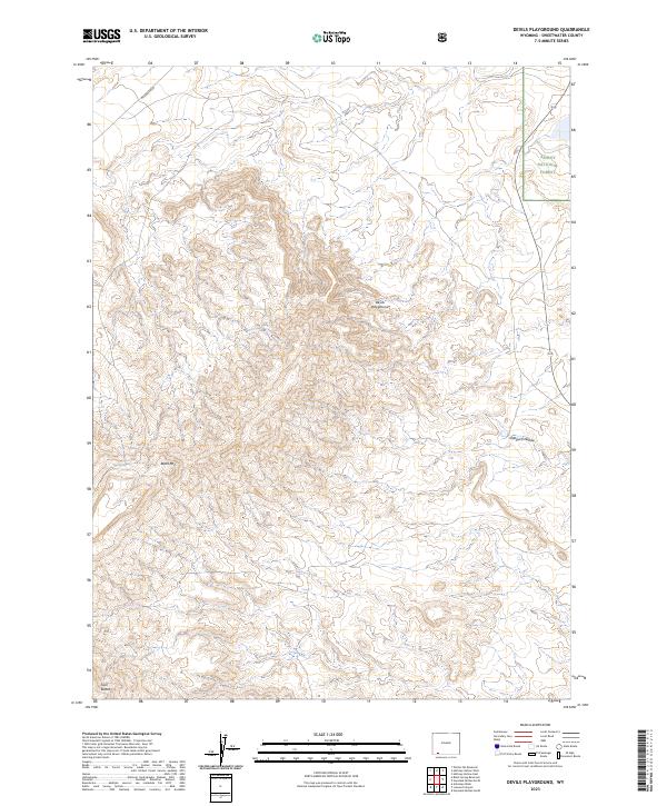
2023 Devils Playground
Sweetwater County, WY
2023 Haystack Buttes North
Sweetwater County, WY