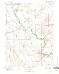
1961 Map of Stevens Flat
USGS Topo · Published 1971About this map
The Green River carves a winding path through this Wyoming landscape, defining the character of Stevens Flat and the surrounding high plains. By the early 1960s, the area supported a mix of livestock ranching and industrial utility, as seen in the presence of Pal Ranch and Hofeldt Ranch alongside a specialized Chemical Plant. This industrial corridor is further supported by a Substation, Filtration Plant, and Sewage Disposal facilities near the riverbank.
Find a feature on this map
23 named features on this map. Tap any name to fly to it.
Don’t see what you’re looking for? This feature index may not catch every label — zoom into the map to look around manually.
Map Details
Editions of this 1961 Stevens Flat Map
4 editions found
Other maps of this area

1954 · Rock Springs
USGS Topo · 1:250,000

1958 · Rock Springs
USGS Topo · 1:250,000

1961 · Blue Point
USGS Topo · 1:24,000

1961 · Little America
USGS Topo · 1:24,000

1961 · Peru
USGS Topo · 1:24,000

1961 · Austin Ranch
USGS Topo · 1:24,000

1961 · Stevens Flat
USGS Topo · 1:24,000

1961 · Bryan
USGS Topo · 1:24,000

1962 · Rock Springs
USGS Topo · 1:250,000

1963 · Big Island Bridge
USGS Topo · 1:24,000