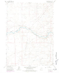
1963 Map of Gasson Bridge
USGS Topo · Published 1981About this map
The Big Sandy River meanders across this high desert landscape, serving as a primary corridor for travel and infrastructure in Sweetwater County. The map documents the historic path of the Emigrant Trail, which parallels the river and intersects with the Farson Cutoff Road. This convergence of trails and roads highlights the area's significance as a transit point for westward migration and later ranching operations.
Find a feature on this map
11 named features on this map. Tap any name to fly to it.
Don’t see what you’re looking for? This feature index may not catch every label — zoom into the map to look around manually.
Map Details
Editions of this 1963 Gasson Bridge Map
2 editions found
Other maps of this area

1954 · Rock Springs
USGS Topo · 1:250,000

1955 · Lander
USGS Topo · 1:250,000

1958 · Lander
USGS Topo · 1:250,000

1958 · Rock Springs
USGS Topo · 1:250,000

1961 · Lander
USGS Topo · 1:250,000

1962 · Rock Springs
USGS Topo · 1:250,000

1963 · Gasson Bridge
USGS Topo · 1:24,000

1963 · Pittman Well
USGS Topo · 1:24,000

1963 · Big Island Bridge
USGS Topo · 1:24,000
1963 · Thoman School
USGS Topo · 1:24,000