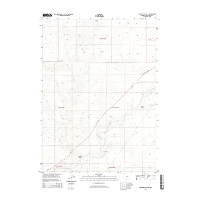
2015 Map of Simpson Gulch SE
USGS Topo · Published 2015About this map
The Big Sandy River winds through this arid expanse of Sweetwater County, shaping a drainage system characterized by significant local landmarks like Simpson Gulch, Carlson Draw, and Bone Draw. The landscape reflects a high-desert environment where water-driven topography is the defining feature, showing the intricate network of seasonal washes that feed into the primary river channel. Human presence is marked by a grid of rural infrastructure, including Lower Farson Cutoff Rd and Cr-8, which facilitate movement across the sprawling township lines of T24N and T25N. Near the southern boundary, the appearance of Main St S suggests the periphery of a settled area, providing a point of reference for those studying the growth of communities in this portion of Wyoming.
Find a feature on this map
13 named features on this map. Tap any name to fly to it.
Don’t see what you’re looking for? This feature index may not catch every label — zoom into the map to look around manually.
Map Details
Editions of this 2015 Simpson Gulch SE Map
This is the sole edition of this map. No revisions or reprints were ever made.
Other maps of this area

1954 · Rock Springs
USGS Topo · 1:250,000

1955 · Lander
USGS Topo · 1:250,000

1958 · Lander
USGS Topo · 1:250,000

1958 · Rock Springs
USGS Topo · 1:250,000

1961 · Lander
USGS Topo · 1:250,000

1962 · Rock Springs
USGS Topo · 1:250,000

1963 · Gasson Bridge
USGS Topo · 1:24,000

1963 · Pittman Well
USGS Topo · 1:24,000

1968 · Farson
USGS Topo · 1:24,000

1968 · Twelvemile Knoll
USGS Topo · 1:24,000