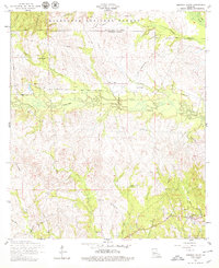
1954 Map of Simpson North
USGS Topo · Published 1979About this map
Kisatchie National Forest dominates the northern reaches of this landscape, where the Natchitoches Parish and Vernon Parish line cuts through a dense network of tributaries. The topography is defined by the winding paths of Comrade Creek, Brushy Creek, and Mims Creek, which carve through the terrain south of the Forest Boundary. The settlement of Hutton sits near the eastern edge, while Simpson is located toward the southern margin, connected by a series of unimproved and state routes that navigate the local ridges.
Find a feature on this map
26 named features on this map. Tap any name to fly to it.
Don’t see what you’re looking for? This feature index may not catch every label — zoom into the map to look around manually.
Map Details
Editions of this 1954 Simpson North Map
3 editions found
Other maps of this area

1937 · Chopin SW
USGS Topo · 1:31,680

1937 · Chopin NW
USGS Topo · 1:31,680

1941 · Slagle
USGS Topo · 1:62,500

1942 · Kisatchie
USGS Topo · 1:62,500

1943 · Leander
USGS Topo · 1:62,500

1943 · Kisatchie
USGS Topo · 1:62,500

1944 · Chopin
USGS Topo · 1:62,500

1944 · Slagle
USGS Topo · 1:62,500

1948 · Chopin
USGS Topo · 1:62,500

1953 · Alexandria
USGS Topo · 1:250,000