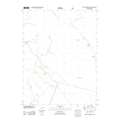
2012 Map of Simpson Park Canyon
USGS Topo · Published 2012About this map
Givens Ranch and Blackbird Ranch anchor this high-desert landscape in central Nevada, reflecting a history of isolated cattle operations and land use in the Great Basin. The terrain is defined by the dramatic descent from Bob Scotts Summit toward the expansive Big Smoky Valley, with drainage provided by seasonal watercourses like Bade Cr and Blackbird Cr. Local reliance on scarce water is evident in the naming of critical water sources such as Windlass Spring, Reeder Spring, and Goodyear Spring. These features, along with several canyons including Simpson Park Canyon and Rye Patch Canyon, illustrate the topographical barriers and essential lifelines for those navigating or settling this segment of Lander County. The road network, including Frontier and Grass Valley Rd, underscores the importance of connectivity between these remote outposts.
Find a feature on this map
19 named features on this map. Tap any name to fly to it.
Don’t see what you’re looking for? This feature index may not catch every label — zoom into the map to look around manually.
Map Details
Editions of this 2012 Simpson Park Canyon Map
This is the sole edition of this map. No revisions or reprints were ever made.
Other maps of this area

1926 · Roberts Mountains
USGS Topo · 1:250,000

1929 · Roberts Mountains
USGS Topo · 1:250,000

1955 · Millett
USGS Topo · 1:250,000

1956 · Mount Callaghan
USGS Topo · 1:62,500

1956 · Austin
USGS Topo · 1:62,500

1959 · Millett
USGS Topo · 1:250,000

1960 · Spencer Hot Springs
USGS Topo · 1:62,500

1969 · Yankee Blade
USGS Topo · 1:24,000

1978 · Summit Mountain
USGS Topo · 1:100,000

1979 · Simpson Park Mtns
USGS Topo · 1:100,000