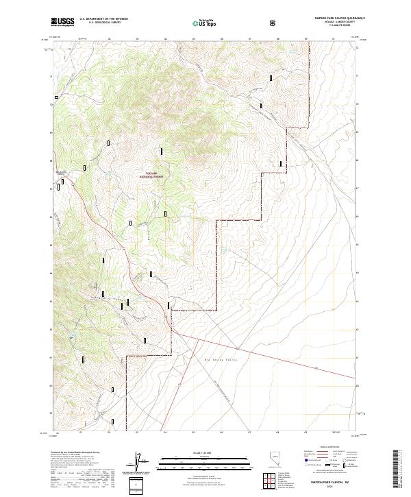
2021 Map of Simpson Park Canyon
USGS Topo · Published 2021About this map
Toiyabe National Forest lands dominate this central Nevada landscape, where the high terrain of the Simpson Park Range meets the northern reaches of the Big Smoky Valley. The map highlights a network of water sources essential to this arid environment, including Windlass Spring, Reeder Spring, and Goodyear Spring. A historical legacy is preserved in the naming of the Pony Express Loop in the northeast, alongside modern forest access routes like Natl Forest Develop Road 054 Rd. Ranching and resource extraction are evident through the Blackbird Ranch and the Lowboy Mine spur, while notable elevations like Bob Scotts Summit define the western boundary. This survey provides a look at the intersection of public land management and the enduring geographic markers of the American West.
Find a feature on this map
31 named features on this map. Tap any name to fly to it.
Don’t see what you’re looking for? This feature index may not catch every label — zoom into the map to look around manually.
Map Details
Editions of this 2021 Simpson Park Canyon Map
This is the sole edition of this map. No revisions or reprints were ever made.
Other maps of this area

1926 · Roberts Mountains
USGS Topo · 1:250,000

1929 · Roberts Mountains
USGS Topo · 1:250,000

1955 · Millett
USGS Topo · 1:250,000

1956 · Mount Callaghan
USGS Topo · 1:62,500

1956 · Austin
USGS Topo · 1:62,500

1959 · Millett
USGS Topo · 1:250,000

1960 · Spencer Hot Springs
USGS Topo · 1:62,500

1969 · Yankee Blade
USGS Topo · 1:24,000

1978 · Summit Mountain
USGS Topo · 1:100,000

1979 · Simpson Park Mtns
USGS Topo · 1:100,000