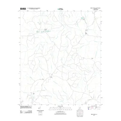
2011 Map of Sims Chapel
USGS Topo · Published 2011About this map
Sims Chapel serves as a primary anchor in this part of northern Mobile County, defined by its namesake Sims Chapel Cemetery and Sims Chapel church. The landscape is heavily dissected by a dense network of watercourses, including Bates Creek and Poll Bayou, which feed into various man-made catchments like Johnsons Pond and the Tensaw Land and Timber Co Pond. These features, along with several dams such as Johnson Dam and Best Dam, suggest a land managed for timber or private recreation during the early 21st century.
Find a feature on this map
56 named features on this map. Tap any name to fly to it.
Don’t see what you’re looking for? This feature index may not catch every label — zoom into the map to look around manually.
Map Details
Editions of this 2011 Sims Chapel Map
This is the sole edition of this map. No revisions or reprints were ever made.
Other maps of this area

1942 · Deer Park
USGS Topo · 1:62,500

1943 · Deer Park
USGS Topo · 1:62,500

1943 · Citronelle
USGS Topo · 1:62,500

1943 · McIntosh
USGS Topo · 1:62,500

1944 · McIntosh
USGS Topo · 1:62,500

1946 · Citronelle
USGS Topo · 1:62,500

1953 · Hattiesburg
USGS Topo · 1:250,000

1958 · Hattiesburg
USGS Topo · 1:250,000

1974 · Vinegar Bend
USGS Topo · 1:24,000
1982 · Citronelle West
USGS Topo · 1:24,000