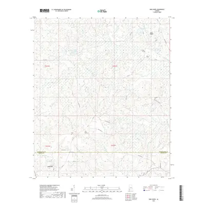
2018 Map of Sims Chapel
USGS Topo · Published 2018About this map
The community of Sims Chapel serves as the focal point of this southwestern Alabama landscape, situated along the northern reaches of the Washington Co Mobile Co line. This 2018 survey reveals a terrain defined by an intricate network of waterways, including the winding Poll Bayou, Cedar Cr, and Bates Cr, which drain the low-lying timberlands. For genealogists and local historians, the map is particularly valuable for its documentation of several family and community burial sites, including Charity Chapel Cem, Red Wash Cem, and Sawyer Cem. To the south, the northern outskirts of Citronelle appear, showing the transition from more established residential streets like Elizabeth St and Averett Ln to the expansive drainage basins and ponds, such as the Tensaw Land and Timber Co Pond, that characterize the regional land use.
Find a feature on this map
50 named features on this map. Tap any name to fly to it.
Don’t see what you’re looking for? This feature index may not catch every label — zoom into the map to look around manually.
Map Details
Editions of this 2018 Sims Chapel Map
This is the sole edition of this map. No revisions or reprints were ever made.
Other maps of this area

1942 · Deer Park
USGS Topo · 1:62,500

1943 · Deer Park
USGS Topo · 1:62,500

1943 · Citronelle
USGS Topo · 1:62,500

1943 · McIntosh
USGS Topo · 1:62,500

1944 · McIntosh
USGS Topo · 1:62,500

1946 · Citronelle
USGS Topo · 1:62,500

1953 · Hattiesburg
USGS Topo · 1:250,000

1958 · Hattiesburg
USGS Topo · 1:250,000

1974 · Vinegar Bend
USGS Topo · 1:24,000
1982 · Citronelle West
USGS Topo · 1:24,000