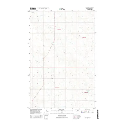
2014 Map of Sims Spring
USGS Topo · Published 2014About this map
Sims Spring and its namesake spring-fed water sources anchor this survey of the Missouri River plateau in northeastern Montana. The landscape is defined by the winding paths of Chelsea Cr and Boxelder Cr, which carve through the high prairie alongside the north-south corridor of MT-13. In the northern reaches of the sheet, Smith Coulee provides a distinct break in the elevation near the intersection with Boxelder Cr. This modern data shows a sparsely populated region dedicated to ranching and water management, evidenced by the presence of engineered features like Structure Number 149 Reservoir. The map illustrates the continuing importance of historical water points, including the precisely identified 30N48E22DDCA01 Spring, which have sustained agricultural life in Roosevelt County for generations.
Find a feature on this map
14 named features on this map. Tap any name to fly to it.
Don’t see what you’re looking for? This feature index may not catch every label — zoom into the map to look around manually.
Map Details
Editions of this 2014 Sims Spring Map
This is the sole edition of this map. No revisions or reprints were ever made.
Other maps of this area

1910 · Cuskers
USGS Topo · 1:62,500

1912 · Chelsea
USGS Topo · 1:62,500

1915 · Tule Valley
USGS Topo · 1:62,500

1915 · Cuskers
USGS Topo · 1:62,500

1916 · Wolf Point
USGS Topo · 1:62,500

1954 · Wolf Point
USGS Topo · 1:250,000

1958 · Wolf Point
USGS Topo · 1:250,000

1972 · Chelsea
USGS Topo · 1:24,000

1972 · Chelsea NW
USGS Topo · 1:24,000
1972 · Wolf Point NE
USGS Topo · 1:24,000