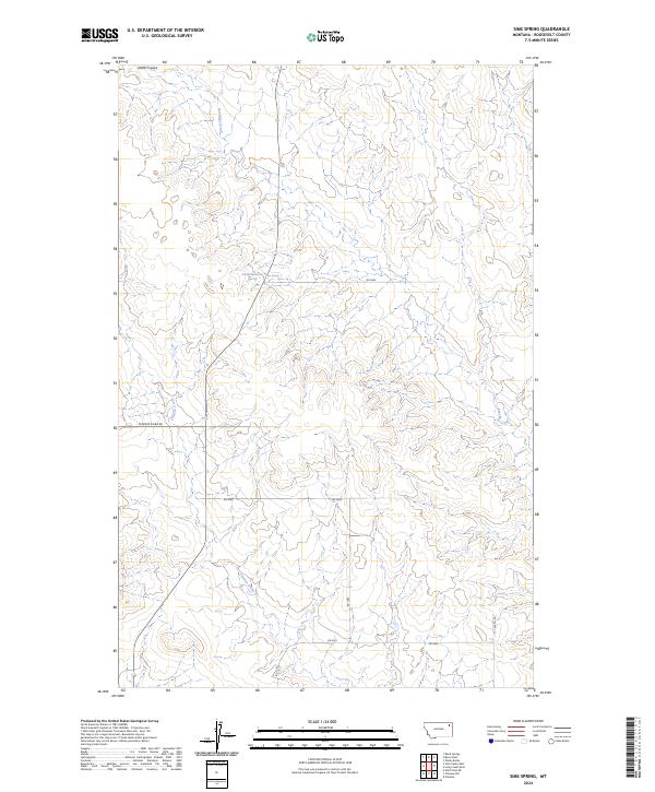
2024 Map of Sims Spring
USGS Topo · Published 2024About this map
Sims Spring serves as a vital water source in this high plains landscape of Roosevelt County, where the terrain is defined by a network of drainage coulees and seasonal creeks. The mapping reveals a distinct grid of section lines and rural routes, such as Powder River Rd and 17 1059 Co Rd, that navigate the undulating breaks between Boxelder Creek and Chelsea Creek. These watercourses carve through the township boundaries of T30N and T29N, illustrating the traditional range-and-township survey system used to organize this vast Montana rangeland.
Find a feature on this map
17 named features on this map. Tap any name to fly to it.
Don’t see what you’re looking for? This feature index may not catch every label — zoom into the map to look around manually.
Map Details
Editions of this 2024 Sims Spring Map
This is the sole edition of this map. No revisions or reprints were ever made.
Other maps of this area

1910 · Cuskers
USGS Topo · 1:62,500

1912 · Chelsea
USGS Topo · 1:62,500

1915 · Tule Valley
USGS Topo · 1:62,500

1915 · Cuskers
USGS Topo · 1:62,500

1916 · Wolf Point
USGS Topo · 1:62,500

1954 · Wolf Point
USGS Topo · 1:250,000

1958 · Wolf Point
USGS Topo · 1:250,000

1972 · Chelsea
USGS Topo · 1:24,000

1972 · Chelsea NW
USGS Topo · 1:24,000
1972 · Wolf Point NE
USGS Topo · 1:24,000