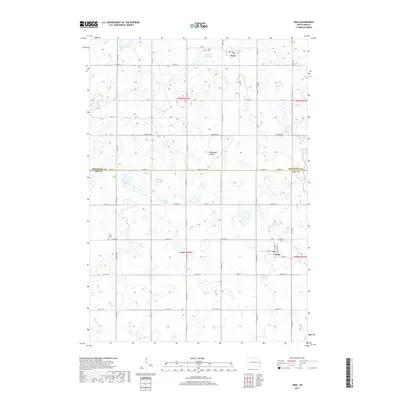
2017 Map of Sinai
USGS Topo · Published 2017About this map
Sinai and Nunda serve as the primary hubs for this agricultural landscape within the Coteau des Prairies upland. The 2017 survey reveals a terrain defined by its complex hydrography, characterized by numerous glacial wetlands and sloughs. To the north, Bolstad Slough and Sinai Cem mark the outskirts of the town, while the southern reaches of the map include the waters of East Lake Badus and Quam Slough.
Find a feature on this map
52 named features on this map. Tap any name to fly to it.
Don’t see what you’re looking for? This feature index may not catch every label — zoom into the map to look around manually.
Map Details
Editions of this 2017 Sinai Map
This is the sole edition of this map. No revisions or reprints were ever made.
Other maps of this area

1953 · Watertown
USGS Topo · 1:250,000

1958 · Watertown
USGS Topo · 1:250,000

1968 · Lake Sinai
USGS Topo · 1:24,000

1968 · Arlington
USGS Topo · 1:24,000

1968 · Volga
USGS Topo · 1:24,000

1968 · Ramona
USGS Topo · 1:24,000

1968 · Madison
USGS Topo · 1:24,000

1968 · Sinai
USGS Topo · 1:24,000
1968 · Madison NW
USGS Topo · 1:24,000
1968 · Rutland
USGS Topo · 1:24,000