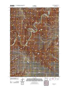
2011 Map of Sinamox
USGS Topo · Published 2011About this map
The Deschutes River carves a deep, winding path through this portion of Wasco County, creating a landscape defined by dramatic vertical relief and numerous side drainages. Small settlements and named junctions such as Sinamox and Butlers Corner are connected by a sparse network of rural roads, including Payne Loop and Buckley Rd. The river’s course is punctuated by features like Cedar Island, while the surrounding plateaus are incised by a series of significant canyons including Ferry Canyon, Box Elder Canyon, and French Canyon. This 2011 survey captures the area's transition from the riverbanks at Oakbrook to the higher elevations where Elder Creek drains the western hills, illustrating the enduring influence of the river on local geography and navigation.
Find a feature on this map
20 named features on this map. Tap any name to fly to it.
Don’t see what you’re looking for? This feature index may not catch every label — zoom into the map to look around manually.
Map Details
Editions of this 2011 Sinamox Map
This is the sole edition of this map. No revisions or reprints were ever made.
Other maps of this area

1930 · Dufur
USGS Topo · 1:125,000

1934 · Dufur
USGS Topo · 1:125,000

1953 · The Dalles
USGS Topo · 1:250,000

1956 · The Dalles
USGS Topo · 1:250,000

1957 · The Dalles
USGS Topo · 1:250,000

1962 · Sherars Bridge
USGS Topo · 1:24,000

1962 · Erskine
USGS Topo · 1:24,000

1962 · Summit Ridge
USGS Topo · 1:24,000

1962 · Dufur East
USGS Topo · 1:24,000

1962 · Sinamox
USGS Topo · 1:24,000