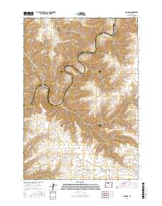
2017 Map of Sinamox
USGS Topo · Published 2017About this map
The Deschutes River carves a deep, winding path through this portion of north-central Oregon, defining the boundary between Wasco and Sherman Counties. The river's serpentine course is punctuated by Cedar Island and surrounded by a high plateau dissected by numerous drainages, including Box Elder Canyon and Oak Canyon. The remote station at Sinamox sits on the river's eastern bank, illustrating the area's isolation and its reliance on the river corridor for access. Further inland, the terrain rises toward Tygh Ridge, while local ranching or agricultural access is marked by corridors like Brown Rd and Payne Loop. The map also records the lower reaches of Elder Cr, showing how these intermittent water sources have shaped the local landscape and settlement patterns in this arid region.
Find a feature on this map
17 named features on this map. Tap any name to fly to it.
Don’t see what you’re looking for? This feature index may not catch every label — zoom into the map to look around manually.
Map Details
Editions of this 2017 Sinamox Map
This is the sole edition of this map. No revisions or reprints were ever made.
Other maps of this area

1930 · Dufur
USGS Topo · 1:125,000

1934 · Dufur
USGS Topo · 1:125,000

1953 · The Dalles
USGS Topo · 1:250,000

1956 · The Dalles
USGS Topo · 1:250,000

1957 · The Dalles
USGS Topo · 1:250,000

1962 · Sherars Bridge
USGS Topo · 1:24,000

1962 · Erskine
USGS Topo · 1:24,000

1962 · Summit Ridge
USGS Topo · 1:24,000

1962 · Dufur East
USGS Topo · 1:24,000

1962 · Sinamox
USGS Topo · 1:24,000