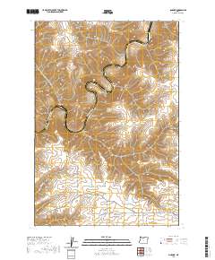
2020 Map of Sinamox
USGS Topo · Published 2020About this map
The Deschutes River carves a deep, winding path through the high desert landscape of Wasco County, separating it from Sherman County to the east. This section of the river is defined by sharp meanders and dramatic elevation changes, with Cedar Island sitting at a prominent bend. The surrounding plateau is dissected by an extensive network of tributary drainages, including Rattlesnake Canyon, Oak Canyon, and Gert Canyon, which draw down from the heights of Tygh Ridge.
Find a feature on this map
24 named features on this map. Tap any name to fly to it.
Don’t see what you’re looking for? This feature index may not catch every label — zoom into the map to look around manually.
Map Details
Editions of this 2020 Sinamox Map
This is the sole edition of this map. No revisions or reprints were ever made.
Other maps of this area

1930 · Dufur
USGS Topo · 1:125,000

1934 · Dufur
USGS Topo · 1:125,000

1953 · The Dalles
USGS Topo · 1:250,000

1956 · The Dalles
USGS Topo · 1:250,000

1957 · The Dalles
USGS Topo · 1:250,000

1962 · Sherars Bridge
USGS Topo · 1:24,000

1962 · Erskine
USGS Topo · 1:24,000

1962 · Summit Ridge
USGS Topo · 1:24,000

1962 · Dufur East
USGS Topo · 1:24,000

1962 · Sinamox
USGS Topo · 1:24,000