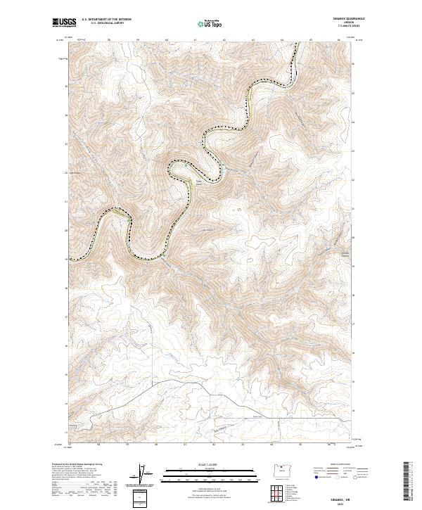
2023 Map of Sinamox
USGS Topo · Published 2023About this map
The Deschutes Wild and Scenic River carves a deep, winding path through this corner of North Central Oregon, serving as the natural boundary between Wasco and Sherman counties. This landscape is defined by its dramatic drainage system, where the river loops around Cedar Island while collecting runoff from a dense network of canyons. To the west, Tygh Ridge looms over deep incisions like Oak Canyon, while the eastern plateau is etched by numerous branches including Peterson Canyon and French Canyon. Settled life in this high-desert environment is tied to the limited road network, with routes such as Brown Rd and Payne Loop providing access across the undulating terrain. Small seasonal waterways like Elder Creek highlight the drainage patterns that have shaped the region's topography and agricultural potential over generations.
Find a feature on this map
25 named features on this map. Tap any name to fly to it.
Don’t see what you’re looking for? This feature index may not catch every label — zoom into the map to look around manually.
Map Details
Editions of this 2023 Sinamox Map
This is the sole edition of this map. No revisions or reprints were ever made.
Other maps of this area

1930 · Dufur
USGS Topo · 1:125,000

1934 · Dufur
USGS Topo · 1:125,000

1953 · The Dalles
USGS Topo · 1:250,000

1956 · The Dalles
USGS Topo · 1:250,000

1957 · The Dalles
USGS Topo · 1:250,000

1962 · Sherars Bridge
USGS Topo · 1:24,000

1962 · Erskine
USGS Topo · 1:24,000

1962 · Summit Ridge
USGS Topo · 1:24,000

1962 · Dufur East
USGS Topo · 1:24,000

1962 · Sinamox
USGS Topo · 1:24,000