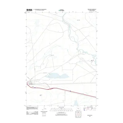
2012 Map of Sinclair
USGS Topo · Published 2012About this map
Sinclair occupies the southern edge of this high desert landscape, characterized by the winding path of the N Platte River as it flows northward through Carbon County. The town's grid is clearly defined, with streets like Union Ave and 8th St serving as the central core just north of the major transportation corridor. The surrounding terrain is marked by significant geologic and water-management features, including the prominent Grenville Dome to the south and the Parco Ditch irrigation system. Further north, the landscape transitions into the open country of Cedar Ridge and Rattlesnake Butte, where the Duncan Ranch sits near the confluence of Sugar Cr and the river. This survey captures a moment when traditional ranching and modern infrastructure intersect, shown through the network of local routes such as Seminoe Rd and Golf Course Rd extending into the basin.
Find a feature on this map
18 named features on this map. Tap any name to fly to it.
Don’t see what you’re looking for? This feature index may not catch every label — zoom into the map to look around manually.
Map Details
Editions of this 2012 Sinclair Map
This is the sole edition of this map. No revisions or reprints were ever made.
Other maps of this area

1893 · Fort Steele
USGS Topo · 1:125,000

1914 · Walcott
USGS Topo · 1:62,500

1953 · Sinclair
USGS Topo · 1:24,000

1953 · Rawlins
USGS Topo · 1:24,000

1953 · Lone Haystack Mountain
USGS Topo · 1:24,000

1953 · Rawlins NW
USGS Topo · 1:24,000

1954 · Rawlins
USGS Topo · 1:250,000

1955 · Savage Ranch
USGS Topo · 1:24,000

1956 · Bolten Ranch
USGS Topo · 1:62,500

1958 · Rawlins
USGS Topo · 1:250,000