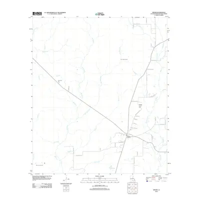
2012 Map of Singer
USGS Topo · Published 2012About this map
Singer and the neighboring settlement of Newlin anchor this corner of Beauregard Parish, where a dense network of family-named roads reflects generations of local residency. The landscape is defined by the sluggish waters of the Bear Head Marsh and Persimmon Marsh, alongside major drainage systems like Beckwith Cr and Spring Cr. This environment is a working one, heavily influenced by the petroleum industry as seen in the North Singer Oil Field, the Black Branch Oil Field, and the West Juanita Oil Field.
Find a feature on this map
54 named features on this map. Tap any name to fly to it.
Don’t see what you’re looking for? This feature index may not catch every label — zoom into the map to look around manually.
Map Details
Editions of this 2012 Singer Map
This is the sole edition of this map. No revisions or reprints were ever made.
Other maps of this area

1946 · Merryville
USGS Topo · 1:31,680

1947 · Singer
USGS Topo · 1:31,680

1947 · Pujo
USGS Topo · 1:31,680

1947 · Oretta
USGS Topo · 1:31,680

1947 · DeRidder
USGS Topo · 1:31,680

1947 · Kernan
USGS Topo · 1:31,680

1947 · Hyatt
USGS Topo · 1:31,680

1947 · Bivens
USGS Topo · 1:31,680

1947 · Beckwith School
USGS Topo · 1:31,680

1949 · Kernan
USGS Topo · 1:31,680