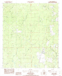
1986 Map of Singer
USGS Topo · Published 1986About this map
Singer sits at the heart of this mid-1980s landscape, serving as a focal point for a region defined by its waterway network and petroleum exploration. The map captures the industrial character of the parish with the North Singer Oil Field and the West Juanita Oil Field, while the dense grid of a Fire Break system suggests managed timberland or forestry activity across the terrain. A small settlement at Newlin appears to the northeast, connected to the larger infrastructure by an Underground Pipeline.
Find a feature on this map
25 named features on this map. Tap any name to fly to it.
Don’t see what you’re looking for? This feature index may not catch every label — zoom into the map to look around manually.
Map Details
Editions of this 1986 Singer Map
This is the sole edition of this map. No revisions or reprints were ever made.
Other maps of this area

1946 · Merryville
USGS Topo · 1:31,680

1947 · Singer
USGS Topo · 1:31,680

1947 · Pujo
USGS Topo · 1:31,680

1947 · Oretta
USGS Topo · 1:31,680

1947 · DeRidder
USGS Topo · 1:31,680

1947 · Kernan
USGS Topo · 1:31,680

1947 · Hyatt
USGS Topo · 1:31,680

1947 · Bivens
USGS Topo · 1:31,680

1947 · Beckwith School
USGS Topo · 1:31,680

1949 · Kernan
USGS Topo · 1:31,680