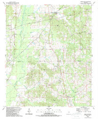
1989 Map of Singleton
USGS Topo · Published 1989About this map
The Yockanookany River winds along the western edge of this territory, where the historic Natchez Trace Parkway bisects the landscape near McVille. This area at the Attala Co Leake Co line is defined by a dense network of country churches and family burial grounds, reflecting the deep-rooted rural communities of the late twentieth century. Settlements like Singleton and Dossville serve as local hubs, connected by a web of unimproved roads and creek crossings including Coleman Creek and Bokshenya Creek.
Find a feature on this map
49 named features on this map. Tap any name to fly to it.
Don’t see what you’re looking for? This feature index may not catch every label — zoom into the map to look around manually.
Map Details
Editions of this 1989 Singleton Map
This is the sole edition of this map. No revisions or reprints were ever made.
Other maps of this area

1953 · Meridian
USGS Topo · 1:250,000

1953 · West Point
USGS Topo · 1:250,000

1957 · Meridian
USGS Topo · 1:250,000

1958 · West Point
USGS Topo · 1:250,000

1962 · Edinburg
USGS Topo · 1:62,500

1962 · Thomastown
USGS Topo · 1:62,500

1963 · West Point
USGS Topo · 1:250,000

1964 · Kosciusko
USGS Topo · 1:24,000
1964 · McAdams
USGS Topo · 1:24,000

1965 · Meridian
USGS Topo · 1:250,000