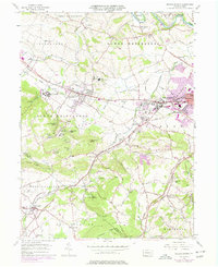
1955 Map of Sinking Spring
USGS Topo · Published 1977About this map
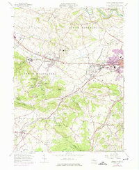
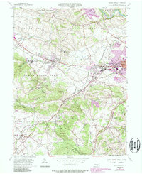
Wernersville State Hospital dominates the western slopes of this Berks County landscape, situated just south of the Conrail lines that connect Wernersville to Sinking Spring. The map documents a transition from the agricultural valleys of Tulpehocken Creek to the wooded elevations of Laurel Ridge and Cushion Peak. The presence of the Union Canal near Blue Marsh reflects the region's early nineteenth-century transport roots, even as mid-century suburban expansion appears around West Wyomissing and West Lawn.
Find a feature on this map
81 named features on this map. Tap any name to fly to it.
Don’t see what you’re looking for? This feature index may not catch every label — zoom into the map to look around manually.
Map Details
Editions of this 1955 Sinking Spring Map
6 editions found
Other maps of this area

1894 · Reading
USGS Topo · 1:62,500

1902 · Wernersville
USGS Topo · 1:62,500

1905 · Honey Brook
USGS Topo · 1:62,500

1906 · New Holland
USGS Topo · 1:62,500

1907 · Honeybrook
USGS Topo · 1:62,500

1908 · New Holland
USGS Topo · 1:62,500

1913 · Reading
USGS Topo · 1:62,500

1915 · Reading
USGS Topo · 1:62,500

1941 · Honeybrook
USGS Topo · 1:62,500

1941 · New Holland
USGS Topo · 1:62,500
Featured Places
- Sinking Spring, PA
- Wernersville, PA
- Reinholds, West Cocalico Township
- North Heidelberg Township, PA
- West Cocalico Township, PA