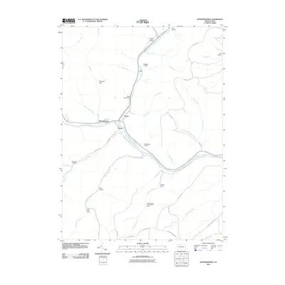
2010 Map of Sinnemahoning
USGS Topo · Published 2010About this map
Sinnemahoning sits at the confluence of several vital watercourses, where the First Fork Sinnemahoning Creek joins the main stem of Sinnemahoning Creek. This 2010 survey shows a landscape defined by deeply incised valleys and named draws, including Poormans Draft and the suggestively named Jerry Lick Draft. Small settlements like Wyside and Jericho are positioned along the river corridor, which also contains the protected lands of Bucktail State Park. The map's detail provides a look at local burial sites such as Miller Cemetery and the remote Lower Jerry Run Natural Area. Numerous hollows like Bog Ore Hollow and Rammage Hollow carve into the surrounding uplands, reflecting a long history of local land-use and geographic naming conventions in this part of Clinton County.
Find a feature on this map
43 named features on this map. Tap any name to fly to it.
Don’t see what you’re looking for? This feature index may not catch every label — zoom into the map to look around manually.
Map Details
Editions of this 2010 Sinnemahoning Map
This is the sole edition of this map. No revisions or reprints were ever made.
Other maps of this area

1928 · Snow Shoe
USGS Topo · 1:48,000

1929 · Karthaus
USGS Topo · 1:62,500

1931 · Show Shoe
USGS Topo · 1:62,500

1932 · Karthaus
USGS Topo · 1:62,500

1945 · Driftwood
USGS Topo · 1:48,000

1945 · First Fork
USGS Topo · 1:24,000

1945 · Sinnemahoning
USGS Topo · 1:24,000

1945 · Driftwood
USGS Topo · 1:24,000

1945 · Cameron
USGS Topo · 1:24,000

1946 · Renovo West
USGS Topo · 1:62,500
Featured Places
- East Keating Township, PA
- West Keating Township, PA
- Wyside, Grove Township
- Jericho, Grove Township
- Gibson Township, PA