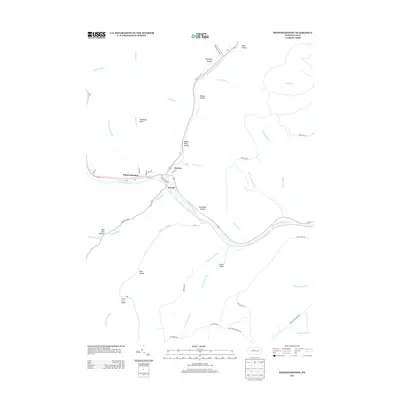
2013 Map of Sinnemahoning
USGS Topo · Published 2013About this map
Sinnemahoning sits at the confluence of several vital watercourses, serving as a focal point for the small settlements of Jericho and Wyside. The terrain is defined by a dense network of valleys and drafts, such as Bog Ore Hollow and Jerry Lick Draft, which feed into the Sinnemahoning Cr. The geography here shows a landscape where human habitation is tightly constrained by the steep drainages of the First Fork Sinnemahoning Cr and the winding course of Rte 120. This 2013 survey illustrates the enduring nature of these mountain passages, where roads like Wykoff Run Rd and Montour Rd follow the natural contours of the land. Remote hollows such as Pumpkin Hollow and Riddles Hollow suggest a long history of local naming conventions tied to specific topographical features or early family tracts.
Find a feature on this map
56 named features on this map. Tap any name to fly to it.
Don’t see what you’re looking for? This feature index may not catch every label — zoom into the map to look around manually.
Map Details
Editions of this 2013 Sinnemahoning Map
This is the sole edition of this map. No revisions or reprints were ever made.
Other maps of this area

1928 · Snow Shoe
USGS Topo · 1:48,000

1929 · Karthaus
USGS Topo · 1:62,500

1931 · Show Shoe
USGS Topo · 1:62,500

1932 · Karthaus
USGS Topo · 1:62,500

1945 · Driftwood
USGS Topo · 1:48,000

1945 · First Fork
USGS Topo · 1:24,000

1945 · Sinnemahoning
USGS Topo · 1:24,000

1945 · Driftwood
USGS Topo · 1:24,000

1945 · Cameron
USGS Topo · 1:24,000

1946 · Renovo West
USGS Topo · 1:62,500
Featured Places
- East Keating Township, PA
- West Keating Township, PA
- Wyside, Grove Township
- Jericho, Grove Township
- Gibson Township, PA