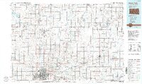
1955 Map of Sioux Falls
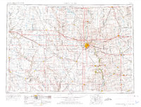
USGS Topo · Published 1976About this map
The Sioux Falls metropolitan area serves as the primary anchor for this 1955 survey, which covers a massive cross-section of the eastern South Dakota plains and the neighboring corners of Minnesota and Iowa. This era captures the region's dense agricultural grid before the consolidation of family farms, with small towns like Salem, Canton, and Madison functioning as vital railroad hubs. The landscape is defined by the glacial legacy of the Prairie Coteau, evidenced by the cluster of water bodies in the north including Lake Madison, Lake Herman, and Brant Lake.
Find a feature on this map
174 named features on this map. Tap any name to fly to it.
Don’t see what you’re looking for? This feature index may not catch every label — zoom into the map to look around manually.
Map Details
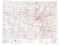
Editions of this 1955 Sioux Falls Map
3 editions found

Historical Maps of Sioux Falls Through Time
3 maps found