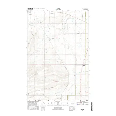
2017 Map of Sipple
USGS Topo · Published 2017About this map
Ross Fork Cr and its tributaries, including Little Trout Cr and Olsen Cr, carve a network of drainage patterns across this Central Montana landscape. The area is defined by a series of geographic coulees such as Big Coulee, Weber Coulee, and Hauck Coulee, which shape the local topography around the high plains. Small settlements and ranching hubs like Hobson, Hauck, and Sipple serve as the primary points of human activity, connected by a grid of rural roads such as Gumbo Flats Rd and Bullhaven Rd.
Find a feature on this map
34 named features on this map. Tap any name to fly to it.
Don’t see what you’re looking for? This feature index may not catch every label — zoom into the map to look around manually.
Map Details
Editions of this 2017 Sipple Map
This is the sole edition of this map. No revisions or reprints were ever made.
Other maps of this area

1889 · Big Snowy Mountain
USGS Topo · 1:250,000

1893 · Big Snowy Mountain
USGS Topo · 1:250,000

1954 · Roundup
USGS Topo · 1:250,000

1954 · Lewistown
USGS Topo · 1:250,000

1958 · Roundup
USGS Topo · 1:250,000

1959 · Lewistown
USGS Topo · 1:250,000
1970 · Buffalo
USGS Topo · 1:24,000

1970 · Moore
USGS Topo · 1:24,000
1970 · Martin Coulee
USGS Topo · 1:24,000
1970 · Moccasin
USGS Topo · 1:24,000