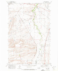
1970 Map of Sipple
USGS Topo · Published 1974About this map
The boundary between Judith Basin and Fergus Counties defines the eastern edge of this landscape, where the prairie is deeply etched by a network of drainage features. Ross Fork Creek meanders northward, joined by tributaries such as Little Trout Creek and Olsen Creek, while the western terrain is marked by significant landforms like Big Coulee and Hauck Coulee. This 1970 snapshot of Central Montana shows a region shaped by major rail corridors, with the Chicago Milwaukee St Paul and Pacific and the Burlington Northern lines traversing the plains.
Find a feature on this map
18 named features on this map. Tap any name to fly to it.
Don’t see what you’re looking for? This feature index may not catch every label — zoom into the map to look around manually.
Map Details
Editions of this 1970 Sipple Map
This is the sole edition of this map. No revisions or reprints were ever made.
Other maps of this area

1889 · Big Snowy Mountain
USGS Topo · 1:250,000

1893 · Big Snowy Mountain
USGS Topo · 1:250,000

1954 · Roundup
USGS Topo · 1:250,000

1954 · Lewistown
USGS Topo · 1:250,000

1958 · Roundup
USGS Topo · 1:250,000

1959 · Lewistown
USGS Topo · 1:250,000
1970 · Buffalo
USGS Topo · 1:24,000

1970 · Moore
USGS Topo · 1:24,000
1970 · Martin Coulee
USGS Topo · 1:24,000
1970 · Moccasin
USGS Topo · 1:24,000