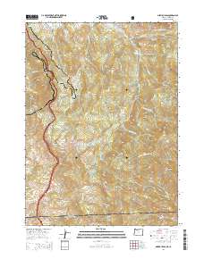
2014 Map of Siskiyou Pass
USGS Topo · Published 2014About this map
Siskiyou Pass serves as the central crossing point in this mountainous corridor where the Siskiyou Mountains bridge the border between Oregon and California. The landscape is defined by the high-elevation passage of both historic and modern transit routes, including the winding path of Old Highway 99 and the high-altitude Pacific Crest National Scenic Trail traversing the eastern ridges. The presence of Toll Road Gap and Buckhorn Springs indicates the longstanding human infrastructure required to navigate this steep terrain, which descends into deep drainages like Cougar Gulch and Bear Gulch. Land management is a dominant feature, with large sections of the Klamath National Forest providing a backdrop to distinctive geological landmarks like the volcanic prominence of Pilot Rock and the high lookout at Little Pilot Rock.
Find a feature on this map
67 named features on this map. Tap any name to fly to it.
Don’t see what you’re looking for? This feature index may not catch every label — zoom into the map to look around manually.
Map Details
Editions of this 2014 Siskiyou Pass Map
This is the sole edition of this map. No revisions or reprints were ever made.
Other maps of this area

1886 · Shasta
USGS Topo · 1:250,000

1891 · Ashland
USGS Topo · 1:250,000

1893 · Ashland
USGS Topo · 1:250,000

1894 · Shasta
USGS Topo · 1:250,000

1897 · Ashland
USGS Topo · 1:250,000

1922 · Shasta Valley Sheet No 15
USGS Topo · 1:24,000

1932 · Yreka
USGS Topo · 1:96,000

1934 · Macdoel
USGS Topo · 1:96,000

1938 · Medford
USGS Topo · 1:125,000

1939 · Yreka
USGS Topo · 1:125,000