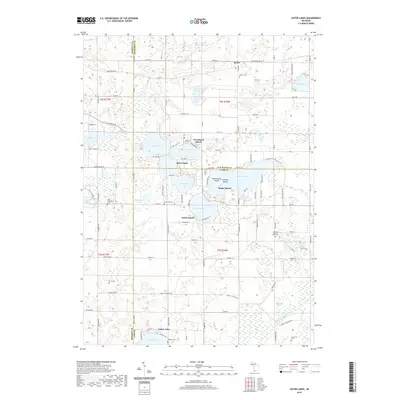
2019 Map of Sister Lakes
USGS Topo · Published 2019About this map
Magician Lake and its surrounding waters define this landscape where the boundaries of Van Buren, Berrien, and Cass counties converge. The glacial topography is dominated by an intricate chain of lakes and wetlands, including Dewey Lake, Cable Lake, and Crooked Lake, which supported the development of resort communities like Woodland Beach and Sandy Beach. For genealogists, the map is particularly detailed regarding burial sites, documenting several rural locations including Keeler Cem near the settlement of Keeler, the Zion Evangelical Cem, and the uniquely named Ely Graves. To the south, the terrain transitions into the Dowagiac Swamp and follows the course of the Dowagiac River. Landforms within the lakes, such as Maple Island and Rattlesnake Island, provide specific landmarks for those studying the evolution of these lakeside summer colonies.
Find a feature on this map
86 named features on this map. Tap any name to fly to it.
Don’t see what you’re looking for? This feature index may not catch every label — zoom into the map to look around manually.
Map Details
Editions of this 2019 Sister Lakes Map
This is the sole edition of this map. No revisions or reprints were ever made.
Other maps of this area

1927 · Niles
USGS Topo · 1:62,500

1927 · Hartford
USGS Topo · 1:62,500

1927 · Benton Harbor
USGS Topo · 1:62,500

1930 · Benton Harbor
USGS Topo · 1:62,500

1930 · Niles
USGS Topo · 1:62,500

1931 · Hartford
USGS Topo · 1:62,500

1943 · Niles
USGS Topo · 1:62,500

1945 · Cassopolis
USGS Topo · 1:62,500

1947 · Cassopolis
USGS Topo · 1:62,500

1953 · Chicago
USGS Topo · 1:250,000