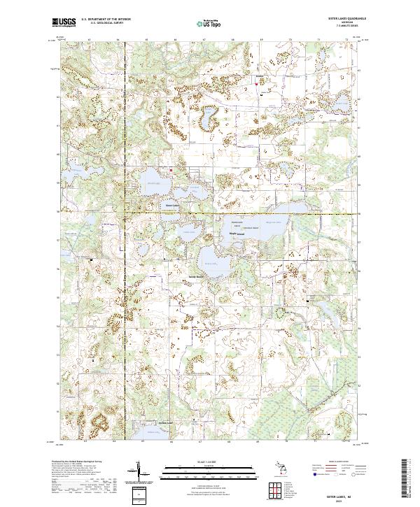
2023 Map of Sister Lakes
USGS Topo · Published 2023About this map
The community of Sister Lakes serves as the focal point of this glacial lake region, situated where the borders of Van Buren and Cass counties meet. This landscape is defined by its high density of water bodies, including the large Magician Lake with its named islands, Hemlock Island and Maple Island, as well as Dewey Lake and Cable Lake. The area's agricultural and rural character is preserved through a network of section-line roads like Territorial Rd W and 84th Ave, connecting the village of Keeler to the north with the southern reach of the Dowagiac River. Local history is anchored by several long-standing burial grounds, including Keeler Cem and Cullinane Cem, while the southern portion of the quadrangle transitions into the wetlands of the Dowagiac Swamp. This map provides an essential reference for understanding the residential and recreational development surrounding these inland waters.
Find a feature on this map
108 named features on this map. Tap any name to fly to it.
Don’t see what you’re looking for? This feature index may not catch every label — zoom into the map to look around manually.
Map Details
Editions of this 2023 Sister Lakes Map
This is the sole edition of this map. No revisions or reprints were ever made.
Other maps of this area

1927 · Niles
USGS Topo · 1:62,500

1927 · Hartford
USGS Topo · 1:62,500

1927 · Benton Harbor
USGS Topo · 1:62,500

1930 · Benton Harbor
USGS Topo · 1:62,500

1930 · Niles
USGS Topo · 1:62,500

1931 · Hartford
USGS Topo · 1:62,500

1943 · Niles
USGS Topo · 1:62,500

1945 · Cassopolis
USGS Topo · 1:62,500

1947 · Cassopolis
USGS Topo · 1:62,500

1953 · Chicago
USGS Topo · 1:250,000