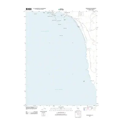
2012 Map of Sister Rocks
USGS Topo · Published 2012About this map
Brother Jonathan Cem stands as a significant historical anchor on the coastline near Crescent City, marking the memory of one of the Pacific's most notable shipwrecks. This coastal landscape is defined by its numerous rocky outcrops and islands, including Battery Point Island and Whaler Island, which protect the waters of Crescent Harbor. The shoreline transitions from the industrial infrastructure of Citizens Dock to the preserved wilderness of Del Norte Coast Redwood SP further south.
Find a feature on this map
29 named features on this map. Tap any name to fly to it.
Don’t see what you’re looking for? This feature index may not catch every label — zoom into the map to look around manually.
Map Details
Editions of this 2012 Sister Rocks Map
This is the sole edition of this map. No revisions or reprints were ever made.
Other maps of this area

1929 · Crescent City
USGS Topo · 1:125,000

1945 · Point St. George
USGS Topo · 1:62,500

1945 · Requa
USGS Topo · 1:62,500

1949 · Eureka
USGS Topo · 1:250,000
1952 · Klamath
USGS Topo · 1:62,500

1952 · Crescent City
USGS Topo · 1:62,500
1956 · Sister Rocks
USGS Topo · 1:24,000

1956 · Crescent City
USGS Topo · 1:24,000

1958 · Eureka
USGS Topo · 1:250,000
1958 · Crescent City
USGS Topo · 1:250,000