
1956 Map of Crescent City
USGS Topo · Published 1957About this map
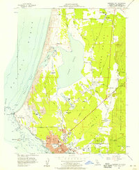
Crescent City anchors this coastal landscape where the timber industry and the Pacific shoreline meet. In the mid-1950s, the area's economy is clearly visible through numerous Lumber Mill sites and a Plywood Plant situated near the County Airport. The map highlights the transition from the grid of the city to the expansive Sand Dunes and coastal lagoons like Lake Earl and Lake Talawa. Historical infrastructure, such as the Old RR Grade and the S S Emidio Memorial, points to the region's maritime and transport history.
Find a feature on this map
46 named features on this map. Tap any name to fly to it.
Don’t see what you’re looking for? This feature index may not catch every label — zoom into the map to look around manually.
Map Details
Editions of this 1956 Crescent City Map
2 editions found
Other maps of this area

1929 · Crescent City
USGS Topo · 1:125,000

1945 · Point St. George
USGS Topo · 1:62,500

1945 · Requa
USGS Topo · 1:62,500

1949 · Eureka
USGS Topo · 1:250,000
1952 · Klamath
USGS Topo · 1:62,500

1952 · Crescent City
USGS Topo · 1:62,500
1956 · Sister Rocks
USGS Topo · 1:24,000

1956 · Smith River
USGS Topo · 1:24,000

1958 · Eureka
USGS Topo · 1:250,000
1958 · Crescent City
USGS Topo · 1:250,000